Bathurst Island (Nunavut)
Bathurst Island is one of the Queen Elizabeth Islands in Nunavut, Canada. It is a member of the Canadian Arctic Archipelago. The area of the island is estimated at 16,042 km2 (6,194 sq mi),[1] 115 to 117 mi (185 to 188 km) long and from 63 mi (101 km) to 72 mi (116 km) to 92.9 mi (149.5 km) wide, making it the 54th largest island in the world and Canada's 13th largest island. It is uninhabited.
 Satellite photo montage of Bathurst Island and its neighbours | |
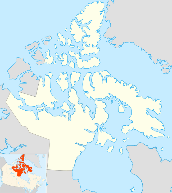
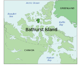 Location of Bathurst Island | |
 Bathurst Island  Bathurst Island | |
| Geography | |
|---|---|
| Location | Northern Canada |
| Coordinates | 75°46′N 099°47′W |
| Archipelago | Queen Elizabeth Islands Canadian Arctic Archipelago |
| Area | 16,042 km2 (6,194 sq mi) |
| Area rank | 54th |
| Length | 117 mi (188 km) |
| Width | 63–94 mi (101–151 km) |
| Administration | |
| Territory | Nunavut |
| Demographics | |
| Population | 0 |
The island is low-lying with few parts higher than 330 m (1,083 ft) in elevation. The highest point is 412 m (1,352 ft) at Stokes Mountain in the Stokes Range. This in turn forms part of the Arctic Cordillera mountain system. Good soil conditions produce abundant vegetation and support a more prolific wildlife population than other Arctic islands.
The island contains both the International Biological Program site Polar Bear Pass and Qausuittuq National Park.
History
The island was first inhabited by Independence I culture native peoples around 2000 BC. They were followed by Independence II, Pre-Dorset, and Dorset cultures. Brooman Point Village[2] on the eastern coast of Bathurst Island was the site of Thule native tribes around A.D. 1000, conceivably during a warmer climate episode. No modern Inuit resided there at the time of European discovery in the 1800s. But Inuit people in the region likely knew of its abundant wildlife, and possibly traveled there on hunting trips. William Edward Parry was the first European to discover the island in 1819, charting its southern coast.[3] It was named for Henry Bathurst, 3rd Earl Bathurst, British Secretary of State for War and the Colonies 1812-1827. Robert Aldrich charted much of its west coast in 1851, while George Henry Richards and Sherard Osborn charted its north coast in 1853.[4][5]
The Earth's North Magnetic Pole tracked northwards across Bathurst and Seymour Islands during the 1960s and 1970s. The Canadian National Museum of Natural Sciences, led by renowned Arctic biologist Stewart D. Macdonald, Curator of Vertebrate Ethology, established a permanent High Arctic Research Station there in 1973. Located on the Goodsir River in Polar Bear Pass, the station was staffed seasonally until the 1980s.
References
- "Atlas of Canada". Atlas.nrcan.gc.ca. 2009-08-12. Archived from the original on 2013-01-22. Retrieved 2010-08-30.
- Robert McGhee. Brooman Point Village. The Canadian Encyclopedia. Retrieved August 26, 2019.
- Parry, William Edward (1821). Journal of a voyage for the discovery of a North-West passage from the Atlantic to the Pacific: performed in the years 1819-20. London: John Murray.
William Edward Parry 1819.
- Mills, William James (2003). Exploring polar frontiers: a historical encyclopedia. Santa Barbara: ABC-CLIO.
- M'Dougall, George F. (1857). The eventful voyage of H.M. discovery ship "Resolute" to the Arctic regions, in search of Sir John Franklin and the missing crews of H.M. discovery ships "Erebus" and "Terror," 1852, 1853, 1854. London: Longman, Brown, Green, Longmans, & Roberts. p. 452.
The Eventful Voyages of HMS Resolute.
Further reading
- Anglin, Carolyn Diane, and John Christopher Harrison. Mineral and Energy Resource Assessment of Bathurst Island Area, Nunavut Parts of NTS 68G, 68H, 69B and 79A. [Ottawa]: Geological Survey of Canada, 1999.
- Blake, Weston. Preliminary Account of the Glacial History of Bathurst Island, Arctic Archipelago. Ottawa: Department of Mines and Technical Surveys, 1964.
- Danks, H. V. Arthropods of Polar Bear Pass, Bathurst Island, Arctic Canada. Syllogeus, no. 25. Ottawa: National Museum of Natural Sciences, National Museums of Canada, 1980.
- Freeman, Milton M. R., and Linda M. Hackman. Bathurst Island NWT A Test Case of Canada's Northern Policy. Canadian Public Policy, Vol.1,No.3, Summer. 1975.
- Givelet, N, F Roos-Barraclough, M E Goodsite, and W Shotyk. 2003. "A 6,000-Years Record of Atmospheric Mercury Accumulation in the High Arctic from Peat Deposits on Bathurst Island, Nunavut, Canada". Journal De Physique. IV, Colloque : JP. 107: 545.
- Hueber, F. M. Early Devonian Plants from Bathurst Island, District of Franklin. Ottawa: Energy, Mines and Resources Canada, 1971.
- Kerr, J. William. Geology of Bathurst Island Group and Byam Martin Island, Arctic Canada (Operation Bathurst Island). Ottawa: Dept. of Energy, Mines and Resources, 1974.
- F.F. Slaney & Company. Peary Caribou and Muskoxen and Panarctic's Seismic Operations on Bathurst Island, N.W.T. 1974. Vancouver: F.F. Slaney & Co. Ltd, 1975.
- Taylor, William Ewart, and Robert McGhee. Deblicquy, a Thule Culture Site on Bathurst Island, N.W.T., Canada. Mercury series. Ottawa: National Museums of Canada, 1981.
External links
| Authority control |
|
|---|