Central West (New South Wales)
The Central West is a region of New South Wales, Australia. The region is geographically in central and eastern New South Wales, in the area west of the Blue Mountains, which are west of Sydney. It has an area of 63,262 square kilometres (24,426 sq mi).[2] The region includes the area meteorologically defined as the Central Tablelands, located in the eastern part of the region.
| Central West New South Wales | |||||||||||||||
|---|---|---|---|---|---|---|---|---|---|---|---|---|---|---|---|
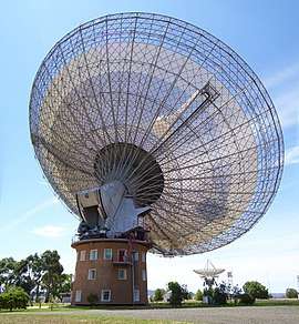 The CSIRO Radio Telescope at Parkes | |||||||||||||||
| Population | 209,810 (30 June 2016)[1] | ||||||||||||||
| LGA(s) | Bathurst Region, City of Orange, Cowra Shire, Parkes Shire, City of Lithgow, Oberon Shire, Mid-Western Regional Council, Forbes Shire, Cabonne Shire, Weddin Shire, Bland Shire, Lachlan Shire | ||||||||||||||
| State electorate(s) | |||||||||||||||
| Federal Division(s) | Calare Parkes | ||||||||||||||
| |||||||||||||||
Major population and service centres in the Central West include Bathurst, Orange, Lithgow, Cowra, Mudgee and Parkes. Bathurst and Orange are home to campuses of Charles Sturt University, and Lithgow housing the University of Notre Dame Regional Clinical School.
Cities and towns
The Central West includes the large regional centres of Bathurst and Orange; the towns of Cowra, Mudgee, Parkes and Lithgow; and smaller centres, such as Oberon, Blayney, Forbes, Canowindra, Cudal, Molong, Grenfell, West Wyalong, Portland, Wallerawang, Condobolin, Rylstone, Kandos, Gulgong and Eugowra.
Demography and area
The following local government areas are contained within the region:
| Central West rank | Local Government Area | Population 30 June 2016[3] | 10 year growth rate | Population density (people/km2) |
|---|---|---|---|---|
| 1 | Bathurst Regional Council | 42,389 | 14.8 | 11.1 |
| 2 | Orange City | 41,384 | 13.8 | 145.6 |
| 3 | Mid-Western Regional Council | 24,569 | 13.5 | 2.8 |
| 4 | City of Lithgow Council | 21,524 | 6.6 | 4.8 |
| 7 | Parkes Shire Council | 14,946 | 2.4 | 2.5 |
| 8 | Cabonne Shire | 13,625 | 7.8 | 2.3 |
| 9 | Cowra Shire | 12,673 | -0.6 | 4.5 |
| 10 | Forbes Shire | 9,808 | 2.8 | 2.1 |
| 11 | Blayney Shire | 7,418 | 10.0 | 4.9 |
| 12 | Lachlan Shire | 6,352 | -7.0 | 0.4 |
| 13 | Bland Shire | 6,031 | -2.9 | 0.7 |
| 14 | Oberon Shire | 5,399 | 4.2 | 1.5 |
| 15 | Weddin Shire | 3,692 | -0.8 | 1.1 |
| Central West | 209,810 | 8.5 | 3.0 | |
Terrain
The Central West's east is higher, wetter and hillier and supports orchards, vineyards, vegetable-growing and pastoralism. The west is flatter and drier and supports grain crops and pastoralism.
Major highways
The Central West region is traversed by the Great Western Highway, the Mid-Western Highway, the Mitchell Highway, the Newell Highway and the Castlereagh Highway.
Media
The Central West has several radio stations, including 97.9 2LVR (a community radio station), 105.1 2GZFM, 105.9 Star FM, 107.9 Move FM, 95.5 ROK FM, 107.5 Community Radio, 103.5 Rhema FM and 1089AM — a commercial station that gets most of its programming from 2SM in Sydney. Other electronic media are represented by the Australian Broadcasting Corporation with both television and radio broadcasting; and by television stations Prime7, WIN, and Southern Cross Nine.
Two major newspapers are published in the region, the Central Western Daily newspaper is published in Orange and the Western Advocate in Bathurst. Numerous other local papers serve the remaining large towns.
History
The Central West area was originally inhabited by the Wiradjuri people. The first white explorer, George Wilson Evans, entered the Lachlan Valley in 1815. He named the area the Oxley Plains after his superior the surveyor-general, John Oxley. In 1817 he deemed the area unfit for white settlement. A Military Depot was established not long after at Soldiers Flat near present-day Billimari. Arthur Ranken and James Sloan, from Bathurst, were amongst the first white settlers on the Lachlan. They moved to the area in 1831.
In the 1850s many gold prospectors passed through headed for gold fields at Lambing Flat (Young) and Grenfell.
References
- "Archived copy". Archived from the original on 5 March 2016. Retrieved 9 August 2017.CS1 maint: archived copy as title (link)
- Central West Region - the agricultural heart of New South Wales website of New South Wales Department of State and Regional Development, accessed 12 November 2006
- "3218.0 – Regional Population Growth, Australia, 2016". Australian Bureau of Statistics. Archived from the original on 5 March 2016. Retrieved 9 August 2017.
External links
| Wikivoyage has a travel guide for Central West (New South Wales). |
- NSW Forecast Areas map
- Department of Local Government page for the region listing links to council pages
- "Open Directory" listing