Wuustwezel
| Wuustwezel | |||
|---|---|---|---|
| Municipality | |||
| |||
 Wuustwezel Location in Belgium
Location of Wuustwezel in the region Flemish Region 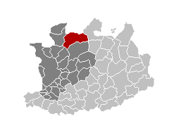 | |||
| Coordinates: 51°23′N 04°36′E / 51.383°N 4.600°ECoordinates: 51°23′N 04°36′E / 51.383°N 4.600°E | |||
| Country | Belgium | ||
| Community | Flemish Community | ||
| Region | Flemish Region | ||
| Province | Antwerp | ||
| Arrondissement | Antwerp | ||
| Government | |||
| • Mayor | Dieter Wouters (CD&V) | ||
| • Governing party/ies | CD&V | ||
| Area | |||
| • Total | 89.43 km2 (34.53 sq mi) | ||
| Population (1 January 2017)[1] | |||
| • Total | 20,459 | ||
| • Density | 230/km2 (590/sq mi) | ||
| Postal codes | 2990 | ||
| Area codes | 03 | ||
| Website | www.wuustwezel.be | ||


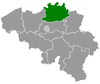
Wuustwezel (Dutch pronunciation: [ʋystˈʋeːzəl]) is a municipality located in the north of the Belgian province of Antwerp.
The municipality as it is now originated in 1977, when Wuustwezel merged with the municipality of Loenhout. It now consists of three major villages, Wuustwezel proper, Gooreind and Loenhout, and two minor hamlets, Braken and Sterbos.
On January 1, 2006 Wuustwezel had a total population of 18,338; in 2005 there were 8,238 residents in Wuustwezel, 6,340 in Gooreind and 3,603 in Loenhout. There were also 1,039 residents with a non-Belgian nationality. The total area is 89.43 km² which gives it a population density of 205 inhabitants per km².
The Azencross Loenhout is a December cyclo-cross competition, which is part of the BPost Bank Trophy.
Its neighbouring municipalities are Zundert in the Netherlands, Kalmthout, Kapellen, Brasschaat, Brecht and Hoogstraten.
Wuustwezel has the postal code 2990.
References
- ↑ Population per municipality as of 1 January 2017 (XLS; 397 KB)
External links

- (in Dutch) Official website
Places adjacent to Wuustwezel | ||||||||||
|---|---|---|---|---|---|---|---|---|---|---|
| ||||||||||