Rijkevorsel
| Rijkevorsel | |||
|---|---|---|---|
| Municipality | |||
_-_aerial_view.jpg) | |||
| |||
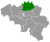
 Rijkevorsel Location in Belgium
Location of Rijkevorsel in the province of Antwerp  | |||
| Coordinates: 51°21′N 04°46′E / 51.350°N 4.767°ECoordinates: 51°21′N 04°46′E / 51.350°N 4.767°E | |||
| Country | Belgium | ||
| Community | Flemish Community | ||
| Region | Flemish Region | ||
| Province | Antwerp | ||
| Arrondissement | Turnhout | ||
| Government | |||
| • Mayor | Dorien Cuylaerts (N-VA) | ||
| • Governing party/ies | CD&V, sp.a, VORSEL | ||
| Area | |||
| • Total | 46.79 km2 (18.07 sq mi) | ||
| Population (1 January 2017)[1] | |||
| • Total | 11,879 | ||
| • Density | 250/km2 (660/sq mi) | ||
| Postal codes | 2310 | ||
| Area codes | 03, 014 | ||
| Website | www.rijkevorsel.be | ||


Rijkevorsel (Dutch pronunciation: [ˌrɛi̯kəˈvɔrsəl]) is a municipality located in the Belgian province of Antwerp. The municipality comprises the town of Rijkevorsel, Achtel, Sint-Jozef-Rijkevorsel and Gammel. In 2015, Rijkevorsel had a total population of 10.495. The total area is 46.79 km² which gives a population density of 224 inhabitants per km².
History
Rijkevorsel, Vaishak, Voirssele, Forsela in 1194. Recent archaeological finds at the Willow Street attest to human presence in the late stone age, the bronze and iron age and the Roman times. A large cemetery with cremation (urnfield) on the Helhoekheide may point to a first settlement being present here already before the beginning of our era.
Notable inhabitants
- AC Zimi, writer
- Aster Berkhof, writer
- Leo Pleysier, writer
- George Kooymans, composer, musician, producer, guitarist at Golden Earring rockband
References
- ↑ Population per municipality as of 1 January 2017 (XLS; 397 KB)
External links

- Official website - Available only in Dutch
Places adjacent to Rijkevorsel | ||||||||||
|---|---|---|---|---|---|---|---|---|---|---|
| ||||||||||
This article is issued from
Wikipedia.
The text is licensed under Creative Commons - Attribution - Sharealike.
Additional terms may apply for the media files.