Wommelgem
| Wommelgem | |||
|---|---|---|---|
| Municipality | |||
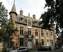 Selsaete castle in Wommelgem | |||
| |||
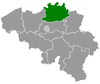
 Wommelgem Location in Belgium
Location of Wommelgem in the province of Antwerp  | |||
| Coordinates: 51°12′N 04°31′E / 51.200°N 4.517°ECoordinates: 51°12′N 04°31′E / 51.200°N 4.517°E | |||
| Country | Belgium | ||
| Community | Flemish Community | ||
| Region | Flemish Region | ||
| Province | Antwerp | ||
| Arrondissement | Antwerp | ||
| Government | |||
| • Mayor | Frank Gys (N-VA) | ||
| • Governing party/ies | N-VA, Gemeentebelangen | ||
| Area | |||
| • Total | 13.01 km2 (5.02 sq mi) | ||
| Population (1 January 2017)[1] | |||
| • Total | 12,785 | ||
| • Density | 980/km2 (2,500/sq mi) | ||
| Postal codes | 2160 | ||
| Area codes | 03 | ||
| Website | www.wommelgem.be | ||


Wommelgem (Dutch pronunciation: [ˈʋɔməlɣɛm]) is a municipality located in the Belgian province of Antwerp. The municipality only comprises the town of Wommelgem proper. On January 1, 2006 Wommelgem had a total population of 12,126. The total area is 13.01 km² which gives a population density of 932 inhabitants per km².
Wommelgem is one of 25 municipalities within the Albert Canal economic network (Economisch Netwerk Albertkanaal).
References
- ↑ Population per municipality as of 1 January 2017 (XLS; 397 KB)
External links

- (in Dutch) Official website
This article is issued from
Wikipedia.
The text is licensed under Creative Commons - Attribution - Sharealike.
Additional terms may apply for the media files.