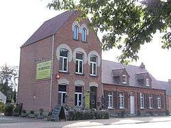
Grobbendonk
| Grobbendonk | |||
|---|---|---|---|
| Municipality | |||
 | |||
| |||
 Grobbendonk Location in Belgium
Location of Grobbendonk in the province of Antwerp 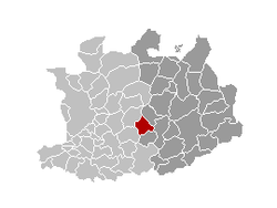 | |||
| Coordinates: 51°12′N 04°43′E / 51.200°N 4.717°ECoordinates: 51°12′N 04°43′E / 51.200°N 4.717°E | |||
| Country | Belgium | ||
| Community | Flemish Community | ||
| Region | Flemish Region | ||
| Province | Antwerp | ||
| Arrondissement | Turnhout | ||
| Government | |||
| • Mayor | Eric van Meensel (N-VA) | ||
| • Governing party/ies | N-VA, CD&V, sp.a | ||
| Area | |||
| • Total | 28.36 km2 (10.95 sq mi) | ||
| Population (1 January 2017)[1] | |||
| • Total | 11,237 | ||
| • Density | 400/km2 (1,000/sq mi) | ||
| Postal codes | 2280, 2288 | ||
| Area codes | 014, 03 | ||
| Website | www.grobbendonk.be | ||


Grobbendonk (Dutch pronunciation: [ˈɣrɔbə(n)dɔŋk]) is a municipality located in the Belgian province of Antwerp (Dutch: Antwerpen). The municipality comprises the towns of Bouwel and Grobbendonk proper. On January 1, 2006, Grobbendonk had a total population of 10,747. The total area is 28.36 km² which gives a population density of 379 inhabitants per km².
The official flag of Grobbendonk was adopted in 1989. In terms of heraldry, the flag is quartered, I and IV argent, three hills vert, a bird sable (specifically a raven), II and III gules three fleur-de-lis argent.
Lord of Grobbendonk
The house of Ursel is still lord of Grobbendonk, owner of the Heerlijkheid.
The heerlijkheid was in 1545 property of Erasmus II Schetz, the first Baron was his grandson Antonie II Schetz, Baron of Grobbendonck. The next generations were created Count of Grobbendonk, amongst these descendant duke of Ursel who was herederuty Count of Grobbendonk.
Famous inhabitants
- Rik Van Looy, cyclist, twice World Cycling Champion
- Herman Van Springel, cyclist, finished second in the Tour de France
References
- ↑ Population per municipality as of 1 January 2017 (XLS; 397 KB)
External links

- Official website - Only available in Dutch
Places adjacent to Grobbendonk | ||||||||||
|---|---|---|---|---|---|---|---|---|---|---|
| ||||||||||