Herenthout
| Herenthout | |||
|---|---|---|---|
| Municipality | |||
 | |||
| |||
 Herenthout Location in Belgium
Location of Herenthout in the province of Antwerp 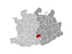 | |||
| Coordinates: 51°09′N 04°46′E / 51.150°N 4.767°ECoordinates: 51°09′N 04°46′E / 51.150°N 4.767°E | |||
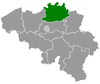
| Country | Belgium | ||
| Community | Flemish Community | ||
| Region | Flemish Region | ||
| Province | Antwerp | ||
| Arrondissement | Turnhout | ||
| Government | |||
| • Mayor | Roger Gabriëls (GBL) | ||
| • Governing party/ies | GBL, CD&V | ||
| Area | |||
| • Total | 23.55 km2 (9.09 sq mi) | ||
| Population (1 January 2017)[1] | |||
| • Total | 8,845 | ||
| • Density | 380/km2 (970/sq mi) | ||
| Postal codes | 2270 | ||
| Area codes | 014 | ||
| Website | www.herenthout.be | ||


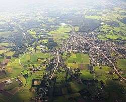
Herenthout (Dutch pronunciation: [ˈɦeːrəntɦʌu̯t]) is a municipality located in the province of Antwerp in Belgium. The municipality only comprises the town of Herenthout proper, including Uilenberg. On January 1, 2006, Herenthout had a total population of 8,361. The total area is 23.55 km², with a population density of 355 inhabitants per km².
This village is also well known for having the officially recognized oldest organized carnival parade in Belgium, with the first edition dating back to February 1882. The mascot of the parade is named "Peer Stoet".
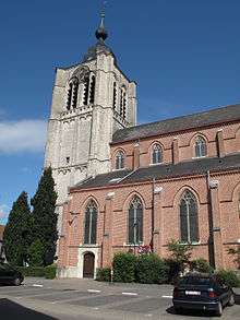
Herenthout church
Notable people
- Jürgen Raeymaeckers (1985) – football striker who currently plays for K. Lyra T.S.V.
- Wim Vandekeybus (1963) – actor, choreographer, dancer and film director
- Johan Van Herck (1974) – former professional tennis player
References
- ↑ Population per municipality as of 1 January 2017 (XLS; 397 KB)
External links

Places adjacent to Herenthout | ||||||||||
|---|---|---|---|---|---|---|---|---|---|---|
| ||||||||||
This article is issued from
Wikipedia.
The text is licensed under Creative Commons - Attribution - Sharealike.
Additional terms may apply for the media files.