Shawangunk, New York
| Shawangunk | |
|---|---|
| Town | |
 Location in Ulster County and the state of New York. | |
| Coordinates: 41°36′59″N 74°13′59″W / 41.61639°N 74.23306°WCoordinates: 41°36′59″N 74°13′59″W / 41.61639°N 74.23306°W | |
| Country | United States |
| State | New York |
| County | Ulster |
| Government | |
| • Supervisor | John Valk Jr.[1] |
| Area[2] | |
| • Total | 56.55 sq mi (146.46 km2) |
| • Land | 56.06 sq mi (145.18 km2) |
| • Water | 0.49 sq mi (1.28 km2) |
| Elevation | 335 ft (102 m) |
| Population (2010)[3] | |
| • Total | 14,332 |
| • Estimate (2016)[4] | 14,063 |
| • Density | 250.87/sq mi (96.86/km2) |
| Time zone | UTC-5 (Eastern (EST)) |
| • Summer (DST) | UTC-4 (EDT) |
| FIPS code | 36-66674 |
| GNIS feature ID | 0979486 |

Shawangunk is a town in southwestern Ulster County, New York, USA. The population was 14,332 at the 2010 census.[3] Like the neighboring mountain range, for which it is named, it is pronounced either as the Munsee Lenape, Shawangunk /ˈʃɑːwəŋɡʌŋk/, or as the colonial Shongum /ˈʃɒnɡʌm/ SHON-gum by local residents. (See Shawangunk Ridge.)
History
Shawangunk was first settled by Europeans around 1670. The region was organized as a precinct in 1743, and became the Town of Shawangunk in 1788. The town's name comes from the Dutch translation of the Munsee Lenape. The Lenape pronunciation for the town was "Scha-WAN-gunk." In Lenape, "Schawan," means "it is smokey air." This was given as referring to the nearby Catskill Mountains which were known as the "Hidden Mountains." The mountain ridge that runs from southwest to northeast creates a heavy humidified atmosphere that would make the Lenape believe the area had smokey air. A Lenape linguist, Raymond Whritenour suggests that the name comes from the burning of a Munsee fort by the Dutch in the year 1663. This fort was nearby a creek later known as the Shawangunk Kill and also what is now known as Old Fort Road. The burning of the fort signaled the end of the Second Esopus War and helped spread the name to the nearby ridge by the early 1700s. Present day citizens of Shawangunk refer to themselves as living in Wallkill, Pine Bush, or other hamlets depending on which part they live in. This has been in part due to the large size and growing population of the town.[5]
Geography
According to the United States Census Bureau, the town has a total area of 56.5 square miles (146 km2), of which, 56.2 square miles (146 km2) of it is land and 0.3 square miles (0.78 km2) of it (0.55%) is water.
The south town line and half of the east town line is the border of Orange County, New York.
The Wallkill River flows through the eastern half of town and lends it its name, which it flows through, while the western (Walker Valley) half climbs the slopes of the eponymous mountains.
Demographics
| Historical population | |||
|---|---|---|---|
| Census | Pop. | %± | |
| 1790 | 2,128 | — | |
| 1820 | 3,372 | — | |
| 1830 | 3,681 | 9.2% | |
| 1840 | 3,886 | 5.6% | |
| 1850 | 4,036 | 3.9% | |
| 1860 | 2,870 | −28.9% | |
| 1870 | 2,823 | −1.6% | |
| 1880 | 2,910 | 3.1% | |
| 1890 | 2,456 | −15.6% | |
| 1900 | 2,406 | −2.0% | |
| 1910 | 2,548 | 5.9% | |
| 1920 | 2,087 | −18.1% | |
| 1930 | 2,127 | 1.9% | |
| 1940 | 3,117 | 46.5% | |
| 1950 | 3,561 | 14.2% | |
| 1960 | 4,604 | 29.3% | |
| 1970 | 5,749 | 24.9% | |
| 1980 | 8,186 | 42.4% | |
| 1990 | 10,081 | 23.1% | |
| 2000 | 12,022 | 19.3% | |
| 2010 | 14,332 | 19.2% | |
| Est. 2016 | 14,063 | [4] | −1.9% |
| U.S. Decennial Census[6] | |||
As of 2009, there were 12,652 people, 4,333 households, and 2,557 families residing in the town. The population density was 225 people per square mile . There were 3,754 housing units at an average density of 66.8 per square mile (25.8/km²). The racial makeup of the town was 83% White, 7.9% African American, 0.2% Native American, 0.9% Asian, 0.01% Pacific Islander, 2.86% from other races, and 1.32% from two or more races. Hispanic or Latino of any race were 6.96% of the population.[7]
There were 3,433 households out of which 39.2% had children under the age of 18 living with them, 61.5% were married couples living together, 8.4% had a female householder with no husband present, and 25.5% were non-families. 20.2% of all households were made up of individuals and 7.0% had someone living alone who was 65 years of age or older. The average household size was 2.78 and the average family size was 3.21.
In the town, the population was spread out with 22.4% under the age of 18, 8.5% from 18 to 24, 38.3% from 25 to 44, 22.2% from 45 to 64, and 8.7% who were 65 years of age or older. The median age was 36 years. For every 100 females, there were 134.3 males. For every 100 females age 18 and over, there were 144.3 males.
The median income for a household in the town was $52,366, and the median income for a family was $59,975. Males had a median income of $40,967 versus $29,608 for females. The per capita income for the town was $19,402. About 4.4% of families and 13.4% of the population were below the poverty line, including 7.0% of those under age 18 and 10.5% of those age 65 or over.
Housing stats
- Total:4,333
- Occupied:3,877
- Owner Occupied:3,092
- Population in Owner Occupied:8,890
- Renter Occupied:795
- Population in Renter Occupied:1,917
- Households with Individuals under 18:1,465
- Vacant:446
- Vacant for rent:87
- Vacant for sale:66[8]
Geology
Something the Shawangunk town and mountain ridge have long been known for is their geology. Rising 2,000 feet above the town are the Shawangunk Mountains primarily consisting of quartz.[9] The mountains were created over 10,000 years ago during the last ice age when retreating glacial ice carved out the Shawangunk Mountains and the surrounding Catskills.[10] To this day the beautiful quartz landscapes can be seen from miles away drawing tourists and climbing enthusiasts from all over the world.[11] The mountainous area is also known for its water bodies of high acidity. Three of the "Sky Lakes," in Minnewaska State Park Preserve are so acidic they cannot support any wildlife.[12] The high acidity is caused by the high quartz makeup of the soil which aids in the runoff of acidic rains.[13] The high acidity in the water does lead to an abundance of rare plant species that normally do not grow in Northeastern New York. Clusters of Quercus illcifolia and Pinus rigida can be found throughout the region.[14]
Communities and locations in Shawangunk
- Ellenville – Also Part of the Town of Wawarsing
- Awosting – A hamlet in the northwest part of the town.
- Bruynswick – A hamlet near the north town line on County Route 7.
- Crawford – A hamlet in the northwest part of the town, south of Awosting.
- Dwaarkill – A hamlet north of Red Mills, located on County Route 7.
- Galeville – A former hamlet in the eastern part of the town, north of Wallkill. Galeville is on the west bank of the Wallkill River. Once home to Galeville Army Air Base, now Shawangunk Grasslands National Wildlife Refuge.
- New Hurley – A former hamlet on Route 208.
- Pine Bush – A hamlet in Orange County; the ZIP Code extends into much of western Shawangunk.
- Red Mills – A hamlet at the south town line and north of Pine Bush.
- Rutsonville
- Shawangunk Kill – A small stream in the town.
- Ulsterville – A hamlet west of Pine Bush, located on Route
- Watchtower – A census-designated-place (CDP) that is entirely made up of the residents of Watchtower Farms, a printing facility that draws tens of thousands of visitors every year.[15] It is owned and operated by the Watchtower Society (a legal entity of Jehovah's Witnesses) and has been in operation since 1963.[16]
- Walker Valley – A hamlet in the southwest part of the town on Route 52. Walker Valley is west of Pine Bush.
- Wallkill – A hamlet at the east town line.
- Shawangunk Correctional Facility – A New York State prison, north of Wallkill.
- Wallkill Correctional Facility – A state prison north of Wallkill.
References
- ↑ Town of Shawangunk, (n.d.). Shawangunk town officials . Retrieved from website: http://www.shawangunk.org/officials-departments.html
- ↑ "2016 U.S. Gazetteer Files". United States Census Bureau. Retrieved Jul 5, 2017.
- 1 2 "American FactFinder". United States Census Bureau. Retrieved 2008-01-31.
- 1 2 "Population and Housing Unit Estimates". Retrieved June 9, 2017.
- ↑ Town of Shawangunk, (n.d.). About shawangunk . Retrieved from website: http://www.shawangunk.org/about-shawangunk.html
- ↑ "Census of Population and Housing". Census.gov. Retrieved June 4, 2015.
- ↑ Onboard Informatics. (n.d.). Shawangunk, new york. Retrieved from Citydata.org
- ↑ Town of Shawangunk, (n.d.). Housing statistics and demographics. Retrieved from website: http://www.shawangunk.org/about-shawangunk.html
- ↑ Bernet, M. (2007). Diagenesis and provenance of silurian quartz arenites in south-eastern new york state. Sedimentary Geology, 201(1-2), 43-65.
- ↑ DiPietro, J. A. (2013). Chapter 23 – the appalachian orogenic belt: An example of compressional mountain building. Landscape Evolution in the United States, 375-408.
- ↑ Olson, R. (2006, February 18). The gunks. Retrieved from http://www.mountainproject.com/v/the-gunks/105798167
- ↑ OPRHP. Office of Parks Recreation and Historic Preservation, (2010). Minnewaska state park preserve master plan: Executive summary. Albany : OPRHP.
- ↑ Kirby, C. S. (2008). Groundtruthing and potential for predicting acid deposition impacts in headwater streams using bedrock geology, gis, angling, and stream chemistry. Science of the Total Environment, 393(2-3), 249-261.
- ↑ Latham, R. E. (2003). Shrubland longevity and rare plant species in the northeastern united state. Forest Ecology and Management, 185(1-2), 21-39.
- ↑ "Archived copy". Archived from the original on 2010-01-18. Retrieved 2009-03-09.
At the request of Watchtower, Muller Martini has designed a very "tour-friendly" layout of the machinery for efficient "visitor management". Every year, the plant, which is based in Wallkill, about two hours from New York, welcomes 50,000 visitors.
- ↑ The Watchtower, September 15, 1983, page 27
External links
| Wikimedia Commons has media related to Shawangunk, New York. |
Municipalities and communities of Ulster County, New York, United States | ||
|---|---|---|
| City | 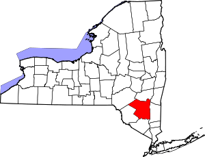 | |
| Towns | ||
| Villages | ||
| CDPs |
| |
| Other hamlets |
| |
| Footnotes | ‡This populated place also has portions in an adjacent county or counties | |