West Whiteland Township, Chester County, Pennsylvania
| West Whiteland Township | |
|---|---|
| Township | |
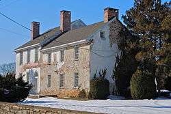 The West Whiteland Inn | |
| Motto(s): "...Pride in Our Past. Pride in Our Progress." | |
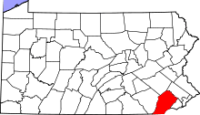
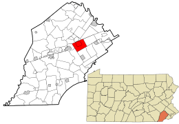 Location in Chester County and the state of Pennsylvania. | |
.svg.png) Location of Pennsylvania in the United States | |
| Coordinates: 39°59′45″N 75°37′59″W / 39.99583°N 75.63306°WCoordinates: 39°59′45″N 75°37′59″W / 39.99583°N 75.63306°W | |
| Country | United States |
| State | Pennsylvania |
| County | Chester |
| Area[1] | |
| • Total | 12.92 sq mi (33.47 km2) |
| • Land | 12.84 sq mi (33.24 km2) |
| • Water | 0.09 sq mi (0.23 km2) |
| Elevation | 394 ft (120 m) |
| Population (2010) | |
| • Total | 18,274 |
| • Estimate (2016)[2] | 18,410 |
| • Density | 1,434.36/sq mi (553.82/km2) |
| Time zone | UTC-5 (EST) |
| • Summer (DST) | UTC-4 (EDT) |
| Area code(s) | 610 |
| FIPS code | 42-029-84192 |
| Website |
www |
West Whiteland Township is a township in Chester County, Pennsylvania, United States. The population was 18,274 at the 2010 census.
Geography
According to the United States Census Bureau, the township has a total area of 13.0 square miles (34 km2), of which 0.04 square miles (0.10 km2), or 0.15%, is water.
Demographics
| Historical population | |||
|---|---|---|---|
| Census | Pop. | %± | |
| 1930 | 928 | — | |
| 1940 | 1,078 | 16.2% | |
| 1950 | 1,573 | 45.9% | |
| 1960 | 4,412 | 180.5% | |
| 1970 | 7,149 | 62.0% | |
| 1980 | 9,581 | 34.0% | |
| 1990 | 12,403 | 29.5% | |
| 2000 | 16,499 | 33.0% | |
| 2010 | 18,274 | 10.8% | |
| Est. 2016 | 18,410 | [2] | 0.7% |
| [3] | |||
At the 2010 census, the township was 78.8% non-Hispanic White, 5.1% Black or African American, 0.2% Native American, 11.4% Asian, and 2.0% were two or more races. 3.0% of the population were of Hispanic or Latino ancestry[4].
As of the census[5] of 2000, there were 16,499 people, 6,618 households, and 4,400 families residing in the township. The population density was 1,273.0 people per square mile (491.5/km²). There were 6,748 housing units at an average density of 520.7/sq mi (201.0/km²). The racial makeup of the township was 89.35% White, 5.38% African American, 0.16% Native American, 3.62% Asian, 0.06% Pacific Islander, 0.48% from other races, and 0.95% from two or more races. Hispanic or Latino of any race were 2.00% of the population.
There were 6,618 households, out of which 32.2% had children under the age of 18 living with them, 56.2% were married couples living together, 7.6% had a female householder with no husband present, and 33.5% were non-families. 26.4% of all households were made up of individuals, and 4.9% had someone living alone who was 65 years of age or older. The average household size was 2.44 and the average family size was 3.00.
In the township the population was spread out, with 25.0% under the age of 18, 6.0% from 18 to 24, 38.1% from 25 to 44, 22.0% from 45 to 64, and 8.8% who were 65 years of age or older. The median age was 35 years. For every 100 females, there were 95.8 males. For every 100 females age 18 and over, there were 93.5 males.
The median income for a household in the township was $71,545, and the median income for a family was $81,868. Males had a median income of $57,334 versus $40,827 for females. The per capita income for the township was $35,031. About 0.8% of families and 2.8% of the population were below the poverty line, including 0.4% of those under age 18 and 4.7% of those age 65 or over.
Education
West Chester Area School District operates public schools.[6]
Elementary schools serving sections of West Whiteland Township include Exton, Mary C. Howse, East Bradford, East Goshen, and Fern Hill.[7] About half of West Whiteland Township is zoned to Pierce Middle School and West Chester Henderson High School, while the other half is zoned to Fugett Middle School and East High School.[8]
See also
References
- ↑ "2016 U.S. Gazetteer Files". United States Census Bureau. Retrieved Aug 13, 2017.
- 1 2 "Population and Housing Unit Estimates". Retrieved June 9, 2017.
- ↑ (DVRPC), Delaware Valley Regional Planning Commission. "DVRPC > Site Search". www.dvrpc.org. Retrieved 16 April 2018.
- ↑ "Census 2010: Pennsylvania - USATODAY.com". usatoday.com. Retrieved 16 April 2018.
- ↑ "American FactFinder". United States Census Bureau. Retrieved 2008-01-31.
- ↑ "West Chester Area Council of Governments Map." On the website of West Goshen Township. Retrieved on September 26, 2018.
- ↑ "School Boundary Adjustment Draft SK8C - Current Boundaries with Zones of Change" (Elementary). West Chester Area School District. Retrieved on September 26, 2018.
- ↑ "School Boundary Adjustment Draft SK8C - Current Boundaries with Zones of Change" (Secondary). West Chester Area School District. Retrieved on September 26, 2018.
External links
| Wikimedia Commons has media related to West Whiteland Township, Chester County, Pennsylvania. |