West Fallowfield Township, Chester County, Pennsylvania
| West Fallowfield Township | |
|---|---|
| Township | |
 | |
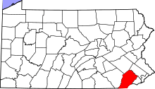
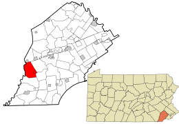 Location in Chester County and the U.S. state of Pennsylvania. | |
| Coordinates: 39°53′46″N 75°58′12″W / 39.89611°N 75.97000°WCoordinates: 39°53′46″N 75°58′12″W / 39.89611°N 75.97000°W | |
| Country | United States |
| State | Pennsylvania |
| County | Chester |
| Area[1] | |
| • Total | 18.25 sq mi (47.27 km2) |
| • Land | 18.15 sq mi (47.01 km2) |
| • Water | 0.10 sq mi (0.27 km2) |
| Elevation | 463 ft (141 m) |
| Population (2010) | |
| • Total | 2,566 |
| • Estimate (2016)[2] | 2,588 |
| • Density | 142.60/sq mi (55.06/km2) |
| Time zone | UTC-5 (EST) |
| • Summer (DST) | UTC-4 (EDT) |
| Area code(s) | 610 |
| FIPS code | 42-029-82936 |
West Fallowfield Township is a township in Chester County, Pennsylvania, United States. The population was 2,566 at the 2010 census. It includes the unincorporated village of Cochranville.
History
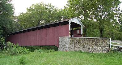
The Bridge in West Fallowfield Township, Mercer's Mill Covered Bridge, and Joseph and Esther Phillips Plantation are listed on the National Register of Historic Places.[3]
Geography
According to the United States Census Bureau, the township has a total area of 18.1 square miles (47 km2), all of it land.
Demographics
| Historical population | |||
|---|---|---|---|
| Census | Pop. | %± | |
| 1930 | 801 | — | |
| 1940 | 931 | 16.2% | |
| 1950 | 1,069 | 14.8% | |
| 1960 | 1,425 | 33.3% | |
| 1970 | 1,694 | 18.9% | |
| 1980 | 2,122 | 25.3% | |
| 1990 | 2,342 | 10.4% | |
| 2000 | 2,485 | 6.1% | |
| 2010 | 2,566 | 3.3% | |
| Est. 2016 | 2,588 | [2] | 0.9% |
| [4] | |||
At the 2010 census, the township was 89.7% non-Hispanic White, 1.5% Black or African American, 0.9% Asian, and 1.6% were two or more races. 6.8% of the population were of Hispanic or Latino ancestry.[5]
As of the census[6] of 2000, there were 2,485 people, 829 households, and 674 families residing in the township. The population density was 137.5 people per square mile (53.1/km²). There were 858 housing units at an average density of 47.5/sq mi (18.3/km²). The racial makeup of the township was 96.54% White, 0.93% African American, 0.28% Native American, 0.24% Asian, 1.09% from other races, and 0.93% from two or more races. Hispanic or Latino of any race were 2.29% of the population.
There were 829 households, out of which 39.3% had children under the age of 18 living with them, 70.1% were married couples living together, 7.6% had a female householder with no husband present, and 18.6% were non-families. 15.4% of all households were made up of individuals, and 5.3% had someone living alone who was 65 years of age or older. The average household size was 3.00 and the average family size was 3.32.
In the township the population was spread out, with 30.3% under the age of 18, 8.3% from 18 to 24, 28.1% from 25 to 44, 22.4% from 45 to 64, and 10.8% who were 65 years of age or older. The median age was 35 years. For every 100 females there were 101.1 males. For every 100 females age 18 and over, there were 97.5 males.
The median income for a household in the township was $50,833, and the median income for a family was $54,940. Males had a median income of $40,566 versus $24,674 for females. The per capita income for the township was $19,853. About 11.3% of families and 14.8% of the population were below the poverty line, including 22.6% of those under age 18 and 12.6% of those age 65 or over.
References
- ↑ "2016 U.S. Gazetteer Files". United States Census Bureau. Retrieved Aug 13, 2017.
- 1 2 "Population and Housing Unit Estimates". Retrieved June 9, 2017.
- ↑ National Park Service (2010-07-09). "National Register Information System". National Register of Historic Places. National Park Service.
- ↑ http://www.dvrpc.org/data/databull/rdb/db82/appedixa.xls
- ↑ https://www.usatoday.com/news/nation/census/profile/PA
- ↑ "American FactFinder". United States Census Bureau. Retrieved 2008-01-31.