West Nottingham Township, Chester County, Pennsylvania
| West Nottingham Township | |
|---|---|
| Township | |
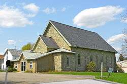 Nottingham Presbyterian Church | |
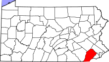
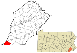 Location in Chester County and the state of Pennsylvania. | |
.svg.png) Location of Pennsylvania in the United States | |
| Coordinates: 39°44′56″N 75°59′44″W / 39.74889°N 75.99556°WCoordinates: 39°44′56″N 75°59′44″W / 39.74889°N 75.99556°W | |
| Country | United States |
| State | Pennsylvania |
| County | Chester |
| Area[1] | |
| • Total | 14.13 sq mi (36.60 km2) |
| • Land | 13.96 sq mi (36.15 km2) |
| • Water | 0.17 sq mi (0.45 km2) |
| Elevation | 492 ft (150 m) |
| Population (2010) | |
| • Total | 2,722 |
| • Estimate (2016)[2] | 2,685 |
| • Density | 192.35/sq mi (74.27/km2) |
| Time zone | UTC-5 (EST) |
| • Summer (DST) | UTC-4 (EDT) |
| Area code(s) | 610 |
| FIPS code | 42-029-83712 |
West Nottingham Township is a township in Chester County, Pennsylvania, United States. The population was 2,722 at the 2010 census.
History
The township was originally disputed territory between Pennsylvania and Maryland, resolved eventually by the Mason–Dixon line.[3] Established in 1718, West Nottingham Township dates back to 1701 when a group of William Penn's followers settled in the Nottingham Area.[4] It is named after Nottinghamshire, England.[3] The township also formed part of the northern section of Susquehanna Manor later known as New Connaught, a large settlement tract established by Maryland and named after the western province of Connacht in Ireland that courted Irish settlement into the area.[3] [5] The dispute led to heavy Quaker and Scotch-Irish settlement of the area.[3]
Geography
According to the United States Census Bureau, the township has a total area of 13.9 square miles (36 km2), of which 0.04 square miles (0.10 km2), or 0.29%, is water.
Demographics
| Historical population | |||
|---|---|---|---|
| Census | Pop. | %± | |
| 1930 | 547 | — | |
| 1940 | 685 | 25.2% | |
| 1950 | 881 | 28.6% | |
| 1960 | 1,137 | 29.1% | |
| 1970 | 1,440 | 26.6% | |
| 1980 | 2,030 | 41.0% | |
| 1990 | 2,183 | 7.5% | |
| 2000 | 2,634 | 20.7% | |
| 2010 | 2,722 | 3.3% | |
| Est. 2016 | 2,685 | [2] | −1.4% |
| [6] | |||
At the 2010 census, the township was 88.0% non-Hispanic White, 2.0% Black or African American, 0.6% Native American, 0.3% Asian, and 2.0% were two or more races. 8.3% of the population were of Hispanic or Latino ancestry[7].
As of the census[8] of 2000, there were 2,634 people, 956 households, and 741 families residing in the township. The population density was 189.9 people per square mile (73.3/km²). There were 1,007 housing units at an average density of 72.6/sq mi (28.0/km²). The racial makeup of the township was 94.68% White, 1.94% African American, 0.38% Native American, 0.27% Asian, 1.67% from other races, and 1.06% from two or more races. Hispanic or Latino of any race were 4.18% of the population.
There were 956 households, out of which 38.7% had children under the age of 18 living with them, 57.6% were married couples living together, 13.0% had a female householder with no husband present, and 22.4% were non-families. 18.2% of all households were made up of individuals, and 7.3% had someone living alone who was 65 years of age or older. The average household size was 2.75 and the average family size was 3.07.
In the township the population was spread out, with 28.0% under the age of 18, 8.0% from 18 to 24, 30.5% from 25 to 44, 23.4% from 45 to 64, and 10.1% who were 65 years of age or older. The median age was 35 years. For every 100 females, there were 100.0 males. For every 100 females age 18 and over, there were 98.0 males.
The median income for a household in the township was $45,142, and the median income for a family was $49,630. Males had a median income of $33,450 versus $23,406 for females. The per capita income for the township was $17,975. About 3.3% of families and 5.0% of the population were below the poverty line, including 2.3% of those under age 18 and 20.2% of those age 65 or over.
West Nottingham is home to Nottingham County Park. The 651 acre park sits atop an out-cropping of serpentine stone greater than one square mile in size – one of the largest serpentine barrens on the East Coast.
West Nottingham is also home to several mobile home communities.
References
- ↑ "2016 U.S. Gazetteer Files". United States Census Bureau. Retrieved Aug 13, 2017.
- 1 2 "Population and Housing Unit Estimates". Retrieved June 9, 2017.
- 1 2 3 4 http://www.risingsunmd.org/department/division.php?fDD=19-68
- ↑ http://www.wnt-gov.org/
- ↑ https://books.google.com/books?id=bCuu565vrmAC&pg=PA116&lpg=PA116&dq=new+connaught+lower+oxford+township&source=bl&ots=Rz_0Vpfstz&sig=7oe4jKG6UWsb4540OUZU5LpsBoU&hl=en&sa=X&ei=qNTRUZWvFsXh4AP-ioC4Ag&ved=0CDwQ6AEwAg#v=onepage&q=new%20connaught%20lower%20oxford%20township&f=false
- ↑ http://www.dvrpc.org/data/databull/rdb/db82/appedixa.xls
- ↑ https://www.usatoday.com/news/nation/census/profile/PA
- ↑ "American FactFinder". United States Census Bureau. Retrieved 2008-01-31.