Embreeville, Pennsylvania
| Embreeville, Pennsylvania | |
|---|---|
| Unincorporated community | |
 | |
 Embreeville Location within the U.S. state of Pennsylvania | |
| Coordinates: 39°55′44″N 75°43′52″W / 39.92889°N 75.73111°WCoordinates: 39°55′44″N 75°43′52″W / 39.92889°N 75.73111°W | |
| Country | United States |
| State | Pennsylvania |
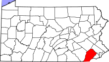
| County | Chester |
| Township | Newlin |
| Time zone | UTC-5 (Eastern (EST)) |
| • Summer (DST) | UTC-4 (EDT) |
| ZIP codes | 19320 |
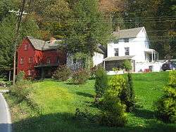
Embreeville is an historical unincorporated community, little more than a rural stretch of road with a few businesses and homes, in Newlin Township, Chester County, Pennsylvania, inside a bend of Brandywine Creek. It is about 30 miles (48 km) west of Philadelphia, and north of Unionville. The Embreeville Historic District, which covers most of the town, is on the National Register of Historic Places.[1]
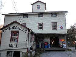
During the 19th and 20th centuries Embreeville was best known as the site of the county poor house and the Chester County Asylum for the Insane, renamed Embreeville State Hospital in 1938 and closed in 1980. Embreeville's other landmarks include the Embreeville Dam, Embreeville Mill, Pennsylvania State Police Barracks, Star Gazers' Stone, and Indian Hannah's grave.
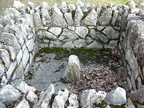
The Star Gazers' Stone marked an important astronomical observation point used by Charles Mason and Jeremiah Dixon in 1764 in surveying the Mason-Dixon line, which lies 15 miles south of the stone.
It is also the location to a Pennsylvania state police station.
References
- ↑ National Park Service (2010-07-09). "National Register Information System". National Register of Historic Places. National Park Service.
External links
- A brief history of the Mason-Dixon survey line Star Gazer's Stone
- Embreeville State Hospital
- Embreeville Mill
- ARCH/National Register of Historic Places