Honey Brook Township, Chester County, Pennsylvania
| Honey Brook Township | |
|---|---|
| Township | |
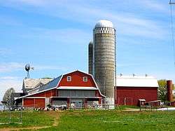 Farm on Pleasant View Rd. | |
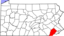
 Location in Chester County and the state of Pennsylvania. | |
.svg.png) Location of Pennsylvania in the United States | |
| Coordinates: 40°07′36″N 75°52′35″W / 40.12667°N 75.87639°WCoordinates: 40°07′36″N 75°52′35″W / 40.12667°N 75.87639°W | |
| Country | United States |
| State | Pennsylvania |
| County | Chester |
| Founded | 1789 |
| Area[1] | |
| • Total | 25.17 sq mi (65.20 km2) |
| • Land | 24.75 sq mi (64.11 km2) |
| • Water | 0.42 sq mi (1.10 km2) |
| Elevation | 879 ft (268 m) |
| Population (2010) | |
| • Total | 7,647 |
| • Estimate (2016)[2] | 8,226 |
| • Density | 332.35/sq mi (128.32/km2) |
| Time zone | UTC-5 (EST) |
| • Summer (DST) | UTC-4 (EDT) |
| Area code(s) | 610 |
| FIPS code | 42-029-35536 |
| Website |
www |
Honey Brook Township is a township in Chester County, Pennsylvania, United States. The population was 7,647 at the 2010 census.
Geography
According to the United States Census Bureau, the township has a total area of 25.4 square miles (66 km2), of which 25.1 square miles (65 km2) is land and 0.3 square miles (0.78 km2), or 1.14%, is water. The headwaters of the Brandywine River start in Honey Brook Township which is a part Brandywine River Tidal Basin. Honey Brook Township is also a part of the Pequea Creek Tidal Basin. Nearly two thirds of the land is in agricultural use.
Demographics
At the 2010 census, the township was 95.4% non-Hispanic White, 1.7% Hispanic or Latino, 1.1% Black or African American, 0.2% Asian, 0.1% Native Hawaiian or other Pacific Islander, and 3.2% were two or more races.[4]
As of the census[5] of 2000, there were 6,278 people, 2,054 households, and 1,554 families residing in the township. The population density was 250.0 people per square mile (96.5/km²). There were 2,134 housing units at an average density of 85.0/sq mi (32.8/km²). The racial makeup of the township was 97.40% White, 1.08% African American, 0.99% Hispanic or Latino of any race, 0.24% Native American, 0.19% Asian, 0.03% Pacific Islander, 0.29% from other races, and 0.76% from two or more races.
There were 2,054 households, out of which 38.7% had children under the age of 18 living with them, 63.5% were married couples living together, 7.8% had a female householder with no husband present, and 24.3% were non-families. 20.5% of all households were made up of individuals, and 11.8% had someone living alone who was 65 years of age or older. The average household size was 2.90 and the average family size was 3.37.
In the township the population was spread out, with 29.0% under the age of 18, 7.5% from 18 to 24, 27.5% from 25 to 44, 19.2% from 45 to 64, and 16.8% who were 65 years of age or older. The median age was 36 years. For every 100 females, there were 90.7 males. For every 100 females age 18 and over, there were 83.8 males.
The median income for a household in the township was $50,609, and the median income for a family was $57,500. Males had a median income of $40,970 versus $28,404 for females. The per capita income for the township was $19,046. About 5.2% of families and 6.8% of the population were below the poverty line, including 6.2% of those under age 18 and 19.5% of those age 65 or over.
References
- ↑ "2016 U.S. Gazetteer Files". United States Census Bureau. Retrieved Aug 13, 2017.
- 1 2 "Population and Housing Unit Estimates". Retrieved June 9, 2017.
- ↑ http://www.dvrpc.org/data/databull/rdb/db82/appedixa.xls
- ↑ https://www.usatoday.com/news/nation/census/profile/PA
- ↑ "American FactFinder". United States Census Bureau. Retrieved 2008-01-31.