Harmony Hill, Pennsylvania
| Harmony Hill, Pennsylvania | |
|---|---|
 Harmony Hill Location in Pennsylvania  Harmony Hill Harmony Hill (the US) | |
| Coordinates: 39°58′54″N 75°40′20″W / 39.98167°N 75.67222°WCoordinates: 39°58′54″N 75°40′20″W / 39.98167°N 75.67222°W | |
| Country | United States |
| State | Pennsylvania |
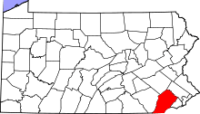
| County | Chester |
| Township | East Bradford |
| Elevation[1] | 384 ft (117 m) |
| Time zone | UTC-5 (Eastern (EST)) |
| • Summer (DST) | UTC-4 (EDT) |
| ZIP codes | 19335 |
| Area code(s) | 610, 484 |
| FIPS code | 42-32736 |
| GNIS feature ID | 1202202 |
Harmony Hill is a populated place situated in East Bradford Township in Chester County, Pennsylvania, United States.[2] It has an estimated elevation of 384 feet (117 m) above sea level.
References
- ↑ "Feature Detail Report for: Hayesville". Geographic Names Information System. United States Geological Survey.
- ↑ "Harmony Hill (in Chester County, PA) Populated Place Profile". PA Hometown Locator. Retrieved December 9, 2015.
This article is issued from
Wikipedia.
The text is licensed under Creative Commons - Attribution - Sharealike.
Additional terms may apply for the media files.