West Somerset
| West Somerset | ||
|---|---|---|
| Non-metropolitan district | ||
| ||
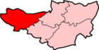
 Shown within Somerset | ||
| Sovereign state | United Kingdom | |
| Constituent country | England | |
| Region | South West England | |
| Ceremonial county | Somerset | |
| Admin HQ | Williton | |
| Created | 1 April 1974 | |
| Government | ||
| • Type | Non-metropolitan district | |
| • Leader | Tim Taylor | |
| • Council | Conservative | |
| • MPs: | Ian Liddell-Grainger C, Rebecca Pow C | |
| Area | ||
| • Total | 280.63 sq mi (726.84 km2) | |
| Population (mid-2017 est.) | ||
| • Total | 34,900 (Ranked 324th) | |
| • Density | 130/sq mi (49/km2) | |
| Time zone | UTC0 (GMT) | |
| • Summer (DST) | UTC+1 (BST) | |
| Post Code | TA - various | |
| Area code(s) | 01984 | |
| Website | http://www.westsomersetonline.gov.uk/ | |
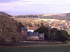
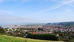
West Somerset is a local government district in the English county of Somerset. The council covers a largely rural area, with a population of 34,900[1] in an area of 740 square kilometres (290 sq mi);[2] it is the least populous non-unitary district in England. According to figures released by the Office for National Statistics in 2009, the population of West Somerset has the oldest average age in the United Kingdom at 52.[3] The largest centres of population are the coastal towns of Minehead (population 10,000) and Watchet (4,400).
The council's administrative headquarters is located in the village of Williton, with an additional office in Minehead.
In September 2016, West Somerset and Taunton Deane councils agreed in principle to merge the districts into one (with one council) subject to consultation.[4] The new district would not be a unitary authority: it would still be part of the Somerset County Council area.[5] In March 2018 both councils voted in favour of the merger and it will come into effect on 1st April 2019, with the first elections to the new council in May 2019. The new authority will be known as Somerset West and Taunton Council.[6][7][8]
History
The district was formed on 1 April 1974, under the Local Government Act 1972, by a merger of the previous urban districts of Minehead and Watchet, along with Dulverton Rural District and Williton Rural District.
Listed buildings
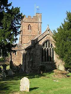
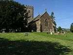
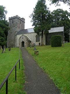
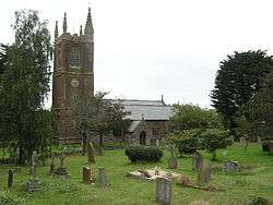
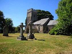
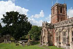
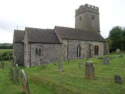
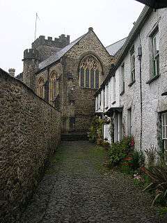
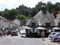
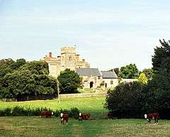
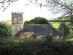
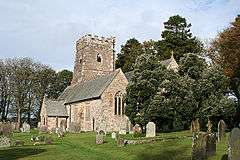
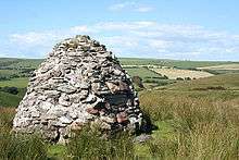
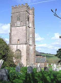
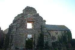
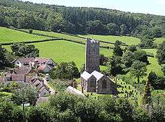
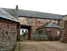
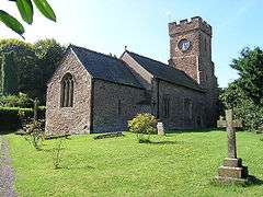
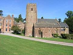
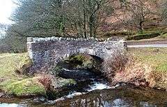
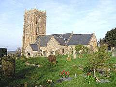
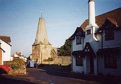
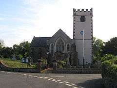
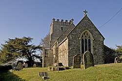
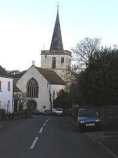
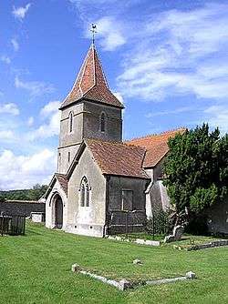
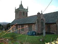
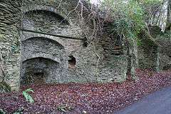
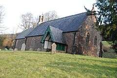
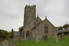
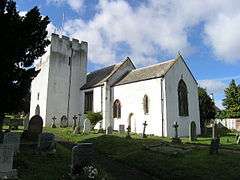
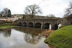
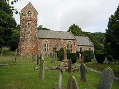
There are 33 Grade I listed buildings in West Somerset: the oldest are Culbone Church (one of the smallest churches in England,[9] and pre-Norman in origin)[10] and Tarr Steps, which some say originates in the Bronze Age, although others date them from around 1400.[11] Dunster has the greatest concentration of Grade I listed buildings including Dunster Castle, the Yarn Market, Gallox Bridge and Priory Church of St George. Other sites include manor houses such as Nettlecombe Court and Orchard Wyndham. The most recent buildings included in the list are Crowcombe Court which was completed in 1739[12] and the Church of St John the Baptist in Carhampton which was rebuilt in 1863.[13] There are numerous religious structures in Somerset, with the largest number being Anglican parish churches, dating from Norman or medieval eras. Some of the churches are included in the Somerset towers, a collection of distinctive, mostly spireless Gothic church towers.

Recent financial difficulties
In 2012 financial difficulties at the council, including a £1 million reduction over three years, lead to plans to outsource most of the services provided to the population and make most of the staff redundant.[14] It is proposed that some services may be shared with Taunton Deane council.[15] In December 2012 the grant received from central government was increased by 0.9% meaning the council had £3.8million to spend on the provision of services.[16]
Geography
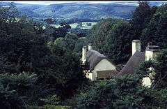
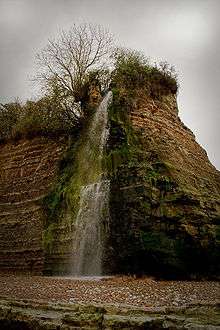
West Somerset benefits from one of the most scenic landscapes in England. Nearly two-thirds of the western land area of the district forms part of Exmoor National Park, designated in 1954, while on the eastern edge of the district are the Quantock Hills, which in 1956 became the first Area of Outstanding Natural Beauty created in the UK. Large areas of Exmoor and the Quantock Hills are also designated as Sites of Special Scientific Interest because of their value for wildlife.
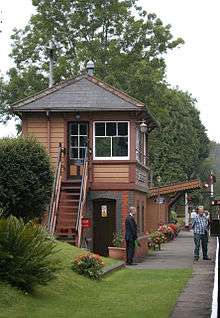
The West Somerset Railway runs through most of the district, from Bishop's Lydeard in the south east to Minehead in the north west. Operated mainly as a tourist attraction, the railway runs mostly steam and some diesel locomotives.
Governance
West Somerset District Council is elected every four years, with currently 28 councillors being elected at each election. From the first election to the council in 1973 to the 1995 election the council had a majority of independents. Since then the Conservative Party won a majority at the 2003 election, but independents took a majority back at the 2007 election. Following the election in 2011 the Conservatives regained a majority and following the 2015 election and several subsequent by-elections, the council is composed of the following councillors:-[17]
| Party | Councillors | |
| Conservative Party | 20 | |
| Independent | 2 | |
| UKIP | 2 | |
| Liberal Democrats | 3 | |
| Labour Party | 1 | |
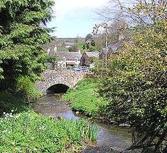
Settlements
- Allerford, Ashbeer
- Battleton, Bickham, Bicknoller, Bilbrook, Bossington, Brandish Street, Bratton, Bridgetown, Brompton Ralph, Brompton Regis, Brushford
- Carhampton, Chapel Cleeve, Churchtown, Clatworthy, Crowcombe, Crowcombe Heathfield, Culbone, Cutcombe
- Dulverton, Dunster
- East Quantoxhead, Elworthy, Escott, Exford, Exton
- Flaxpool
- Halsway, Hawkridge, Higher Vexford, Holford, Huish Champflower
- Kilve, Kilton, Kingsbridge, Kingswood
- Lawford, Leighland Chapel, Lilstock, Lower Vellow, Lower Vexford, Lower Weacombe, Luccombe, Luxborough, Lynch, Lyncombe
- Minehead, Monksilver
- Oare, Oareford, Old Cleeve
- Pooltown, Porlock, Preston
- Roadwater
- St Audries, Sampford Brett, Selworthy, Simonsbath, Skilgate, Stoke Pero, Stogumber, Stogursey, Stringston
- Timberscombe, Tivington, Torre, Treborough, Triscombe
- Upton
- Vellow
- Washford, Watchet, Weacombe, West Quantoxhead, Williton, Winsford, Withycombe, Withypool, Woodford, Wootton Courtenay
- Yarde
Parishes
Education
County schools (those which are not independent) in the five non-metropolitan districts of the county are operated by Somerset County Council.
For a full list of schools see: List of schools in Somerset
See also
References
- ↑ "Statistics & Census Information". West Somerset Council. Retrieved 22 October 2017.
- ↑ "West Somerset (Local Authority): Key Figures for Physical Environment". Neighbourhood Statistics. Office for National Statistics. Retrieved 23 April 2009.
- ↑ "Maps chart UK's ageing population". BBC News. 1 October 2009. Retrieved 3 October 2009.
- ↑ West Somerset Online
- ↑ Your New Council
- ↑ "Somerset councils merger approved despite criticism". BBC. Retrieved 20 March 2018.
- ↑ Simmons, Alice (19 March 2018). "Taunton Deane and West Somerset vote in favour of council merger". Somerset County Gazette. Retrieved 20 March 2018.
- ↑ Ministry of Housing, Communities and Local Government (24 May 2018). "The Somerset West and Taunton (Local Government Changes) Order 2018". legislation.gov.uk. Retrieved 2018-05-28.
- ↑ "Parish Churches". Somerset County archives. Archived from the original on 5 October 2013. Retrieved 24 October 2007.
- ↑ "Culbone church". Images of England. Retrieved 24 October 2007.
- ↑ "Tarr Steps". Everything Exmoor. Archived from the original on 14 June 2012. Retrieved 8 June 2012.
- ↑ "Crowcombe Court". Images of England. English Heritage. Retrieved 17 January 2009.
- ↑ "Church of St John the Baptist, Carhampton". Images of England. English Heritage. Retrieved 17 January 2009.
- ↑ Morris, Steven (12 December 2012). "West Somerset council considers making most of its staff redundant". London: Guardian. Retrieved 14 December 2012.
- ↑ "West Somerset Council anti-bankruptcy plan approved". BBC. 12 December 2012. Retrieved 14 December 2012.
- ↑ "Why West Somerset Council is at risk of going bust". BBC. 19 December 2012. Retrieved 23 December 2012.
- ↑ "Council composition 2018". West Somerset Council. Retrieved 1 July 2018.
- 1 2 3 4 5 6 7 8 9 10 11 12 13 14 15 16 17 18 19 20 21 22 23 24 25 26 27 28 29 30 31 32 33 34 35 36 "Statistics for Wards, LSOAs and Parishes — SUMMARY Profiles" (Excel). Somerset Intelligence. Retrieved 4 January 2014.
- 1 2 3 4 5 6 7 8 9 10 11 12 13 14 15 16 17 18 19 20 21 22 23 24 25 26 27 28 29 "Williton RD". A vision of Britain Through Time. University of Portsmouth. Retrieved 5 January 2014.
- 1 2 3 4 5 6 7 8 9 10 11 "Dulverton RD". A vision of Britain Through Time. University of Portsmouth. Retrieved 5 January 2014.
- ↑ "Minehead UD". A vision of Britain Through Time. University of Portsmouth. Retrieved 5 January 2014.
- ↑ "Watchet UD". A vision of Britain Through Time. University of Portsmouth. Retrieved 5 January 2014.