East Dorset
| East Dorset District | |
|---|---|
| Non-metropolitan district | |
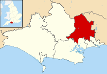 East Dorset shown within Dorset | |
| Sovereign state | United Kingdom |
| Constituent country | England |
| Region | South West England |
| Non-metropolitan county | Dorset |
| Status | Non-metropolitan district |
| Admin HQ | Wimborne |
| Incorporated | 1 April 1974 |
| Government | |
| • Type | Non-metropolitan district council |
| • Body | East Dorset District Council |
| • Leadership | Alternative - Sec.31 (Conservative) |
| • MPs |
Christopher Chope Simon Hoare[1] Michael Tomlinson |
| Area | |
| • Total | 136.8 sq mi (354.4 km2) |
| Area rank | 119th (of 326) |
| Population (mid-2017 est.) | |
| • Total | 89,400 |
| • Rank | 272nd (of 326) |
| • Density | 650/sq mi (250/km2) |
| • Ethnicity | 99.0% White |
| Time zone | UTC0 (GMT) |
| • Summer (DST) | UTC+1 (BST) |
| ONS code |
19UD (ONS) E07000049 (GSS) |
| OS grid reference | SU0130301959 |
| Website |
www |
East Dorset is a local government district in Dorset, England. Its council is based in Wimborne Minster since 2016.[2][3]
The district was formed on 1 April 1974 by the merger of Wimborne Minster Urban District with part of the Ringwood and Fordingbridge Rural District and the Wimborne and Cranborne Rural District. The district was originally known as Wimborne, and adopted its present name in 1988.
The popularity of the area, being close to the New Forest, Bournemouth and the Dorset coast, has seen a rapid expansion in housing from the 1970s with the Verwood, Ferndown, West Moors and Corfe Mullen populations more than quadrupling. There still remains a rural feel, however, especially in the north and west of the area. Wimborne Minster has retained its identity as a historic market town.
East Dorset also contains a large amount of the remaining lowland heath, managed by East Dorset Countryside Management Services in partnership with the Forestry Commission. The expansion of housing has led to a massive decrease in the area of this unusual and unique habitat, which once covered 500 km² but now covers only 15% of that.
Statistics released[4] by the Office for National Statistics show that life expectancy at birth for males in East Dorset was 80.1 years in 2001-2003, the highest in the United Kingdom. Female life expectancy at birth for the same period was 83.4 years, ranking seventh in the UK. The figures for East Dorset during 1991-1993 were 77.9 years for males and 82.5 for females.
Governance
East Dorset District Council is elected every four years, with currently 36 councillors being elected at each election. Since 1976 the Conservative party has held a majority on the council apart from a period between the 1995 and 1999 elections when the Liberal Democrats had control. As of the 2015 election the council is composed of the following councillors:-[5]
| Party | Councillors | |
| Conservative Party | 24 | |
| Liberal Democrats | 3 | |
| Independent | 2 | |
The district and its council will be abolished on 1st April 2019 and, together with the other 4 districts outside the greater Bournemouth area, will form a new Dorset unitary authority.[6]
Settlements
- Settlements with a population over 2,500 are in bold.
- Alderholt
- Chalbury, Colehill, Corfe Mullen, Cranborne
- Edmondsham
- Ferndown
- Gussage
- Hinton Martell, Hinton Parva, Holt, Horton
- Long Crichel
- Moor Crichel
- Pamphill, Pentridge
- St Ives, St Leonards, Shapwick, Sixpenny Handley, Sturminster Marshall
- Verwood
- West Moors, West Parley, Wimborne Minster, Wimborne St Giles, Witchampton, Woodlands
See also
References
- ↑ "Dorset North Parliamentary constituency". Election 2015. BBC. Retrieved 11 May 2015.
- ↑ "Relocation of East Dorset District Council offices". news.dorsetforyou.gov.uk.
- ↑ "Contact East Dorset District Council". www.dorsetforyou.gov.uk.
- ↑ Life expectancy at birth in the United Kingdom, Office for National Statistics
- ↑ "Local election results for Christchurch and East Dorset". dorsetforyou.com. 13 May 2015. Archived from the original on 13 May 2015. Retrieved 17 May 2015.
- ↑ Ministry of Housing, Communities and Local Government (25 May 2018). "The Bournemouth, Dorset and Poole (Structural Changes) Order 2018". legislation.gov.uk. Retrieved 2018-05-28.
Dorset Portal | |
| Unitary authorities | |
| Boroughs or districts | |
| Major settlements | |
| Rivers | |
| Topics | |
Coordinates: 50°48′59.84″N 1°58′53.36″W / 50.8166222°N 1.9814889°W