Skilgate
| Skilgate | |
|---|---|
 St John the Baptist | |
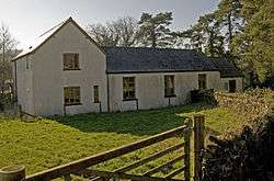 Village Hall | |
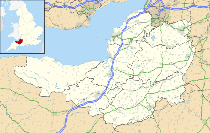 Skilgate Skilgate shown within Somerset | |
| Population | 96 (2001)[1] |
| OS grid reference | SS985275 |
| District | |
| Shire county | |
| Region | |
| Country | England |
| Sovereign state | United Kingdom |
| Post town | Taunton |
| Postcode district | TA4 |
| Police | Avon and Somerset |
| Fire | Devon and Somerset |
| Ambulance | South Western |
| EU Parliament | South West England |
| UK Parliament | |
Skilgate is a village and civil parish 5 miles (8 km) east of Dulverton and 8 miles (13 km) west of Wiveliscombe in the West Somerset district of Somerset, England. It has a population of 96.[1]
The parish, which covers an area of 866 ha,[1] straddles the boundary of the Exmoor National Park lying on the southern edge of the Brendon Hills, and is close to the border with Devon.
History
In the Domesday Book the village was recorded as Scheligate, possibly meaning 'the opening on the boundary'.[1] At that time it was held by Robert de Gatemore under Roger Arundel along with another manor in the parish known as Milton. They passed in the 20th century to the Ferguson Davie baronets.[2]
The parish of Skillgate was part of the Williton and Freemanners Hundred.[3]
Governance
The Parish Meeting has responsibility for local issues, there being no Parish Council.[4]
The village falls within the Non-metropolitan district of West Somerset, which was formed on 1 April 1974 under the Local Government Act 1972, having previously been part of Dulverton Rural District.[5] The district council is responsible for local planning and building control, local roads, council housing, environmental health, markets and fairs, refuse collection and recycling, cemeteries and crematoria, leisure services, parks, and tourism.
Somerset County Council is responsible for running the largest and most expensive local services such as education, social services, libraries, main roads, public transport, policing and fire services, trading standards, waste disposal and strategic planning.
It is also part of the Bridgwater and West Somerset county constituency represented in the House of Commons of the Parliament of the United Kingdom and part of the South West England constituency of the European Parliament.
Religious sites
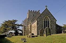
The Church of St John has a 14th-century tower, but the rest of the church was rebuilt in 1872. It has been designated by English Heritage as a Grade II* listed building.[6]
References
| Wikimedia Commons has media related to Skilgate. |
- 1 2 3 4 "Skilgate". Exmoor National Park. Archived from the original on 26 October 2009. Retrieved 4 February 2008.
- ↑ Bush, Robin (1994). Somerset: The Complete Guide. Dovecote Press. p. 184. ISBN 1-874336-26-1.
- ↑ "Somerset Hundreds". GENUKI. Retrieved 23 October 2011.
- ↑ "Skilgate Parish council - West Somerset Council". West Somerset Council. Retrieved 18 November 2015.
- ↑ A Vision of Britain Through Time : Dulverton Rural District Archived 23 March 2012 at the Wayback Machine.
- ↑ "Church of St John". Images of England. Retrieved 4 February 2008.