North Devon
Coordinates: 51°04′52″N 4°03′29″W / 51.081°N 4.058°W
| North Devon District | |
|---|---|
| Non-metropolitan district | |
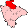
 North Devon shown within Devon | |
| Sovereign state | United Kingdom |
| Constituent country | England |
| Region | South West England |
| Non-metropolitan county | Devon |
| Status | Non-metropolitan district |
| Admin HQ | Barnstaple |
| Incorporated | 1 April 1974 |
| Government | |
| • Type | Non-metropolitan district council |
| • Body | North Devon Council |
| • Leadership | Leader and Cabinet (Conservative / Independent) |
| • MPs | Peter Heaton-Jones (C) |
| Area | |
| • Total | 419.3 sq mi (1,085.9 km2) |
| Area rank | 23rd (of 326) |
| Population (mid-2017 est.) | |
| • Total | 95,400 |
| • Rank | 255th (of 326) |
| • Density | 230/sq mi (88/km2) |
| • Ethnicity | 97.9% White |
| Time zone | UTC0 (GMT) |
| • Summer (DST) | UTC+1 (BST) |
| ONS code |
18UE (ONS) E07000043 (GSS) |
| OS grid reference | SS5586233371 |
| Website |
www |

North Devon is a local government district in Devon, England. Its council is based in Barnstaple. Other towns and villages in the North Devon District include Braunton, Fremington, Ilfracombe, Instow, South Molton, Lynton and Lynmouth. The district was formed on 1 April 1974 as a merger of the Barnstaple municipal borough, the Ilfracombe and Lynton urban districts, and the Barnstaple and South Molton rural districts.
The wider geographic area of North Devon is divided between North Devon District and the district of Torridge, based in Bideford.
Population
North Devon is popular with retired people. The 2011 census showed that 18% of residents were aged 15 years and under, 60% were aged 16–64 and 23% were aged 65 and over. This compares to the 20% of the population who were aged 65 and over when the 2001 census was taken. For comparison, the same age distributions across England were 19%, 64% and 17% respectively.[1] Life expectancy for men, at 77.7, is close to the English average. Female life expectancy is good at 83.1, around 1 year above the English average.[2] There is a gap of 6 years in the life expectancy of men in the least deprived fifth of wards and the most deprived fifth.[2] The region has one of the most ethnically homogenous populations in England, with 97.9% reporting their ethnicity as 'white' in the 2011 census of the population.[3] However, this is a decrease on the 99.0% of the population who declared themselves to be White on the 2001 census.
Governance
North Devon District Council is elected every four years, with currently 43 councillors being elected at each election. From the first election to the council in 1973 to 1987 the council was controlled by independents. This was followed by a period under Liberal Democrat control until the Conservative Party took control at the 2007 election. After the election in 2011 the Conservatives lost their majority [4] and a coalition between the Liberal Democrats and independents took control of the council although this returned to no overall control in 2015.
The political composition of the borough has been as follows:
| Date | Conservative | +/- | Liberal Democrat | +/- | Independent | +/- | UKIP | +/- | Control | ||||
| 1999[5] | 5 | 26 | 13 | 0 | Liberal Democrat | ||||||||
| 2003[6] | 10 | +5 | 22 | -4 | 10 | -2 | 1 | +1 | Liberal Democrat | ||||
| 2007[n 1][7] | 22 | +12 | 17 | -5 | 4 | -7 | 0 | = | Conservative | ||||
| 2011[8] | 18 | -4 | 14 | -3 | 11 | +7 | 0 | NOC | |||||
| 2015[9] | 20 | +2 | 12 | -3 | 11 | = | 0 | NOC | |||||
Transport
Along with its neighbours to the east and west, Torridge and West Somerset, the area has a fairly sparse transport infrastructure. The rump of the post-Beeching railway network has left a branch line to Exeter as the area's sole railway service. Despite being served only by one railway line, the borough is served by 5 railway stations, which is a large amount comparable with more urbanised boroughs such as Plymouth and Mid Devon.
The region is served by three A roads. The primary link is the A361 (known locally as the Link Road) which was constructed between 1986 and 1989. It heads north-west from the M5 motorway, past South Molton, to Barnstaple, with the classification continuing then northwards along older roads to Ilfracombe. The modern Link Road continues westwards from Barnstaple as the A39 where it is designated the Atlantic Highway, and runs via Bideford into Cornwall. The eastern section of the A39 links Barnstaple to Lynton, then traverses the northern coastal hills of Exmoor into Somerset.
The other two A roads in North Devon are the A399, a minor local route between Ilfracombe and South Molton (used as a de facto Barnstaple-bypass to Ilfracombe and Woolacombe), and the A377, which is the main road between Barnstaple and the county town of Devon, Exeter.
Due to significant peak time traffic delays in Barnstaple, coupled with severe congestion at both peak and non-peak times in the summer when tourist traffic is at its busiest, the Barnstaple Western Bypass was opened in 2007.
Economy
North Devon is some distance from the UK's traditional areas of industrial activity and population yet boasts some major manufacturing sites that export around the world. TDK Lambda and Pall Europe in Ilfracombe, Eaton Aerospace and Norbord in South Molton, Perrigo in Braunton as well as multiple businesses in Barnstaple. Due to the historically agricultural nature of the economy alongside a strong tourism industry employment can be seasonal, as a result some areas of North Devon and are considered deprived. The overall average income for the district is 80% of the average for the United Kingdom as a whole. Whilst the 1989 opening of the improved A361 connection to the motorway network helped to promote trade, it had a temporary detrimental effect on a number of distribution businesses. The latter had previously viewed the town as a base for local distribution networks, a need that was removed with an approximate halving of travelling time to the M5 motorway. The region adapted, in 2005 unemployment in North Devon was 1.8–2.4% but in 2018 unemployment in North Devon had come down significantly since its 2010 high to 1.1%. Median weekly full time pay stands at £440 per week, average house prices stand at £230,000 and the number of businesses registered has increased to 4895 up 370 from 2010. 2018 has also seen significant Government investment in the area through Coastal Community grants, Housing Infrastructure funds as well at £83 million to further upgrade the North Devon Link Road. [26]
Because Barnstaple is the main shopping area for North Devon, retail work is a contributor to the economy. There are many generic chain stores in the town centre and in the Roundswell Business Park, on the western fringe of the town. Tesco has several stores in the area, which includes a Tesco Extra hypermarket, a large Tesco superstore. There is also a Sainsbury's superstore, a Lidl supermarket. And, the multi-million pound redevelopment of the former Leaderflush Shapland works at Anchorwood Bank, and the surrounding area, is creating a conservation area near the River Taw, hundreds of new homes, a commercial retail area with new shops, restaurants and leisure facilities. A new Asda superstore and petrol filling station is part of the redevelopment. The whole scheme will be completed by the end of 2017, and the new Asda store opened in November 2016. On the same side of the riverbank a new housing development and Leisure Centre is planned to start in 2019. However, the largest employer in the region is local and central Government. The two main government employers in the area are the Royal Marines Base Chivenor, 3 miles (4.8 km) west of the town, and North Devon District Hospital, 1 mile (1.6 km) to the north.

Barnstaple
Barnstaple is on the River Taw estuary, and functions both as the main service centre and the administrative centre for North Devon Council. The parish of Barnstaple has a population of 23,710 but the population of the urban area of the town taking in Sticklepath, Roundswell and Bickington is 30,916.[10] Near-contiguous areas such as Bishop's Tawton, Fremington and Landkey and other satellite settlements make up a hinterland known as the 'Barnstaple Town Area' which has a population of 53,514.
See also
Notes
- ↑ UKIP member resigned from the party and sat as an independent.
References
- ↑ http://www.devon.gov.uk/census_profile-north_devon.pdf
- 1 2 "Archived copy". Archived from the original on 5 September 2015. Retrieved 9 February 2014.
- ↑ "2011 Census - Ethnicity". ons.gov.uk.
- ↑ "England council elections". BBC News Online. Retrieved 4 August 2011.
- ↑ "North Devon District - Full Election 1999". North Devon District Council. Retrieved 11 February 2017.
- ↑ "North Devon District - Full Election 2003". North Devon District Council. Retrieved 11 February 2017.
- ↑ "North Devon District - Full Election 2007". North Devon District Council. Retrieved 11 February 2017.
- ↑ "North Devon District - Full Election 2011". North Devon District Council. Retrieved 11 February 2017.
- ↑ "North Devon District - Full Election 2015". North Devon District Council. Retrieved 11 February 2017.
- ↑