Vibrac, Charente
| Vibrac | |
|---|---|
| Commune | |
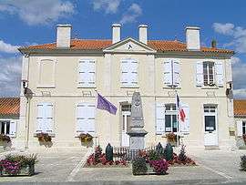 Town hall | |
 Vibrac Location within Nouvelle-Aquitaine region  Vibrac | |
| Coordinates: 45°38′38″N 0°03′42″W / 45.6439°N 0.0617°WCoordinates: 45°38′38″N 0°03′42″W / 45.6439°N 0.0617°W | |
| Country | France |
| Region | Nouvelle-Aquitaine |
| Department | Charente |
| Arrondissement | Cognac |
| Canton | Charente-Champagne |
| Intercommunality | Région de Châteauneuf |
| Government | |
| • Mayor (2008–2014) | Claude Guillot |
| Area1 | 2.82 km2 (1.09 sq mi) |
| Population (2008)2 | 303 |
| • Density | 110/km2 (280/sq mi) |
| Time zone | UTC+1 (CET) |
| • Summer (DST) | UTC+2 (CEST) |
| INSEE/Postal code | 16402 /16120 |
| Elevation |
15–68 m (49–223 ft) (avg. 45 m or 148 ft) |
|
1 French Land Register data, which excludes lakes, ponds, glaciers > 1 km2 (0.386 sq mi or 247 acres) and river estuaries. 2 Population without double counting: residents of multiple communes (e.g., students and military personnel) only counted once. | |
Vibrac is a commune in the Charente department in southwestern France.
Population
| Historical population | ||
|---|---|---|
| Year | Pop. | ±% |
| 1793 | 469 | — |
| 1800 | 435 | −7.2% |
| 1806 | 461 | +6.0% |
| 1821 | 476 | +3.3% |
| 1831 | 458 | −3.8% |
| 1841 | 436 | −4.8% |
| 1846 | 506 | +16.1% |
| 1851 | 496 | −2.0% |
| 1856 | 429 | −13.5% |
| 1861 | 416 | −3.0% |
| 1866 | 420 | +1.0% |
| 1872 | 402 | −4.3% |
| 1876 | 378 | −6.0% |
| 1881 | 381 | +0.8% |
| 1886 | 353 | −7.3% |
| 1891 | 317 | −10.2% |
| 1896 | 314 | −0.9% |
| 1901 | 282 | −10.2% |
| 1906 | 297 | +5.3% |
| 1911 | 291 | −2.0% |
| 1921 | 267 | −8.2% |
| 1926 | 265 | −0.7% |
| 1931 | 244 | −7.9% |
| 1936 | 233 | −4.5% |
| 1946 | 239 | +2.6% |
| 1954 | 243 | +1.7% |
| 1962 | 225 | −7.4% |
| 1968 | 246 | +9.3% |
| 1975 | 266 | +8.1% |
| 1982 | 232 | −12.8% |
| 1990 | 223 | −3.9% |
| 1999 | 243 | +9.0% |
| 2008 | 303 | +24.7% |
See also
References
| Wikimedia Commons has media related to Vibrac (Charente). |
This article is issued from
Wikipedia.
The text is licensed under Creative Commons - Attribution - Sharealike.
Additional terms may apply for the media files.