Pranzac
| Pranzac | |
|---|---|
| Commune | |
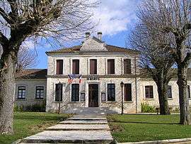 Town hall | |
 Pranzac Location within Nouvelle-Aquitaine region  Pranzac | |
| Coordinates: 45°40′16″N 0°21′05″E / 45.6711°N 0.3514°ECoordinates: 45°40′16″N 0°21′05″E / 45.6711°N 0.3514°E | |
| Country | France |
| Region | Nouvelle-Aquitaine |
| Department | Charente |
| Arrondissement | Angoulême |
| Canton | Val de Tardoire |
| Intercommunality | Bandiat-Tardoire |
| Government | |
| • Mayor (2008–2014) | Jacky Terrade |
| Area1 | 15.06 km2 (5.81 sq mi) |
| Population (2008)2 | 900 |
| • Density | 60/km2 (150/sq mi) |
| Time zone | UTC+1 (CET) |
| • Summer (DST) | UTC+2 (CEST) |
| INSEE/Postal code | 16269 /16110 |
| Elevation |
80–131 m (262–430 ft) (avg. 118 m or 387 ft) |
|
1 French Land Register data, which excludes lakes, ponds, glaciers > 1 km2 (0.386 sq mi or 247 acres) and river estuaries. 2 Population without double counting: residents of multiple communes (e.g., students and military personnel) only counted once. | |
Pranzac is a commune in the Charente department in southwestern France.
Population
| Historical population | ||
|---|---|---|
| Year | Pop. | ±% |
| 1793 | 617 | — |
| 1800 | 574 | −7.0% |
| 1806 | 687 | +19.7% |
| 1821 | 741 | +7.9% |
| 1831 | 760 | +2.6% |
| 1841 | 768 | +1.1% |
| 1846 | 766 | −0.3% |
| 1851 | 799 | +4.3% |
| 1856 | 795 | −0.5% |
| 1861 | 784 | −1.4% |
| 1866 | 751 | −4.2% |
| 1872 | 677 | −9.9% |
| 1876 | 713 | +5.3% |
| 1881 | 736 | +3.2% |
| 1886 | 758 | +3.0% |
| 1891 | 734 | −3.2% |
| 1896 | 710 | −3.3% |
| 1901 | 659 | −7.2% |
| 1906 | 640 | −2.9% |
| 1911 | 671 | +4.8% |
| 1921 | 641 | −4.5% |
| 1926 | 565 | −11.9% |
| 1931 | 569 | +0.7% |
| 1936 | 614 | +7.9% |
| 1946 | 594 | −3.3% |
| 1954 | 578 | −2.7% |
| 1962 | 662 | +14.5% |
| 1968 | 629 | −5.0% |
| 1975 | 667 | +6.0% |
| 1982 | 790 | +18.4% |
| 1990 | 874 | +10.6% |
| 1999 | 792 | −9.4% |
| 2008 | 900 | +13.6% |
See also
References
| Wikimedia Commons has media related to Pranzac. |
This article is issued from
Wikipedia.
The text is licensed under Creative Commons - Attribution - Sharealike.
Additional terms may apply for the media files.