Manot, Charente
| Manot | |
|---|---|
| Commune | |
 | |
 Manot Location within Nouvelle-Aquitaine region  Manot | |
| Coordinates: 45°56′37″N 0°38′17″E / 45.9436°N 0.6381°ECoordinates: 45°56′37″N 0°38′17″E / 45.9436°N 0.6381°E | |
| Country | France |
| Region | Nouvelle-Aquitaine |
| Department | Charente |
| Arrondissement | Confolens |
| Canton | Charente-Vienne |
| Intercommunality | Confolentais |
| Government | |
| • Mayor (2008–2014) | Jean-Luc Dedieu |
| Area1 | 20.34 km2 (7.85 sq mi) |
| Population (2008)2 | 594 |
| • Density | 29/km2 (76/sq mi) |
| Time zone | UTC+1 (CET) |
| • Summer (DST) | UTC+2 (CEST) |
| INSEE/Postal code | 16205 /16500 |
| Elevation |
132–231 m (433–758 ft) (avg. 191 m or 627 ft) |
|
1 French Land Register data, which excludes lakes, ponds, glaciers > 1 km2 (0.386 sq mi or 247 acres) and river estuaries. 2 Population without double counting: residents of multiple communes (e.g., students and military personnel) only counted once. | |
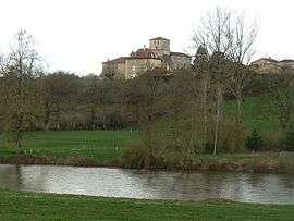
Manot is a commune in the Charente department in southwestern France.
Population
| Historical population | ||
|---|---|---|
| Year | Pop. | ±% |
| 1793 | 1,048 | — |
| 1800 | 1,214 | +15.8% |
| 1806 | 1,079 | −11.1% |
| 1821 | 1,282 | +18.8% |
| 1831 | 1,298 | +1.2% |
| 1841 | 1,320 | +1.7% |
| 1846 | 1,340 | +1.5% |
| 1851 | 1,353 | +1.0% |
| 1856 | 1,345 | −0.6% |
| 1861 | 1,196 | −11.1% |
| 1866 | 1,164 | −2.7% |
| 1872 | 1,124 | −3.4% |
| 1876 | 1,240 | +10.3% |
| 1881 | 1,513 | +22.0% |
| 1886 | 1,269 | −16.1% |
| 1891 | 1,275 | +0.5% |
| 1896 | 1,212 | −4.9% |
| 1901 | 1,160 | −4.3% |
| 1906 | 1,161 | +0.1% |
| 1911 | 1,009 | −13.1% |
| 1921 | 885 | −12.3% |
| 1926 | 821 | −7.2% |
| 1931 | 802 | −2.3% |
| 1936 | 770 | −4.0% |
| 1946 | 684 | −11.2% |
| 1954 | 687 | +0.4% |
| 1962 | 708 | +3.1% |
| 1968 | 681 | −3.8% |
| 1975 | 672 | −1.3% |
| 1982 | 590 | −12.2% |
| 1990 | 584 | −1.0% |
| 1999 | 577 | −1.2% |
| 2008 | 594 | +2.9% |
See also
References
| Wikimedia Commons has media related to Manot. |
This article is issued from
Wikipedia.
The text is licensed under Creative Commons - Attribution - Sharealike.
Additional terms may apply for the media files.