Brigueuil
| Brigueuil | |
|---|---|
| Commune | |
 | |
 Brigueuil Location within Nouvelle-Aquitaine region  Brigueuil | |
| Coordinates: 45°57′13″N 0°51′40″E / 45.9536°N 0.8611°ECoordinates: 45°57′13″N 0°51′40″E / 45.9536°N 0.8611°E | |
| Country | France |
| Region | Nouvelle-Aquitaine |
| Department | Charente |
| Arrondissement | Confolens |
| Canton | Charente-Vienne |
| Intercommunality | Haute-Charente |
| Government | |
| • Mayor (2015 to present[1]) | Robert Rougier |
| Area1 | 47.07 km2 (18.17 sq mi) |
| Population (2008)2 | 1,055 |
| • Density | 22/km2 (58/sq mi) |
| Time zone | UTC+1 (CET) |
| • Summer (DST) | UTC+2 (CEST) |
| INSEE/Postal code | 16064 /16420 |
| Elevation |
190–347 m (623–1,138 ft) (avg. 254 m or 833 ft) |
|
1 French Land Register data, which excludes lakes, ponds, glaciers > 1 km2 (0.386 sq mi or 247 acres) and river estuaries. 2 Population without double counting: residents of multiple communes (e.g., students and military personnel) only counted once. | |
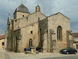
Brigueuil is a commune in the Charente department in southwestern France.
Population
| Historical population | ||
|---|---|---|
| Year | Pop. | ±% |
| 1793 | 2,064 | — |
| 1800 | 2,146 | +4.0% |
| 1806 | 2,152 | +0.3% |
| 1821 | 2,208 | +2.6% |
| 1831 | 2,200 | −0.4% |
| 1841 | 2,071 | −5.9% |
| 1846 | 2,050 | −1.0% |
| 1851 | 2,064 | +0.7% |
| 1856 | 1,986 | −3.8% |
| 1861 | 1,889 | −4.9% |
| 1866 | 1,892 | +0.2% |
| 1872 | 1,850 | −2.2% |
| 1876 | 1,877 | +1.5% |
| 1881 | 1,993 | +6.2% |
| 1886 | 1,990 | −0.2% |
| 1891 | 1,942 | −2.4% |
| 1896 | 1,866 | −3.9% |
| 1901 | 1,855 | −0.6% |
| 1906 | 1,902 | +2.5% |
| 1911 | 1,881 | −1.1% |
| 1921 | 1,688 | −10.3% |
| 1926 | 1,541 | −8.7% |
| 1931 | 1,391 | −9.7% |
| 1936 | 1,323 | −4.9% |
| 1946 | 1,210 | −8.5% |
| 1954 | 1,214 | +0.3% |
| 1962 | 1,164 | −4.1% |
| 1968 | 1,108 | −4.8% |
| 1975 | 978 | −11.7% |
| 1982 | 957 | −2.1% |
| 1990 | 995 | +4.0% |
| 1999 | 1,007 | +1.2% |
| 2008 | 1,055 | +4.8% |
See also
References
- ↑ local knowledge
| Wikimedia Commons has media related to Brigueuil. |
This article is issued from
Wikipedia.
The text is licensed under Creative Commons - Attribution - Sharealike.
Additional terms may apply for the media files.