Saint-Sornin, Charente
| Saint-Sornin | |
|---|---|
| Commune | |
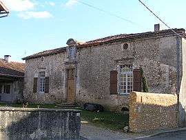 Old house | |
 Saint-Sornin Location within Nouvelle-Aquitaine region  Saint-Sornin | |
| Coordinates: 45°41′41″N 0°26′11″E / 45.6947°N 0.4364°ECoordinates: 45°41′41″N 0°26′11″E / 45.6947°N 0.4364°E | |
| Country | France |
| Region | Nouvelle-Aquitaine |
| Department | Charente |
| Arrondissement | Angoulême |
| Canton | Val de Tardoire |
| Intercommunality | Val de Tardoire |
| Government | |
| • Mayor (2008–2014) | Marcel Rapion |
| Area1 | 11.27 km2 (4.35 sq mi) |
| Population (2008)2 | 819 |
| • Density | 73/km2 (190/sq mi) |
| Time zone | UTC+1 (CET) |
| • Summer (DST) | UTC+2 (CEST) |
| INSEE/Postal code | 16353 /16220 |
| Elevation |
89–242 m (292–794 ft) (avg. 185 m or 607 ft) |
|
1 French Land Register data, which excludes lakes, ponds, glaciers > 1 km2 (0.386 sq mi or 247 acres) and river estuaries. 2 Population without double counting: residents of multiple communes (e.g., students and military personnel) only counted once. | |
Saint-Sornin is a commune in the Charente department in southwestern France.
Population
| Historical population | ||
|---|---|---|
| Year | Pop. | ±% |
| 1793 | 699 | — |
| 1800 | 754 | +7.9% |
| 1806 | 813 | +7.8% |
| 1821 | 781 | −3.9% |
| 1831 | 750 | −4.0% |
| 1841 | 783 | +4.4% |
| 1846 | 809 | +3.3% |
| 1851 | 767 | −5.2% |
| 1856 | 759 | −1.0% |
| 1861 | 870 | +14.6% |
| 1866 | 834 | −4.1% |
| 1872 | 871 | +4.4% |
| 1876 | 859 | −1.4% |
| 1881 | 898 | +4.5% |
| 1886 | 879 | −2.1% |
| 1891 | 834 | −5.1% |
| 1896 | 806 | −3.4% |
| 1901 | 771 | −4.3% |
| 1906 | 753 | −2.3% |
| 1911 | 725 | −3.7% |
| 1921 | 684 | −5.7% |
| 1926 | 644 | −5.8% |
| 1931 | 644 | +0.0% |
| 1936 | 622 | −3.4% |
| 1946 | 611 | −1.8% |
| 1954 | 552 | −9.7% |
| 1962 | 633 | +14.7% |
| 1968 | 618 | −2.4% |
| 1975 | 615 | −0.5% |
| 1982 | 673 | +9.4% |
| 1990 | 694 | +3.1% |
| 1999 | 715 | +3.0% |
| 2008 | 819 | +14.5% |
See also
References
| Wikimedia Commons has media related to Saint-Sornin (Charente). |
This article is issued from
Wikipedia.
The text is licensed under Creative Commons - Attribution - Sharealike.
Additional terms may apply for the media files.