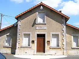
Auge-Saint-Médard
| Auge-Saint-Médard | |
|---|---|
| Commune | |
 | |
 Auge-Saint-Médard Location within Nouvelle-Aquitaine region  Auge-Saint-Médard | |
| Coordinates: 45°50′53″N 0°05′05″W / 45.8481°N 0.0847°WCoordinates: 45°50′53″N 0°05′05″W / 45.8481°N 0.0847°W | |
| Country | France |
| Region | Nouvelle-Aquitaine |
| Department | Charente |
| Arrondissement | Cognac |
| Canton | Val de Nouère |
| Intercommunality | CC Rouillacais |
| Government | |
| • Mayor (2014-2020) | Robert Lesage |
| Area1 | 17.37 km2 (6.71 sq mi) |
| Population (2015)2 | 302 |
| • Density | 17/km2 (45/sq mi) |
| Time zone | UTC+1 (CET) |
| • Summer (DST) | UTC+2 (CEST) |
| INSEE/Postal code | 16339 /16170 |
| Elevation |
69–131 m (226–430 ft) (avg. 92 m or 302 ft) |
|
1 French Land Register data, which excludes lakes, ponds, glaciers > 1 km2 (0.386 sq mi or 247 acres) and river estuaries. 2 Population without double counting: residents of multiple communes (e.g., students and military personnel) only counted once. | |
Auge-Saint-Médard is a commune in the Charente department in southwestern France.
Population
| Historical population | ||
|---|---|---|
| Year | Pop. | ±% |
| 1793 | 441 | — |
| 1800 | 438 | −0.7% |
| 1806 | 432 | −1.4% |
| 1821 | 527 | +22.0% |
| 1831 | 505 | −4.2% |
| 1841 | 533 | +5.5% |
| 1846 | 540 | +1.3% |
| 1851 | 505 | −6.5% |
| 1856 | 490 | −3.0% |
| 1861 | 514 | +4.9% |
| 1866 | 450 | −12.5% |
| 1872 | 440 | −2.2% |
| 1876 | 445 | +1.1% |
| 1881 | 425 | −4.5% |
| 1886 | 378 | −11.1% |
| 1891 | 370 | −2.1% |
| 1896 | 343 | −7.3% |
| 1901 | 314 | −8.5% |
| 1906 | 324 | +3.2% |
| 1911 | 321 | −0.9% |
| 1921 | 291 | −9.3% |
| 1926 | 242 | −16.8% |
| 1931 | 246 | +1.7% |
| 1936 | 233 | −5.3% |
| 1946 | 232 | −0.4% |
| 1954 | 188 | −19.0% |
| 1962 | 178 | −5.3% |
| 1968 | 156 | −12.4% |
| 1975 | 156 | +0.0% |
| 1982 | 157 | +0.6% |
| 1990 | 147 | −6.4% |
| 1999 | 306 | +108.2% |
| 2008 | 312 | +2.0% |
| 2015 | 302 | −3.2% |
See also
References
| Wikimedia Commons has media related to Auge-Saint-Médard. |
This article is issued from
Wikipedia.
The text is licensed under Creative Commons - Attribution - Sharealike.
Additional terms may apply for the media files.