Vitrac-Saint-Vincent
| Vitrac-Saint-Vincent | |
|---|---|
| Commune | |
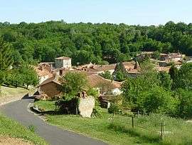 | |
 Vitrac-Saint-Vincent Location within Nouvelle-Aquitaine region  Vitrac-Saint-Vincent | |
| Coordinates: 45°47′48″N 0°29′40″E / 45.7967°N 0.4944°ECoordinates: 45°47′48″N 0°29′40″E / 45.7967°N 0.4944°E | |
| Country | France |
| Region | Nouvelle-Aquitaine |
| Department | Charente |
| Arrondissement | Confolens |
| Canton | Charente-Bonnieure |
| Intercommunality | Haute-Charente |
| Government | |
| • Mayor (2014–) | Pierre Soulat |
| Area1 | 22.07 km2 (8.52 sq mi) |
| Population (2008)2 | 525 |
| • Density | 24/km2 (62/sq mi) |
| Time zone | UTC+1 (CET) |
| • Summer (DST) | UTC+2 (CEST) |
| INSEE/Postal code | 16416 /16310 |
| Elevation |
116–254 m (381–833 ft) (avg. 136 m or 446 ft) |
|
1 French Land Register data, which excludes lakes, ponds, glaciers > 1 km2 (0.386 sq mi or 247 acres) and river estuaries. 2 Population without double counting: residents of multiple communes (e.g., students and military personnel) only counted once. | |
Vitrac-Saint-Vincent is a commune in the Charente department in southwestern France.
Population
| Historical population | ||
|---|---|---|
| Year | Pop. | ±% |
| 1793 | 1,147 | — |
| 1800 | 1,192 | +3.9% |
| 1806 | 1,120 | −6.0% |
| 1821 | 1,183 | +5.6% |
| 1831 | 1,443 | +22.0% |
| 1841 | 1,365 | −5.4% |
| 1846 | 1,419 | +4.0% |
| 1851 | 1,422 | +0.2% |
| 1856 | 1,312 | −7.7% |
| 1861 | 1,250 | −4.7% |
| 1866 | 1,224 | −2.1% |
| 1872 | 1,097 | −10.4% |
| 1876 | 1,080 | −1.5% |
| 1881 | 1,149 | +6.4% |
| 1886 | 1,189 | +3.5% |
| 1891 | 1,163 | −2.2% |
| 1896 | 1,128 | −3.0% |
| 1901 | 1,072 | −5.0% |
| 1906 | 1,057 | −1.4% |
| 1911 | 992 | −6.1% |
| 1921 | 902 | −9.1% |
| 1926 | 863 | −4.3% |
| 1931 | 815 | −5.6% |
| 1936 | 773 | −5.2% |
| 1946 | 715 | −7.5% |
| 1954 | 689 | −3.6% |
| 1962 | 626 | −9.1% |
| 1968 | 545 | −12.9% |
| 1975 | 534 | −2.0% |
| 1982 | 514 | −3.7% |
| 1990 | 513 | −0.2% |
| 1999 | 512 | −0.2% |
| 2008 | 535 | +4.5% |
See also
References
| Wikimedia Commons has media related to Vitrac-Saint-Vincent. |
This article is issued from
Wikipedia.
The text is licensed under Creative Commons - Attribution - Sharealike.
Additional terms may apply for the media files.