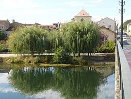
Condac
| Condac | |
|---|---|
| Commune | |
 | |
 Condac Location within Nouvelle-Aquitaine region  Condac | |
| Coordinates: 46°01′30″N 0°13′43″E / 46.025°N 0.2286°ECoordinates: 46°01′30″N 0°13′43″E / 46.025°N 0.2286°E | |
| Country | France |
| Region | Nouvelle-Aquitaine |
| Department | Charente |
| Arrondissement | Confolens |
| Canton | Charente-Nord |
| Intercommunality | Ruffec |
| Government | |
| • Mayor (2008–2014) | Christophe Demaille |
| Area1 | 9.59 km2 (3.70 sq mi) |
| Population (2008)2 | 474 |
| • Density | 49/km2 (130/sq mi) |
| Time zone | UTC+1 (CET) |
| • Summer (DST) | UTC+2 (CEST) |
| INSEE/Postal code | 16104 /16700 |
| Elevation |
77–141 m (253–463 ft) (avg. 85 m or 279 ft) |
|
1 French Land Register data, which excludes lakes, ponds, glaciers > 1 km2 (0.386 sq mi or 247 acres) and river estuaries. 2 Population without double counting: residents of multiple communes (e.g., students and military personnel) only counted once. | |
Condac is a commune in the Charente department in southwestern France.
Population
| Historical population | ||
|---|---|---|
| Year | Pop. | ±% |
| 1793 | 489 | — |
| 1800 | 576 | +17.8% |
| 1806 | 519 | −9.9% |
| 1821 | 517 | −0.4% |
| 1831 | 453 | −12.4% |
| 1841 | 472 | +4.2% |
| 1846 | 499 | +5.7% |
| 1851 | 504 | +1.0% |
| 1856 | 496 | −1.6% |
| 1861 | 462 | −6.9% |
| 1866 | 449 | −2.8% |
| 1872 | 437 | −2.7% |
| 1876 | 390 | −10.8% |
| 1881 | 422 | +8.2% |
| 1886 | 411 | −2.6% |
| 1891 | 405 | −1.5% |
| 1896 | 369 | −8.9% |
| 1901 | 375 | +1.6% |
| 1906 | 384 | +2.4% |
| 1911 | 373 | −2.9% |
| 1921 | 355 | −4.8% |
| 1926 | 330 | −7.0% |
| 1931 | 300 | −9.1% |
| 1936 | 318 | +6.0% |
| 1946 | 341 | +7.2% |
| 1954 | 287 | −15.8% |
| 1962 | 277 | −3.5% |
| 1968 | 327 | +18.1% |
| 1975 | 376 | +15.0% |
| 1982 | 401 | +6.6% |
| 1990 | 429 | +7.0% |
| 1999 | 470 | +9.6% |
| 2008 | 474 | +0.9% |
See also
References
| Wikimedia Commons has media related to Condac. |
This article is issued from
Wikipedia.
The text is licensed under Creative Commons - Attribution - Sharealike.
Additional terms may apply for the media files.