Saint-Ciers-sur-Bonnieure
| Saint-Ciers-sur-Bonnieure | |
|---|---|
| Commune | |
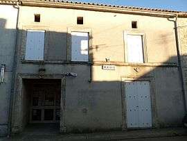 Town hall | |
 Saint-Ciers-sur-Bonnieure Location within Nouvelle-Aquitaine region  Saint-Ciers-sur-Bonnieure | |
| Coordinates: 45°51′38″N 0°14′43″E / 45.8606°N .24528°ECoordinates: 45°51′38″N 0°14′43″E / 45.8606°N .24528°E | |
| Country | France |
| Region | Nouvelle-Aquitaine |
| Department | Charente |
| Arrondissement | Confolens |
| Canton | Boixe-et-Manslois |
| Intercommunality | Pays Manslois |
| Government | |
| • Mayor (2008–2014) | Chantal Parthenay |
| Area1 | 10.44 km2 (4.03 sq mi) |
| Population (2008)2 | 288 |
| • Density | 28/km2 (71/sq mi) |
| Time zone | UTC+1 (CET) |
| • Summer (DST) | UTC+2 (CEST) |
| INSEE/Postal code | 16307 /16230 |
| Elevation |
60–122 m (197–400 ft) (avg. 60 m or 200 ft) |
|
1 French Land Register data, which excludes lakes, ponds, glaciers > 1 km2 (0.386 sq mi or 247 acres) and river estuaries. 2 Population without double counting: residents of multiple communes (e.g., students and military personnel) only counted once. | |
Saint-Ciers-sur-Bonnieure is a commune in the Charente department in southwestern France.
Population
| Historical population | ||
|---|---|---|
| Year | Pop. | ±% |
| 1793 | 498 | — |
| 1800 | 537 | +7.8% |
| 1806 | 566 | +5.4% |
| 1821 | 703 | +24.2% |
| 1831 | 675 | −4.0% |
| 1841 | 702 | +4.0% |
| 1846 | 703 | +0.1% |
| 1851 | 663 | −5.7% |
| 1856 | 701 | +5.7% |
| 1861 | 704 | +0.4% |
| 1866 | 678 | −3.7% |
| 1872 | 614 | −9.4% |
| 1876 | 547 | −10.9% |
| 1881 | 538 | −1.6% |
| 1886 | 577 | +7.2% |
| 1891 | 549 | −4.9% |
| 1896 | 479 | −12.8% |
| 1901 | 444 | −7.3% |
| 1906 | 457 | +2.9% |
| 1911 | 436 | −4.6% |
| 1921 | 387 | −11.2% |
| 1926 | 381 | −1.6% |
| 1931 | 378 | −0.8% |
| 1936 | 345 | −8.7% |
| 1946 | 296 | −14.2% |
| 1954 | 279 | −5.7% |
| 1962 | 271 | −2.9% |
| 1968 | 271 | +0.0% |
| 1975 | 264 | −2.6% |
| 1982 | 256 | −3.0% |
| 1990 | 240 | −6.2% |
| 1999 | 256 | +6.7% |
| 2008 | 288 | +12.5% |
See also
References
| Wikimedia Commons has media related to Saint-Ciers-sur-Bonnieure. |
This article is issued from
Wikipedia.
The text is licensed under Creative Commons - Attribution - Sharealike.
Additional terms may apply for the media files.