Pleuville
| Pleuville | |
|---|---|
| Commune | |
 | |
 Pleuville Location within Nouvelle-Aquitaine region  Pleuville | |
| Coordinates: 46°05′28″N 0°29′48″E / 46.0911°N .4967°ECoordinates: 46°05′28″N 0°29′48″E / 46.0911°N .4967°E | |
| Country | France |
| Region | Nouvelle-Aquitaine |
| Department | Charente |
| Arrondissement | Confolens |
| Canton | Charente-Vienne |
| Intercommunality | Confolentais |
| Government | |
| • Mayor (2008–2014) | Daniel Legendre |
| Area1 | 33.63 km2 (12.98 sq mi) |
| Population (2008)2 | 371 |
| • Density | 11/km2 (29/sq mi) |
| Time zone | UTC+1 (CET) |
| • Summer (DST) | UTC+2 (CEST) |
| INSEE/Postal code | 16264 /16490 |
| Elevation |
130–187 m (427–614 ft) (avg. 175 m or 574 ft) |
|
1 French Land Register data, which excludes lakes, ponds, glaciers > 1 km2 (0.386 sq mi or 247 acres) and river estuaries. 2 Population without double counting: residents of multiple communes (e.g., students and military personnel) only counted once. | |
Pleuville is a commune in the Charente department in southwestern France.
Population
| Historical population | ||
|---|---|---|
| Year | Pop. | ±% |
| 1793 | 819 | — |
| 1800 | 754 | −7.9% |
| 1806 | 773 | +2.5% |
| 1821 | 801 | +3.6% |
| 1831 | 842 | +5.1% |
| 1841 | 947 | +12.5% |
| 1846 | 1,020 | +7.7% |
| 1851 | 1,003 | −1.7% |
| 1856 | 1,045 | +4.2% |
| 1861 | 1,014 | −3.0% |
| 1866 | 1,021 | +0.7% |
| 1872 | 968 | −5.2% |
| 1876 | 1,045 | +8.0% |
| 1881 | 1,074 | +2.8% |
| 1886 | 1,126 | +4.8% |
| 1891 | 1,040 | −7.6% |
| 1896 | 1,000 | −3.8% |
| 1901 | 970 | −3.0% |
| 1906 | 963 | −0.7% |
| 1911 | 971 | +0.8% |
| 1921 | 874 | −10.0% |
| 1926 | 889 | +1.7% |
| 1931 | 831 | −6.5% |
| 1936 | 726 | −12.6% |
| 1946 | 718 | −1.1% |
| 1954 | 693 | −3.5% |
| 1962 | 672 | −3.0% |
| 1968 | 606 | −9.8% |
| 1975 | 534 | −11.9% |
| 1982 | 511 | −4.3% |
| 1990 | 454 | −11.2% |
| 1999 | 364 | −19.8% |
| 2008 | 371 | +1.9% |
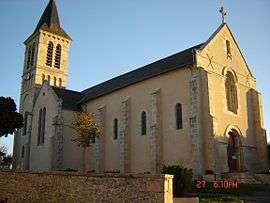
Landmarks
The village includes the Château de Pleuville and the Château de Gorce.
See also
References
| Wikimedia Commons has media related to Pleuville. |
This article is issued from
Wikipedia.
The text is licensed under Creative Commons - Attribution - Sharealike.
Additional terms may apply for the media files.