Uwchlan Township, Chester County, Pennsylvania
| Uwchlan Township | |
|---|---|
| Township | |
 | |
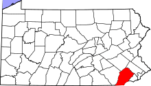
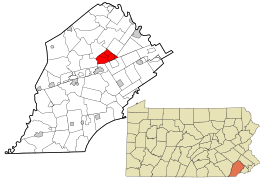 Location in Chester County and the state of Pennsylvania. | |
.svg.png) Location of Pennsylvania in the United States | |
| Coordinates: 40°02′59″N 75°38′53″W / 40.04972°N 75.64806°WCoordinates: 40°02′59″N 75°38′53″W / 40.04972°N 75.64806°W | |
| Country | United States |
| State | Pennsylvania |
| County | Chester |
| Founded | 1712 |
| Government | |
| • Body | Board of Supervisors |
| • Chairman | Bill Miller |
| • Vice Chairman | Mayme Baumann |
| Area[1] | |
| • Total | 10.45 sq mi (27.08 km2) |
| • Land | 10.40 sq mi (26.93 km2) |
| • Water | 0.06 sq mi (0.15 km2) |
| Elevation | 522 ft (159 m) |
| Population (2010) | |
| • Total | 18,088 |
| • Estimate (2016)[2] | 18,977 |
| • Density | 1,824.89/sq mi (704.56/km2) |
| Time zone | UTC-5 (EST) |
| • Summer (DST) | UTC-4 (EDT) |
| Area code(s) | 610 |
| FIPS code | 42-029-79480 |
| Website |
www |
Uwchlan Township (/ˈjuːklən/; Welsh: [ˈɪuxlan], "above the parish") is a township in Chester County, Pennsylvania, United States. The population was 18,088 at the 2010 census.
History
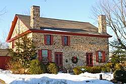
The Lionville Historic District and Uwchlan Meetinghouse are listed on the National Register of Historic Places.[3]
Geography
Uwchlan Township is located at 40°02′59″N 75°38′53″W / 40.04972°N 75.64806°W[4] at an elevation of 522 feet (159.1 m).[4] According to the United States Census Bureau, the township has a total area of 10.4 square miles (27 km2), all of it land.
Adjacent municipalities
- Upper Uwchlan Township (north)
- West Pikeland Township (northeast)
- Charlestown Township (east)
- West Whiteland Township (southeast)
- East Caln Township (south)
- East Brandywine Township (west)
Demographics
At the 2010 census, the township was 88.8% non-Hispanic White, 2.5% Black or African American, 0.1% Native American, 5.2% Asian, and 1.4% were two or more races. 2.3% of the population were of Hispanic or Latino ancestry.[5]
As of the census[6] of 2000, there were 16,576 people, 5,921 households, and 4,565 families residing in the township. The population density was 1,587.1 people per square mile (613.0/km²). There were 6,030 housing units, at an average density of 577.4/sq mi (223.0/km²). The racial makeup of the township was 93.67% White, 1.85% African American, 0.08% Native American, 3.24% Asian, 0.01% Pacific Islander, 0.31% from other races, and 0.86% from two or more races. Hispanic or Latino of any race were 1.24% of the population.
There were 5,921 households, of which 43.7% had children under the age of 18 living with them, 68.9% were married couples living together, 6.3% had a female householder with no husband present, and 22.9% were nonfamilies. 18.2% of all households were made up of individuals, and 3.8% had someone living alone who was 65 years of age or older. The average household size was 2.80, and the average family size was 3.24.
| Historical population | |||
|---|---|---|---|
| Census | Pop. | %± | |
| 1930 | 507 | — | |
| 1940 | 599 | 18.1% | |
| 1950 | 761 | 27.0% | |
| 1960 | 995 | 30.7% | |
| 1970 | 5,473 | 450.1% | |
| 1980 | 8,364 | 52.8% | |
| 1990 | 12,999 | 55.4% | |
| 2000 | 16,576 | 27.5% | |
| 2010 | 18,088 | 9.1% | |
| Est. 2016 | 18,977 | [2] | 4.9% |
| [7] | |||
In the township, the population was spread out, with 30.2% under the age of 18, 5.2% from 18 to 24, 34.0% from 25 to 44, 24.1% from 45 to 64, and 6.6% who were 65 years of age or older. The median age was 36 years. For every 100 females, there were 96.5 males. For every 100 females age 18 and over, there were 92.9 males.
The median income for a household in the township was $81,985, and the median income for a family was $90,486. Males had a median income of $67,054 versus $35,658 for females. The per capita income for the township was $33,785. About 0.7% of families and 1.2% of the population were below the poverty line, including 0.3% of those under age 18 and 4.0% of those age 65 or over.
Education
Uwchlan Township is home to five schools of the Downingtown Area School District:
- Lionville Elementary School
- Shamona Creek Elementary School
- Uwchlan Hills Elementary School
- Lionville Middle School
- Downingtown High School East Campus
The area also includes a private school:
- Saint Elizabeth Roman Catholic Parish School
Transportation
Uwchlan Township is crossed by two Pennsylvania state highways, Route 100 and Route 113. Route 100 (Pottstown Pike) runs from the southeast near Exton in West Whiteland Township to the northwest, near Eagle in Upper Uwchlan Township. Route 100 is a four-lane divided highway from West Whiteland Township to Route 113, where it becomes a six-lane divided highway to Upper Uwchlan Township.
Route 113 (Uwchlan Avenue) runs from the southwest, near Downingtown, East Caln Township and an interchange with US 30 to the northeast, near Chester Springs in West Pikeland Township. The two roads cross in the village of Lionville. Route 113 is a two-lane highway from East Caln Township to Peck Road, at which point it becomes a four-lane highway (with a center turn lane) all the way to West Pikeland Township.
The northern part of the township is crossed by Interstate 76 (Pennsylvania Turnpike) and is home to Exit 312 of the Turnpike, an interchange with Route 100.
The northern terminus of the Struble Trail, a multi-use rail trail, is located on Dorlan's Mill Road in the township.
See also
References
- ↑ "2016 U.S. Gazetteer Files". United States Census Bureau. Retrieved Aug 13, 2017.
- 1 2 "Population and Housing Unit Estimates". Retrieved June 9, 2017.
- ↑ National Park Service (2010-07-09). "National Register Information System". National Register of Historic Places. National Park Service.
- 1 2 "US Board on Geographic Names". United States Geological Survey. 2007-10-25. Retrieved 2008-01-31.
- ↑ https://www.usatoday.com/news/nation/census/profile/PA
- ↑ "American FactFinder". United States Census Bureau. Retrieved 2008-01-31.
- ↑ http://www.dvrpc.org/data/databull/rdb/db82/appedixa.xls