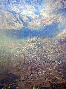
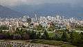
Urmia
| Urmia ارومیه | ||
|---|---|---|
| City | ||
| ||
| Nickname(s): Paris of Iran, Cradle of Water | ||
 Urmia | ||
| Coordinates: 37°33′19″N 45°04′21″E / 37.55528°N 45.07250°ECoordinates: 37°33′19″N 45°04′21″E / 37.55528°N 45.07250°E | ||
| Country |
| |
| Region | 3 | |
| Province | West Azerbaijan | |
| County | Urmia | |
| Bakhsh | Central | |
| Government | ||
| • Mayor | Mohammad Hazratpour | |
| • Parliament | Ghazipour, Bahadori & Ruhollah Hazratpour | |
| Elevation | 1,332 m (4,370 ft) | |
| Population (2016 Census) | ||
| • Urban | 736,224 [1] | |
| • Metro | 1,000,000 | |
| • Population Rank in Iran | 10th | |
| Time zone | UTC+3:30 (IRST) | |
| • Summer (DST) | UTC+4:30 (IRDT) | |
| Area code(s) | 044 | |
| Website | www.urmia.ir | |
Urmia[nb 1] (Persian: ارومیه; Kurdish: Ûrmiye, ورمێ; Azerbaijani: اورمیه; Syriac: ܐܘܪܡܝܐ; (pronounced [oɾumiˈje] (![]()
Urmia is the 10th most populated city in Iran. At the 2012 census, its population was 667,499, with 197,749 households.The city's inhabitants are predominantly Azerbaijanis who speak the Azerbaijani language.[2][3][4][5] There are also minorities of Kurds, Assyrians, and Armenians.[6] The city is the trading center for a fertile agricultural region where fruits (especially apples and grapes) and tobacco are grown.
The Christian history of Urmia is well preserved, and is especially evident in the city's many churches and cathedrals.
An important town by the 9th century, the city has had a diverse population which has at times included Muslims (Shias and Sunnis), Christians (Catholics, Protestants, Nestorians, and Orthodox), Jews, Bahá'ís and Sufis. Around 1900, Christians made up more than 40% of the city's population; however, most of the Christians fled in 1918[7][8][8][9] as a result of the Persian Campaign during World War I and the Armenian and Assyrian Genocides by Ottoman Empire.
Name
Richard Nelson Frye suggested Urartian origin for the name[10] while T. Burrow connected the origin of the name Urmia to Indo-Iranian urmi- "wave" and urmya- "undulating, wavy",[11] which comes from the local Assyrian folk etymology for the name which related mia to a Syriac word meaning "water". Hence Urmia simply means "Watertown" – a name befitting a city situated by a lake and surrounded by rivers, a kind of "cradle of water".
As of 1921, Urmia was also called, Urumia and Urmi.[12] During the Pahlavi Dynasty (1925–1979), the city was called Rezaiyeh[nb 3] (Persian: رضائیه) after Rezā Shāh, the dynasty's founder, whose name ultimately derives from the Islamic concept of rida via the Eighth Imam in Twelver Shia Islam, Ali al-Ridha.
History

According to Vladimir Minorsky, there were villages in the Urmia Plain as early as 2000 BC, with their civilization under the influence of the Kingdom of Van. Excavations of the ancient ruins near Urmia led to the discovery of utensils that date to the 20th century BC. In ancient times, the west bank of Urmia Lake was called Gilzan, and in the 9th century BC an independent government ruled there, which later joined the Urartu or Mana empire; in the 8th century BC, the area was a vassal of the Asuzh government until it joined the Median Empire.
During the Safavid era, the neighboring Ottoman Turks, who were the archrivals of the Safavids,[13] made several incursions into the city and captured it on more than one occasion, but the Safavids successfully regained control over the area. When in 1622, during the reign of Safavid king Abbas I (r. 1588–1629) Qasem Sultan Afshar was appointed governor of Mosul,[14][15] he was forced to leave his office shortly afterwards due to the outbreak of a plague.[16] He moved to the western part of Azerbaijan, and became the founder of the Afshar community of Urmia.[16] The city was the capital of the Urmia Khanate from 1747–1865. The first monarch of Iran's Qajar dynasty, Agha Muhammad Khan, was crowned in Urmia in 1795.
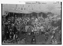
Due to the presence of a substantial Christian minority at the end of the 19th century, Urmia was also chosen as the site of the first American Christian mission in Iran in 1835. Another mission was soon underway in nearby Tabriz as well. During World War I the population was estimated by Dr. Caujole to be 30,000, a quarter of which (7,500) were Assyrians and 1,000 Jews.[9]
During the 19th century, the region became the center of a short-lived Assyrian renaissance with many books and newspapers being published in Syriac. Urmia was also the seat of a Chaldean diocese.[17][18]
At the beginning of the First World War tens of thousands of Assyrians and Armenians from the Ottoman Empire found refuge in Urmia. During the war, the city changed hands several times between the Russians and the Ottoman troops and their Kurdish allies in the following two years. [19] The influx of Christian refugees and their alliance with the Russians angered the Muslims who attacked the Christian quarter in February 1918. The better armed Assyrians managed to capture the whole city following a brief battle.[19] The region descended into chaos again after the assassination of the Assyrian patriarch Shimun XIX Benyamin at the hands of Simko Shikak one month later. Turkish troops and Simko managed to take and plunder the city in June/July 1918.[20] Thousands of Assyrians were massacred as part of the Assyrian Genocide; others found refuge under British protection in Iraq.[20][21]
Population
Demographics
According to the 2016 census, population of Urmia city is 736,224, with an annual growth rate of 2.0% and an average of 3.27 people per household.
Ethnic composition
The city has been home to various ethnic groups during its history. The population of Urmia in the early Islamic period was Christian.[22] At the beginning of the 20th century, the city had a significant Christian minority (Assyrians and Armenians) [7][23] with the Christian population of the town consisting of 40–50 % of the total population.[24] According to Macuch, and Ishaya, the city was the spiritual capital of the Assyrians, who were influenced by four Christian missions that had been established in the city in the period from 1830 to the end of World War I.[25] A large number of the Assyrians and Armenians were killed in 1914 during the Armenian and Assyrian genocides,[26] which resulted in a change in the city's demographics.[25] During the era of Reza Shah Pahlavi, Iranian Assyrians were invited to return to the region, and several thousand did return. There are around 5,000 Assyrians remaining in the city,[27] or around 1% of the population.
Until the Iran crisis of 1946 and the Establishment of the State of Israel in 1947, several thousand Jews also lived Urmia, and their language (Lishán Didán) is still spoken by an aging community in Israel.
According to some sources, the population is mostly made up of Azerbaijanis who live alongside minorities of Kurds,[4][5] Assyrians[4][5] and Armenians.[4][5]. However, according to the Federal Research Division of Library of Congress, ethnic Azeris form around 40% of the population of Urmia region[28].
The majority of the population can speak the official language of Iran, Persian, in addition to their own native tongue.[29][30][31]
Religions
The majority of people are followers of Shia Islam.
The city is the archiepiscopal see of the Eastern Catholic Metropolitan Chaldean Catholic Archeparchy of Urmyā, which has a suffragan in Salmas. There are also Protestants, Church of the East adherents and Armenian Orthodox. There are four churches in the central part of the city, two being Assyrian Church of the East, one Armenian, and one Chaldean.[32][33]
The city is also home to followers of Sunni Islam, the Bahá'í Faith, Judaism and different kinds of Yazdanism, whose adherents are Kurds.
Parks and touristic centers
Urmia has many parks and touristic coastal villages in the shore of Urmia Lake. The oldest park in Urmia, called Park-e Saat, was established in the first Pahlavi era. Urmia's largest park is Ellar Bagi Park (Azerbaijani "People's Garden") along the Shahar Chayi, or the "City River".
Lakes and ponds
- Urmia Lake Natural Park
- Hasanloo Lake
- Marmisho lake
- Shahrchay ِDam
- Urmia Lake Islands
Lagoons
- Haft Abad
- Soole Dokel
- Dana Boğan
- Ali Pancesi
- Isti Sou
Parks
- Park-e Saat (Clock Park)
- Park-e Jangali (Jungle Park)
- Ellar Bagi (People`s Garden)
- Park-e Shahr (City Park)
- Park-e Saheli (Riverside Park)
- Park-e Shaghayegh
- Alghadir Park
- Tokhmemorghi (Oval) Park
- Ghaem Park
Scenic coastal villages:
- Chichest
- Bari
- Fanoos
- Sier
- Band
- Khoshako
Landscape attractions:
- Qasimlu Valley
- Kazem Dashi Islet in Lake Urmia
- Kashtiban Village
- Imamzada Village
- Silvana Region
- Rashekan to Dash Aghol
- Nazloo
- Dalamper
- Kaboodan Island[34]
Climate
Urmia's climate is cold semi-arid (Köppen: BSk) with cold winters, mild springs, hot dry summers, and warm autumns. Precipitation is heavily concentrated in late autumn, winter (mostly in the form of snow), and especially spring, while precipitation is scarce in summer. Temperatures in Urmia are much colder than most of the remainder of Iran because of the elevation. Although dry for being a traditional continental climate, it has cold enough winters to qualify as general continental.
| Climate data for Urmia (Orumiyeh) | |||||||||||||
|---|---|---|---|---|---|---|---|---|---|---|---|---|---|
| Month | Jan | Feb | Mar | Apr | May | Jun | Jul | Aug | Sep | Oct | Nov | Dec | Year |
| Record high °C (°F) | 16.4 (61.5) |
18 (64) |
26 (79) |
26 (79) |
30.6 (87.1) |
36 (97) |
38 (100) |
38 (100) |
35 (95) |
30 (86) |
22 (72) |
17 (63) |
38 (100) |
| Average high °C (°F) | 2.6 (36.7) |
4.8 (40.6) |
10.4 (50.7) |
16.8 (62.2) |
22.2 (72) |
27.5 (81.5) |
31.2 (88.2) |
31.0 (87.8) |
27.1 (80.8) |
20.1 (68.2) |
12.2 (54) |
5.7 (42.3) |
17.6 (63.7) |
| Daily mean °C (°F) | −3.3 (26.1) |
−1.5 (29.3) |
4.5 (40.1) |
10.5 (50.9) |
15.5 (59.9) |
20.2 (68.4) |
23.8 (74.8) |
23.1 (73.6) |
19.0 (66.2) |
12.5 (54.5) |
6.1 (43) |
0.4 (32.7) |
10.9 (51.6) |
| Average low °C (°F) | −6.1 (21) |
−4.8 (23.4) |
−0.1 (31.8) |
5.2 (41.4) |
9.1 (48.4) |
12.9 (55.2) |
16.6 (61.9) |
15.9 (60.6) |
11.5 (52.7) |
6.6 (43.9) |
1.4 (34.5) |
−3.2 (26.2) |
5.4 (41.8) |
| Record low °C (°F) | −22.8 (−9) |
−22 (−8) |
−19 (−2) |
−12 (10) |
−1.6 (29.1) |
4 (39) |
10 (50) |
8 (46) |
3.4 (38.1) |
−5 (23) |
−13.4 (7.9) |
−20 (−4) |
−22.8 (−9) |
| Average precipitation mm (inches) | 30.2 (1.189) |
33.2 (1.307) |
52.3 (2.059) |
62.2 (2.449) |
45.6 (1.795) |
14.2 (0.559) |
5.5 (0.217) |
2.1 (0.083) |
4.4 (0.173) |
21.8 (0.858) |
40.0 (1.575) |
29.7 (1.169) |
341.2 (13.433) |
| Average precipitation days | 9.6 | 9.4 | 11.4 | 12.7 | 12.0 | 5.0 | 2.2 | 1.7 | 2.1 | 7.1 | 8.3 | 8.5 | 90 |
| Average snowy days | 8.5 | 7.5 | 3.7 | 0.8 | 0.0 | 0.0 | 0.0 | 0.0 | 0.0 | 0.3 | 1.5 | 5.5 | 27.8 |
| Average relative humidity (%) | 76 | 74 | 65 | 60 | 58 | 51 | 48 | 48 | 49 | 60 | 70 | 74 | 61 |
| Mean monthly sunshine hours | 114.0 | 132.9 | 169.6 | 197.9 | 268.6 | 344.3 | 364.0 | 341.2 | 293.1 | 222.3 | 166.4 | 118.7 | 2,733 |
| Source #1: worldweather.com[35] | |||||||||||||
| Source #2: NOAA (extremes, mean, snow, sun, humidity, 1961–1990)[36] | |||||||||||||
Sport
Sports are an important part of Urmia's culture. The most popular sport in Urmia is volleyball. Urmia is considered Iran's volleyball capital, and that is because of the ranks that Shahrdari Urmia VC got in Iranian Volleyball Super League and for the great volleyball players who play on the Iran men's national volleyball team (such as Saed Marouf, Abdolreza Alizadeh, and Milad Ebadipour) and first-class coaches in Iran. Recently, Urmia has also been called "the city of volleyball lovers" by the Fédération Internationale de Volleyball (International Volleyball Federation, FIVB) official website.
The 2010 Asian Men's Cup Volleyball Championship was held in Ghadir Arena in Urmia, 2012 WAFF Futsal Championship, and the 2012 Asian Junior Men's Volleyball Championship was also held in Urmia.
Culture
.JPG)
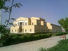
Museums
- Natural History Museum – Displays the animals native to the vicinity of Urmia.
- Urmia Museum – Archaeological museum affiliated with the faculty of Shahid Beheshti University.
- Urmia Museum of Crafts and Classical Arts.
- Urmia Museum of َAntrophology.
Education

The first modern style school established in urmia in 1834.[37]
Higher education
Urmia was an important center for higher education approximately a century ago; indeed, the medical college of Urmia, which was built by Joseph Cochran and a team of American medical associates in 1878, is the first university of Iran. Unfortunately the college was shut down even before the establishment of the first official university of Iran, University of Tehran. Today, Urmia has become an important center of education, with several state and private universities and institutes, including those listed below.
Universities in Urmia:
| University | Web Site |
|---|---|
| Urmia University | |
| Malek Ashtar University of Technology Urmia Branch | |
| Urmia University of Medical Sciences | |
| Urmia University of Technology | |
| Islamic Azad University of Urmia | |
| Payame Noor University of Urmia | |
| Elmi Karbordi University of Urmia | |
| University College of Saba | |
| University College of Azarabadegan | |
| University College of Elm O fan | |
| University College of Kamal | |
| Shahid Beheshti Technical School | |
| Ghazi Tabatabaee Technical School | |
| The Girls Technical School of Urmia | |
| Najand Institute of Higher Education | |
| University College Afagh |
Libraries
- Allame Tabatabayee Library
- Central Library of Urmia
- Library of Ghaem
- Library of I.R. Iran Education Ministry
- Library of Imam Ali
- Library of kanoon parvaresh fekri
- Library of Khane-ye-Javan
- Library of Shahid Motahhari
- Library of Shahid Bahonar
- Library of Urmia Cultural and Artistical Center
Media
Television
Urmia has one state-owned television channel, Urmia TV, which broadcasts in both Kurdish, Azerbaijani, and Farsis, and internationally through satellite Intelsat 902.[38]
Radio
Urmia has one radio channel broadcasting in Kurdish, Azerbaijani and Farsi. The name of the local radio is Chichest.[38]
Press
Among others, the city's print media include:
- Orumiye
- Barish news
- Sedaye Urmia
- Amanat
- Koosha
- Araz
Infrastructure
Transportation
Most of Urmia's residents travel by car through the system of roads and highways. Urmia is also served by taxis and public buses. There are also some private groups that provide services called "Phone-taxi." A metro-line for Urmia is under study.
Urmia is linked to Europe through Turkey's roads and Sero border crossing. Urmia Airport, which opened in 1964, was the first international airport in West Azerbaijan county, Iran. As of April 2015 it only has regularly scheduled domestic flights to Tehran's Mehrabad International Airport. The city is not served by Iran National Railways (IRIR, Persian: رجا ).
Health systems
The Iranian government operates public hospitals in the Urmia metropolitan region. There are also a number of private hospitals and medical centers in the city. Hospitals include: Hospitals:
- 523 Artesh(Army) Hospital
- Arefian Hospital[39]
- Azerbaijan Hospital[40]
- Gholipour Children's Hospital
- Imam Khomeini Hospital[41]
- Imam Reza Hospital
- Milad international medical center[42]
- Motahari Hospital[43]
- Omid Hospital[44]
- Razi Psychiatry Hospital[45]
- Taleghani Hospital[46]
- Seyedoshohada Heart Hospital[47]
- Shafa Hospital[48]
- Shams Hospital[49]
- Solati Hospital[50]
Clinics:
- Fatimiye Pro-Medical Clinic
- Kosar Women's Pro-Medical Clinic
Consulates
The Turkish government has a consulate on Beheshti Avenue, Urmia, Iran.
People
During its history Urmia was the origin for many Iranian illumination and modernization movements. The city was the hometown of numerous figures including politicians, revolutionaries, artists, and military leaders. Following is a partial list of some of the people who was born or lived in Urmia.
For a complete list see: Category:People from Urmia
 Safi al-Din al-Urmawi, was a renowned musician and writer on the theory of music.
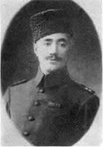 Haydar Khan e Amo-oghli, was a leftist revolutionary during the Iranian Constitutional Revolution and among the founders of the Communist Party of Iran.
 Fatma Mukhtarova, was a Soviet opera singer.
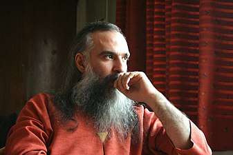
.jpg) Gholamreza Hassani, is the previous Friday prayer, First imam of Masjid-e-Jamé mosque of the city of Urmia.
Gholamreza Hassani, is the previous Friday prayer, First imam of Masjid-e-Jamé mosque of the city of Urmia.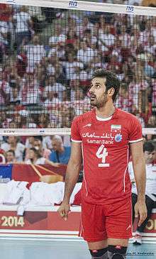 Saeid Marouf, is an Iranian volleyball player who plays as a setter for the Iranian national team which he captains.
 Davood Azad, is an Iranian singer and of Iranian classical music and Azerbaijani folk music.
Twin towns and sister cities
See also
Notes
- ↑ Urmia can be found at GEOnet Names Server, at this link, by opening the Advanced Search box, entering "-3077456" in the "Unique Feature Id" form, and clicking on "Search Database".
- ↑ Variously transliterated as Oroumieh, Oroumiyeh, Orūmīyeh and Urūmiyeh
- ↑ Also Rezaeyeh, Rezā’īyeh, Rezâiyye
References
- ↑ https://www.amar.org.ir/english
- ↑ "Country Study Guide-Azerbaijanis". STRATEGIC INFORMATION AND DEVELOPMENTS-USA. Retrieved 13 August 2013.
- ↑ "Iran-Azarbaijanis". Library of Congress Country Studies. December 1987. Retrieved 13 August 2013.
- 1 2 3 4 "Orumiyeh". Looklex Encyclopaedia. Retrieved 2013-08-13.
- 1 2 3 4 "Orumiye". Encyclopædia Britannica. Retrieved 2013-08-13.
- ↑ "Orumiyeh (Iran)". Encyclopedia Britannica.
- 1 2 http://www.encyclopedia.com/doc/1E1-Urmia.html
- 1 2 "Assyrians in the History of Urmia, Iran".
- 1 2 E. J. Brill's First Encyclopaedia of Islam, 1913–1936, M. Th Houtsma, p. 1035, 1987
- ↑ Richard Nelson Frye, The history of ancient Iran, München (1984), 48–49
- ↑ The Proto-Indoaryans, by T. Burrow, The Journal of the Royal Asiatic Society of Great Britain and Ireland, No. 2 (1973), pp. 123–140, published by: Cambridge University Press, see 139
- ↑ Sykes, Percy (1921). A History of Persia. London: Macmillan and Company. p. 67.
- ↑ Rothman 2015, p. 236.
- ↑ Nasiri & Floor 2008, p. 248.
- ↑ Oberling 1984, pp. 582-586.
- 1 2 Oberling 1984, pp. 582–586.
- ↑ "CATHOLIC ENCYCLOPEDIA: Urmiah".
- ↑ Naby, Eden (September 2007). "Theater, Language and Inter-Ethnic Exchange: Assyrian Performance before World War I Eden Naby1" (PDF). Iranian Studies, 40:4. 4. 40: 501–510. Retrieved 30 September 2011.
- 1 2 Tejirian, Eleanor H.; Simon, Reeva S. (1 September 2012). Conflict, conquest, and conversion. Columbia University Press. pp. 350–351. ISBN 978-0-231-51109-4. Retrieved 7 April 2013.
- 1 2 Atabaki, Touraj (4 September 2006). Iran and the First World War: Battleground of the Great Powers. I.B.Tauris. p. 87. ISBN 978-1-86064-964-6. Retrieved 7 April 2013.
- ↑ Gaunt, David; Beṯ-Şawoce, Jan (2006), Massacres, resistance, protectors: Muslim-Christian relations in Eastern Anatolia during World War I, Gorgias Press LLC, pp. 106–107, ISBN 978-1-59333-301-0
- ↑ "URMIYA", Encyclopaedia of Islam (edition 2)
- ↑ Iran.
- ↑ "Urmia".
- 1 2 "ASSYRIANS IN IRAN".
- ↑ "The Armenian Genocide".
- ↑ "Evidence in Stone and Wood: The Assyrian/Syriac History and Heritage of the Urmia Region in Iran". academia.edu.
- ↑ Curtis, Glenn E. (2008). Iran: A Country Study. Washington D.C.: Federal Research Division of the Library of Congress. p. 97. ISBN 978-0-8444-1187-3.
- ↑ "Iran - Azarbaijanis".
- ↑ دكتر م پناهايان، مجموعه اي در چهار جلد به نام " فرهنگ جغرافياي ملي تركان ايران زمين " سال 1351
- ↑ سيري در تاريخ زبان ولهجه هاي تركي , دكتر جواد هئيت- چاپ سوم , سال1380,ص 307
- ↑ Location of Nestorian Churches- https://www.google.com/maps/place/Holy+Mary+Church/@37.5441966,45.0678303,244m/data=!3m1!1e3!4m2!3m1!1s0x0000000000000000:0x3a31bcdb0de639d3!6m1!1e1
- ↑ Location of Armenian and Chaldean churches- https://www.google.com/maps/place/37%C2%B033'04.3%22N+45%C2%B003'57.9%22E/@37.5511954,45.0653628,244m/data=!3m2!1e3!4b1!4m2!3m1!1s0x0:0x0
- ↑ http://www.bari.ir/bari/en/tours/jazebeha/kaboodan/%5Bpermanent+dead+link%5D
- ↑ "World Weather Information Service - Orumiyeh".
- ↑ "Oroomieh Climate Normals 1961–1990". National Oceanic and Atmospheric Administration. Retrieved December 27, 2012.
- ↑ "معاون شهرسازی و معماری شهردار ارومیه خبر داد تخصیص بودجه 550 میلیارد تومانی شهرداری ارومیه".
- 1 2 "پایگاه اطلاع رسانی صدا و سیمای مرکز آذربایجان غربی".
- ↑ "Arefian hospital".
- ↑ "Azerbaijan Hospital".
- ↑ "Imam Khomeini Hospital".
- ↑ "Milad hospital". Archived from the original on 3 December 2013. Retrieved 1 December 2013.
- ↑ "Motahari Hospital".
- ↑ "Omid Hospital".
- ↑ "Razi Hospital".
- ↑ "Taleghani Hospital".
- ↑ "Seyedoshohada Hospital".
- ↑ "Shafa Hospital".
- ↑ "Shams Hospital".
- ↑ "Solati Hospital".
- ↑ Urmia, Erzurum sign sisterhood agreement , retrieved 24 May 2015
Sources
- Nasiri, Ali Naqi; Floor, Willem M. (2008). Titles and Emoluments in Safavid Iran: A Third Manual of Safavid Administration. Mage Publishers. p. 309. ISBN 978-1933823232.
- Oberling, P. (1984). "AFŠĀR". Encyclopaedia Iranica, Vol. I, Fasc. 6. pp. 582–586. Archived from the original on 29 April 2011.
- Rothman, E. Nathalie (2015). Brokering Empire: Trans-Imperial Subjects between Venice and Istanbul. Cornell University Press. ISBN 978-0801463129.
- Hooglund, Eric (2008). "The Society and Its Environment". In Curtis, Glenn E.; Hooglund, Eric. Iran: A Country Study (PDF). Area Handbook Series. United States Library of Congress, Federal Research Division (5th ed.). Washington, D.C.: United States Government Printing Office. pp. 81–142. ISBN 978-0-8444-1187-3. Retrieved 13 October 2013.
External links
| Wikimedia Commons has media related to Urmia. |
- Official website
- The Governor of West Azerbaijan Province
- Urmia Branch of Ministry of Internal Affairs
| Styles |
|  | ||||||
|---|---|---|---|---|---|---|---|---|
| Types | ||||||||
| Elements | ||||||||
| Traditional cities | ||||||||
| Theory and analysis | ||||||||
| Lists |
| |||||||
| Capital | 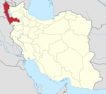 | |
|---|---|---|
| Counties and cities | ||
| Tourism | ||
| Places | ||
Largest cities or towns in Iran 2016 census | |||||||||
|---|---|---|---|---|---|---|---|---|---|
| Rank | Name | Province | Pop. | Rank | Name | Province | Pop. | ||
 Tehran 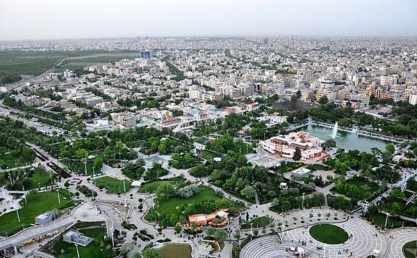 Mashhad |
1 | Tehran | Tehran | 8,693,706 | 11 | Rasht | Gilan | 679,995 | 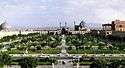 Isfahan .jpg) Karaj |
| 2 | Mashhad | Razavi Khorasan | 3,001,184 | 12 | Zahedan | Sistan and Baluchestan | 587,730 | ||
| 3 | Isfahan | Isfahan | 1,961,260 | 13 | Hamadan | Hamadan | 554,406 | ||
| 4 | Karaj | Alborz | 1,592,492 | 14 | Kerman | Kerman | 537,718 | ||
| 5 | Shiraz | Fars | 1,565,572 | 15 | Yazd | Yazd | 529,673 | ||
| 6 | Tabriz | East Azarbaijan | 1,558,693 | 16 | Ardabil | Ardabil | 529,374 | ||
| 7 | Qom | Qom | 1,201,158 | 17 | Bandar Abbas | Hormozgan | 526,648 | ||
| 8 | Ahwaz | Khuzestan | 1,184,788 | 18 | Arak | Markazi | 520,944 | ||
| 9 | Kermanshah | Kermanshah | 946,651 | 19 | Eslamshahr | Tehran | 448,129 | ||
| 10 | Urmia | West Azarbaijan | 736,224 | 20 | Zanjan | Zanjan | 430,871 | ||
| Authority control |
|---|