Special routes of U.S. Route 13
| |
|---|---|
| Highway system | |

U.S. Route 13 (US 13) runs along the Atlantic coastline for over 500 miles (800 km), passing through five states. Along its route, it possessed numerous special routes, which are all loops off the mainline US 13. At present, there are at least fourteen special routes in existence: two in North Carolina, five in Virginia, two in Maryland, four in Delaware, and one in Pennsylvania. Seven others have existed in the past, but have been deleted.
- This transport-related list is incomplete; you can help by expanding it.
Existing
Bethel, NC business loop
| |
|---|---|
| Location | Bethel, North Carolina |
| Length | 2.9 mi[1] (4.7 km) |
| Existed | 2004[2]–present |
U.S. Route 13 Business is a business route of U.S. Route 13, passing through Bethel in the state of North Carolina. It is entirely overlapped with North Carolina Highway 11 Business. The route branches from US 13 just south of the town and follows South Main Street through the town, intersecting US 64 Alternate within. It rejoins US 13 just south of its interchange with US 64.
| County | Location | mi[1] | km | Destinations | Notes |
|---|---|---|---|---|---|
| Pitt | | 0.0 | 0.0 | South end of NC 11 Business overlap | |
| Bethel | 1.2 | 1.9 | |||
| Edgecombe | | 2.9 | 4.7 | North end of NC 11 Business overlap | |
1.000 mi = 1.609 km; 1.000 km = 0.621 mi
| |||||
Windsor, NC business loop
| |
|---|---|
| Location | Windsor, North Carolina |
| Length | 2.2 mi[3] (3.5 km) |
| Existed | 1960[2]–present |
U.S. Route 13 Business is a business route of U.S. Route 13 serving Windsor, North Carolina. It begins by following US 17 off the concurrency with US 13 south of the town, but leaves US 17 at the very next intersection, following South Granville Street. It then turns onto West Granville Street, where it follows NC 308, and then north on North King Street, leaving behind NC 308. US 13 Business continues north along King Street until it rejoins US 13 north of the town.
The entire route is in Windsor, Bertie County.
| mi[3] | km | Destinations | Notes | ||
|---|---|---|---|---|---|
| 0.0 | 0.0 | South end of US 17 Business overlap | |||
| 0.1 | 0.16 | North end of US 17 Business overlap | |||
| 0.9 | 1.4 | West end of NC 308 Business overlap | |||
| 1.2 | 1.9 | East end of NC 308 Business overlap | |||
| 2.2 | 3.5 | ||||
| 1.000 mi = 1.609 km; 1.000 km = 0.621 mi | |||||
Suffolk, VA business loop
| |
|---|---|
| Location | Suffolk, Virginia |
| Length | 6.43 mi[4] (10.35 km) |
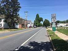
_at_Coleman_Court_in_Suffolk%2C_Virginia.jpg)
U.S. Route 13 Business is a business route of U.S. Route 13 serving the City of Suffolk in the state of Virginia. It consists of the original routing of the highway before mainline US 13 was rerouted onto a freeway bypass to the west and north of the city. It begins near Suffolk Municipal Airport, where US 13 leaves the roadway at a trumpet interchange, travelling west, while US 13 Business continues north on Carolina Road concurrent with Virginia State Route 32. As it travels deeper into the city, it intersects Washington Street, which carries Virginia State Route 337, and becomes concurrent with Virginia State Route 10. The three routes follow Main Street north until it meets the business routes of U.S. Route 58 and U.S. Route 460. Here, US 13 Business joins the two business routes and heads east on Constance Road. The name changes to Portsmouth Boulevard and US 13 Bus./US 58 Bus./US 460 Bus. cross VA 337. The three-route overlap of business routes rejoin their mainline route, US 13/58/460, at a directional interchange (with no access to the southbound/westbound carriageway from the northbound business route) and resumes toward Norfolk.
Major intersections
The entire route is in Suffolk.
| mi[4] | km | Destinations | Notes | ||
|---|---|---|---|---|---|
| 0.00 | 0.00 | Interchange, south end of SR 32 overlap | |||
| 2.05 | 3.30 | South end of SR 10 overlap | |||
| 2.73 | 4.39 | North end of SR 10/SR 32 overlap, south end of US 58 Bus./US 460 Bus. overlap | |||
| 5.21 | 8.38 | ||||
| 6.43 | 10.35 | Interchange, north end of US 58 Bus./US 460 Bus. overlap | |||
| 1.000 mi = 1.609 km; 1.000 km = 0.621 mi | |||||
Cheriton, VA business loop
| |
|---|---|
| Location | Cheriton, Virginia |
| Length | 1.59 mi[4] (2.56 km) |
_at_U.S._Route_13_(Lankford_Highway)_in_Cheriton%2C_Northampton_County%2C_Virginia.jpg)
U.S. Route 13 Business is a business route of U.S. Route 13 serving Cheriton in the state of Virginia. The route begins at an intersection with mainline US 13 and Virginia State Route 184, where SR 184 goes westward and US 13 Business leaves to the east of US 13. The route follows Bayside Road for its entire length, providing access to Oyster via Sunnyside Road.
Major intersections
The entire route is in Northampton County.
| Location | mi[4] | km | Destinations | Notes | |
|---|---|---|---|---|---|
| Cape Junction | 0.00 | 0.00 | |||
| Cheriton | 1.59 | 2.56 | |||
| 1.000 mi = 1.609 km; 1.000 km = 0.621 mi | |||||
Eastville, VA business loop
| |
|---|---|
| Location | Eastville, Virginia |
| Length | 2.71 mi[4] (4.36 km) |
_at_U.S._Route_13_(Lankford_Highway)_in_James_Crossroads%2C_Northampton_County%2C_Virginia.jpg)
U.S. Route 13 Business is a business route of U.S. Route 13 serving Eastville in the state of Virginia. It is a two-lane road which follows Courthouse Road for its entire length. It begins in Stumptown, where it leaves US 13 at an intersection to the west, passes through Eastville, and recombines with US 13 north of town in Kendall Grove. The route provides access to Old Town Neck Drive, which leads to the Chesapeake Bay.
Major intersections
The entire route is in Eastville, Northampton County.
| mi[4] | km | Destinations | Notes | ||
|---|---|---|---|---|---|
| 0.00 | 0.00 | ||||
| 2.71 | 4.36 | ||||
| 1.000 mi = 1.609 km; 1.000 km = 0.621 mi | |||||
Exmore, VA business loop
| |
|---|---|
| Location | Exmore, Virginia |
| Length | 2.14 mi[4] (3.44 km) |
_at_U.S._Route_13_(Lankford_Highway)_in_Exmore%2C_Northampton_County%2C_Virginia.jpg)
U.S. Route 13 Business is a business route of U.S. Route 13 serving Exmore in the state of Virginia. It begins with an intersection south of town with US 13, parallel to a railroad alignment, and carries Exmore's Main Street. In town, it intersects SR 183 before leaving Main Street for Lincoln Avenue; Main Street continues as SR 178. Lincoln Avenue sends US 13 Business back to its parent just south of the Accomack County line.
Major intersections
The entire route is in Exmore, Northampton County.
| mi[4] | km | Destinations | Notes | ||
|---|---|---|---|---|---|
| 0.00 | 0.00 | ||||
| 1.50 | 2.41 | ||||
| 2.14 | 3.44 | ||||
| 1.000 mi = 1.609 km; 1.000 km = 0.621 mi | |||||
Onley–Accomac, VA business loop
| |
|---|---|
| Location | Onley, Tasley and Accomac, VA |
| Length | 5.73 mi[4] (9.22 km) |
| Tourist routes |
|
_at_Sawyer_Drive_(Virginia_State_Secondary_Route_659)_in_Tasley%2C_Accomack_County%2C_Virginia.jpg)
U.S. Route 13 Business is a business route of U.S. Route 13 serving Onley, Tasley, and Accomac in the state of Virginia, weaving across the parent US 13 several times. It begins in Onley in the south with an intersection with US 13, leaving the mainline route to the east and following Coastal Avenue. It closely parallels a railroad alignment as both of them pass under the mainline US 13 with no interchange, now following the route to its west. SR 650 intersects that route just before it curves to the northeast, meeting SR 316 (Greenbush Avenue) and SR 126 (Fairgrounds Road) at a roundabout. US 13 Business heads east here and takes on the name Tasley Road as it passes through Tasley. Tasley Road carries US 13 Business back towards its parent, intersecting it, and continuing across as it enters Accomac on Front Street. Front Street eventually expands into a four-lane boulevard just before it rejoins mainline US 13, the southbound lanes intersecting with the north bound merging into it as a ramp.
Major intersections
The entire route is in Accomack County.
| Location | mi[4] | km | Destinations | Notes | |
|---|---|---|---|---|---|
| Onley | 0.00 | 0.00 | |||
| Tasley | 1.35 | 2.17 | Interchange | ||
| 1.77 | 2.85 | Roundabout | |||
| Accomac | |||||
| 5.73 | 9.22 | ||||
| 1.000 mi = 1.609 km; 1.000 km = 0.621 mi | |||||
Pocomoke City, MD business loop
| |
|---|---|
| Location | Pocomoke City, Maryland |
| Length | 2.48 mi[5] (3.99 km) |
| Existed | 1994–present |
_at_U.S._Route_13_(Ocean_Highway)_in_southern_Somerset_County%2C_Maryland.jpg)
U.S. Route 13 Business is a 2.48-mile (3.99-km)[5] business route of U.S. Route 13 that passes through Pocomoke City in Worcester and Somerset Counties in Maryland.
The route begins south of Pocomoke City; US 13's four-lane divided mainline curves away to the right around the town, while US 13 Business continues straight ahead as a two-lane town street.
After intersecting MD 366 the route connects with the original southern terminus of US 113, the latter having been rolled back to terminate at mainline US 13. For a time, the marooned segment was part of MD 250, but is now designated MD 250A. Continuing north the route heads towards the city waterfront and business district, passing through a pair of intersections with traffic lights permanently set to "flash" mode due to lack of traffic.
The route soon reaches the Pocomoke River, crossing it on a drawbridge that was first constructed in the 1920s, reconstructed in the 1990s, and continues in active service today. After crossing the river the route heads out of town into rural surroundings before terminating on US 13 at the southern terminus of MD 364.
The route was originally created as a segment of Maryland Route 675 by 1975, when the four-lane divided Ocean Highway opened around the eastern and northern edges of the town for US 13, allowing through traffic to avoid congested inner-city streets.[6] The road was eventually designated US 13 Business.
Junction list
| County | Location | mi[5] | km | Destinations | Notes |
|---|---|---|---|---|---|
| Worcester | Pocomoke City | 0.00 | 0.00 | Access from US 13 Bus. to southbound US 13 and from northbound US 13 to US 13 Bus. | |
| 0.41 | 0.66 | ||||
| 0.50 | 0.80 | Former US 113/MD 250 | |||
| 1.54 | 2.48 | ||||
| 1.86 | 2.99 | ||||
| Somerset | West Pocomoke | 2.48 | 3.99 | ||
| 1.000 mi = 1.609 km; 1.000 km = 0.621 mi | |||||
Salisbury, MD business loop
| |
|---|---|
| Location | Fruitland – Salisbury, Maryland |
| Length | 8.14 mi[5] (13.10 km) |
| Existed | 1982–present |
U.S. Route 13 Business (US 13 Business) is a business route of U.S. Route 13 in the state of Maryland. The highway runs 8.14 mi (13.10 km) between US 13 south of Fruitland and US 13 and US 50 on the north side of Salisbury. US 13 Business is a four-lane highway with divided and undivided sections that provides access to downtown Salisbury, where the highway intersects US 50 Business, Salisbury University, and Fruitland, where the highway meets MD 513. US 13 Business was constructed as a new alignment of US 13 in several steps in the 1930s and early 1940s. The section of the highway through Salisbury was originally constructed with four lanes, while the portion of the highway through Fruitland and at the northern end was expanded to a divided highway in the first half of the 1950s. US 13 Business was designated when US 13 was moved to the Salisbury Bypass upon its completion in 1982.
Bridgeville, DE business loop
| |
|---|---|
| Location | Bridgeville, Delaware |
| Length | 2.46 mi[7] (3.96 km) |
| Existed | 1970[8]–present |
U.S. Route 13 Business (US 13 Bus.) is a 2.46-mile (3.96 km)[7] business route of US 13 that passes through the town of Bridgeville in Sussex County, Delaware. The business route begins at an intersection with US 13 and DE 404 south of Bridgeville, where it heads west concurrent with DE 404 Bus. as four-lane divided South Main Street. The road immediately curves to the north as it passes to the west of businesses, narrowing into a two-lane undivided road. The route heads north-northwest through farmland before heading into Bridgeville, where it passes homes. In the center of town, DE 404 Bus. splits from US 13 Bus. by heading to the west. US 13 Bus. becomes North Main Street and curves to the north-northeast, leaving Bridgeville and heading through farmland with some development. The business route has a junction with Redden Road before it reaches its northern terminus at an intersection with US 13/DE 404 only accessible to and from the southbound lanes of US 13.[9][10] US 13 Bus. has an annual average daily traffic count ranging from a high of 6,171 vehicles at the north end of the DE 404 Bus. concurrency to a low of 3,429 vehicles at the northern border of Bridgeville.[7] None of US 13 Bus. is part of the National Highway System.[11]
The route was originally built as a state highway south of Bridgeville by 1920 and north of Bridgeville by 1924,[12][13] and received the US 13 designation in 1926.[14][15] In 1952, US 13 was rerouted to bypass Bridgeville to the east on a new divided highway.[16][17] The former alignment through Bridgeville became US 13 Alt. by 1957.[18] US 13 Bus. was established in 1970, replacing the previous US 13 Alt. designation.[8] In June 2007, a $15 million project began that realigned the intersection at the southern terminus with US 13 and DE 404 from a skewed intersection to a perpendicular intersection and built service roads on both sides of US 13. The project was intended to improve safety at the intersection, which saw a high accident rate due to its design. Work on the project was completed on May 21, 2009, with DelDOT secretary Carolann Wicks and President of Commissioners for the Town of Bridgeville William Jefferson in attendance at a ceremony.[19][20]
Major intersections
The entire route is in Bridgeville, Sussex County.
| mi[7] | km | Destinations | Notes | ||
|---|---|---|---|---|---|
| 0.00 | 0.00 | South end of DE 404 Bus. overlap; southern terminus; eastern terminus of DE 404 Bus. | |||
| 1.50 | 2.41 | North end of DE 404 Bus. overlap | |||
| 2.46 | 3.96 | No access to or from northbound US 13/westbound DE 404; northern terminus | |||
1.000 mi = 1.609 km; 1.000 km = 0.621 mi
| |||||
Camden, DE alternate route
| |
|---|---|
| Location | Canterbury–Camden, Delaware |
| Length | 5.69 mi[7] (9.16 km) |
| Existed | 1954[21]–present |
| Tourist routes |
|
U.S. Route 13 Alternate (US 13 Alt.) is a 5.69-mile (9.16 km)[7] alternate route of US 13 that passes through the towns of Woodside and Camden in Kent County, Delaware. The route's southern terminus is at US 13 and DE 15 near Canterbury. From here, US 13 Alt. heads northwest concurrent with DE 15 on two-lane undivided Upper King Road. The alternate route passes through farmland with some homes before reaching Woodside. In this town, the road heads through residential areas and intersects DE 10 Alt., where DE 15 splits from US 13 Alt. by heading west along DE 10 Alt. US 13 Alt. leaves Woodside and runs north through a mix of farm fields and woods with some homes, passing to the east of Derby Pond. The route curves northeast and passes a mix of agricultural areas and residential subdivisions before it enters Camden. In this town, the road becomes Main Street and is lined with homes, crossing DE 10. US 13 Alt. continues past more residences and businesses and heads to the east of Caesar Rodney High School. The alternate route intersects Caboose Road, a one-way road which heads east to provide access to US 13. A short distance later, US 13 Alt. reaches its northern terminus at an intersection with the southbound lanes of US 13 in the northern part of Camden near Brecknock Park.[9][22] The portion of the route between Voshells Mill Road and a point north of Old North Road in Camden is part of the Harriet Tubman Underground Railroad Byway, a Delaware Byway.[23] US 13 Alt. has an annual average daily traffic count ranging from a high of 10,269 vehicles at the South Street intersection in Camden to a low of 3,845 vehicles at the southern border of Woodside.[7] None of US 13 Alt. is part of the National Highway System.[11]
By 1920, the portion of road south of Woodside was under contract as a state highway while the portion north of there was proposed as one.[12] The state highway was completed by 1924 and was designated as US 13 in 1926.[13][14] In 1954, US 13 was rerouted to a new divided highway alignment to the east of Woodside and Camden, and US 13 Alt. was designated onto the former alignment that was bypassed.[21]
Major intersections
The entire route is in Kent County.
| Location | mi[7] | km | Destinations | Notes | |
|---|---|---|---|---|---|
| Canterbury | 0.00 | 0.00 | South end of DE 15 overlap; southern terminus | ||
| Woodside | 1.76 | 2.83 | North end of DE 15 overlap | ||
| Camden | 4.89 | 7.87 | |||
| 5.35 | 8.61 | One-way eastbound | |||
| 5.69 | 9.16 | No access from northbound US 13 Alt. to northbound US 13; northern terminus | |||
1.000 mi = 1.609 km; 1.000 km = 0.621 mi
| |||||
Dover, DE alternate route
| |
|---|---|
| Location | Dover, Delaware |
| Length | 3.86 mi[7] (6.21 km) |
| Existed | 1959[24]–present |
| Tourist routes |
|
U.S. Route 13 Alternate is a 3.86-mile (6.21 km)[7] alternate route of US 13 that passes through the downtown area of the city of Dover in Kent County, Delaware. The route's southern terminus is at US 13 in Rodney Village; this intersection has no access from southbound US 13 Alt. to northbound US 13. From here, the alternate route heads north on South Governors Avenue, a three-lane road with a center left-turn lane. The road passes homes to the west and businesses to the east, entering Dover at the Webbs Lane intersection. The route curves northeast past more commercial establishments prior to bending north and passing through residential areas with a few businesses. US 13 Alt. heads into more commercial areas and passes to the west of Bayhealth Kent General hospital, where it bends to the north-northwest. At this point, the route loses the center turn lane and becomes a two-lane undivided road. The road heads into downtown Dover, where it crosses West Loockerman Street. The route becomes lined with homes before it crosses DE 8. Past this intersection, US 13 Alt. becomes North Governors Avenue and passes to the west of Wesley College before it continues through residential areas. The route splits from North Governors Avenue and heads northeast on Governors Boulevard to an intersection with Walker Road and North State Street. At this intersection, US 13 Alt. heads north on four-lane undivided North State Street and crosses Silver Lake. The road heads into business areas and gains a center left-turn lane while it carries two northbound lanes and one southbound lane. US 13 Alt. reaches its northern terminus at an intersection with US 13 and Leipsic Road near Dover International Speedway and Dover Downs; this intersection has no access from northbound US 13 to southbound US 13 Alt.[9][25] The portion of the route between North State Street/Walker Road and the northern terminus at US 13 in Dover is part of the Harriet Tubman Underground Railroad Byway, a Delaware Byway.[23] US 13 Alt. has an annual average daily traffic count ranging from a high of 14,324 vehicles at the northern terminus at US 13 to a low of 5,311 vehicles at the Walker Road intersection.[7] None of US 13 Alt. is part of the National Highway System.[11]
Governors Avenue and North State Street through Dover were originally designated as part of US 13 in 1926.[14][15] In 1937, the narrow crossing of Silver Lake was replaced with a new, wider bridge.[26] In April 1952, US 13 was shifted to a divided highway bypass to the east of downtown Dover.[16][17] US 13 Alt. was designated onto the former alignment of US 13 through downtown Dover by 1959.[24]
Major intersections
The entire route is in Kent County.
| Location | mi[7] | km | Destinations | Notes | |
|---|---|---|---|---|---|
| Rodney Village | 0.00 | 0.00 | No access from southbound US 13 Alt. to northbound US 13; southern terminus | ||
| Dover | 2.44 | 3.93 | |||
| 3.86 | 6.21 | No access from northbound US 13 to southbound US 13 Alt.; northern terminus | |||
| 1.000 mi = 1.609 km; 1.000 km = 0.621 mi | |||||
Wilmington, DE business loop
| |
|---|---|
| Location | Wilmington, Delaware |
| Length | 8.19 mi[7] (13.18 km) |
| Existed | 1970[8]–present |
| Tourist routes |
Washington–Rochambeau Revolutionary Route |
U.S. Route 13 Business (US 13 Bus.) is an 8.19-mile (13.18 km)[7] business route of US 13 that runs through the heart of the city of Wilmington in New Castle County, Delaware, where US 13 bypasses downtown Wilmington to the east, running near Interstate 495 (I-495) and the Delaware River. US 13 Bus. begins at US 13 at the southern border of Wilmington and heads north toward the downtown area, where it splits into a one-way pair. Past downtown, the business route heads through the northeastern part of the city on North Market Street before continuing through suburban Brandywine Hundred on Philadelphia Pike. US 13 Bus. reaches its northern terminus at US 13 in Claymont.[9][27] US 13 Bus. is a four-lane road for much of its length. The portion of the route between A Street and DE 9 (4th Street) in Wilmington is part of the Harriet Tubman Underground Railroad Byway, a Delaware Byway.[23] The Philadelphia Pike was built in the 1820s and improved to a state highway by 1920.[12][28] US 13 was designated to run through downtown Wilmington and along Philadelphia Pike in 1926.[14][15] US 13 Bus. was designated in 1970 when US 13 was routed to bypass Wilmington along the former US 13 Alt.[8]
Prospect Park, PA truck route
| |
|---|---|
| Location | Prospect Park, Pennsylvania |
| Existed | 2013–present |
US 13 Truck is a truck route for traffic on US 13. The route follows Pennsylvania Route 420, Interstate 95, and Pennsylvania Route 320. It was formed and established in September 2013.
Bensalem, PA alternate truck route
| |
|---|---|
| Location | Bensalem Township, Pennsylvania |
| Existed | 2013–present |
U.S. Route 13 Alternate Truck (US 13 Alt. Truck) is a truck route around a weight-restricted bridge on US 13 over the St. Francis Creek in Bensalem Township, Bucks County, Pennsylvania, on which trucks over 32 tons and combination loads over 40 tons are prohibited. The route follows PA 132, PA 513, Gibson Road, and Bensalem Boulevard. US 13 Alt. Truck was signed in 2013.[29][30]
Former
Windsor, NC alternate route
| |
|---|---|
| Location | Windsor, North Carolina |
| Length | 2.2 mi[3] (3.5 km) |
| Existed | 1957–1960 |
U.S. Route 13 Alternate (US 13A) was an alternate route of U.S. Route 13 serving Windsor, North Carolina. Established by 1957 when mainline US 13 was bypassed west of Windsor, the alternate route followed the original alignment through downtown Windsor. In 1960 it was redesignated as a business route.[2][31]
Delmar, DE alternate route
| |
|---|---|
| Location | Delmar, MD–Seaford, DE |
| Length | 18.76 mi[5][32] (30.19 km) |
| Existed | 1954[21]–1957[18] |
U.S. Route 13 Alternate (US 13 Alt.) was a 18.76 mi (30.19 km) alternate route extending from US 13 in Delmar, Maryland to Hearne's Mill near Seaford, Delaware. US 13 Alt. began at US 13 south of Delmar in Wicomico County, Maryland, heading northwest into the town on two-lane undivided Bi State Boulevard. The road turned north and came to an intersection with MD 455, at which point it crossed the state line and entered Delmar in Sussex County, Delaware. The route continued north before it left Delmar and headed through rural areas, with a Pennsylvania Railroad line a short distance to the west and US 13 to the east. Farther north, US 13 Alt. entered Laurel, where it became Central Avenue. In Laurel, the route intersected DE 24 and crossed Broad Creek on a drawbridge. The road curved to the northwest and left the town and continued through rural land along Seaford Road, with the railroad tracks to the west and US 13 to the east. The route entered the town of Blades, where it headed north on and reached a junction with DE 20 at High Street. At this point, DE 20 turned north for a concurrency with US 13 Alt., and the two routes continued north, crossing the Nanticoke River on a drawbridge. Here, the road entered the city of Seaford and became Front Street, running north. On the northern edge of Seaford, DE 20 split from US 13 Alt. by turning west onto Stein Highway. From this point, US 13 Alt. left Seaford and became Bridgeville Highway, heading northeast through rural areas to its northern terminus at an intersection with US 13 at Hearne's Mill.[21][33]
US 13 Alt. was designated in 1954 following the completion of a new divided highway alignment of US 13 between south of Delmar, Maryland and north of Seaford, Delaware.[21][33] The route was decommissioned in 1957.[18] By 1983, the portion of the former route in Maryland was designated as a section of MD 675.[34] The former route in Delaware is state-maintained and is designated as Road 13.[32] Despite the fact that the road has been decommissioned, locals in Wicomico and Sussex counties still refer to the route as "Alternate 13" or "U.S. Route 13A".[35]
Major intersections
| County | Location | mi [5][32] | km | Destinations | Notes |
|---|---|---|---|---|---|
| Wicomico | Delmar | 0.00 | 0.00 | Southern terminus | |
| Wicomico – Sussex | Delmar, MD – Delmar, DE | 2.09 | 3.36 | Maryland-Delaware state line, current Route 54 | |
| Sussex | Laurel | 9.16 | 14.74 | ||
| Blades | 15.15 | 24.38 | South end of DE 20 overlap | ||
| Seaford | 16.03 | 25.80 | North end of DE 20 overlap | ||
| 18.76 | 30.19 | Northern terminus | |||
1.000 mi = 1.609 km; 1.000 km = 0.621 mi
| |||||
Bridgeville, DE alternate route
| |
|---|---|
| Location | Bridgeville, Delaware |
| Length | 2.46 mi[7] (3.96 km) |
| Existed | 1957[18]–1970[8] |
U.S. Route 13 Alternate (US 13 Alt.) was a 2.46-mile (3.96-km)[7] alternate route of US 13 that passed through the town of Bridgeville in Sussex County, Delaware. US 13 Alt. began at an intersection with US 13 and DE 404 southeast of Bridgeville, heading northwest concurrent with DE 404 on two-lane undivided Main Street. The road entered Bridgeville and headed north through the town, with DE 404 splitting from US 13 Alt. by heading west along Market Street. US 13 Alt. left Bridgeville and continued northeast to its terminus at another intersection with US 13.[36] US 13 Alt. was designated in 1957 on the former routing of US 13 through Bridgeville that was bypassed.[18] US 13 Alt. was decommissioned in 1970 when it was replaced with US 13 Bus.[8]
Major intersections
The entire route was in Bridgeville, Sussex County.
| mi[7] | km | Destinations | Notes | ||
|---|---|---|---|---|---|
| 0.00 | 0.00 | South end of DE 404 overlap | |||
| 1.50 | 2.41 | North end of DE 404 overlap | |||
| 2.46 | 3.96 | No access to or from northbound US 13 | |||
1.000 mi = 1.609 km; 1.000 km = 0.621 mi
| |||||
Wilmington, DE alternate route
| |
|---|---|
| Location | Wilmington, Delaware |
| Length | 8.70 mi[7] (14.00 km) |
| Existed | 1939[37]–1970[8] |
U.S. Route 13 Alternate (US 13 Alt.) was an 8.70-mile (14.00 km) [7] alternate route of US 13 located in the city of Wilmington in the state of Delaware. The route served as an eastern bypass of the city. US 13 Alt. began at an intersection with US 13/US 202 at the southern edge of the city of Wilmington, heading northeast on Heald Street. The route crossed a Reading Railroad line at-grade before it curved to the north-northeast and came to a bridge over a Penn Central Railroad line. US 13 Alt. came to an intersection with the northern terminus of DE 9 before it reached Christiana Avenue, where it turned northwest and crossed over the Christina River on a drawbridge. At this point, the alternate route became 4th Street and passed under a Penn Central Railroad line before it turned northeast onto the one-way pair of Church Street northbound and Spruce Street southbound. US 13 Alt. ran through the eastern portion of the city before both directions rejoined at 11th Street. The route headed northeast and passed over the Brandywine Creek, becoming a divided highway called Northeast Boulevard that ran through more of Wilmington. The road curved east and left Wilmington, becoming Governor Printz Boulevard and passing through the community of Edgemoor. Here, US 13 Alt. turned northeast and ran parallel to a Penn Central Railroad line and the Delaware River, both to the east of the route. The road continued past Holly Oak before it reached Claymont. Here, US 13 Alt. turned northwest and came to its northern terminus at an intersection with US 13.[36]
Plans were made in 1918 for a bypass to the east of downtown Wilmington for through traffic, avoiding Market Street. The bypass would utilize Heald Street, Church and Spruce streets, and would construct Northeast Boulevard heading northeast from the Eleventh Street Bridge.[38] The bypass was needed as Philadelphia Pike had steep grades that were difficult for trucks at the time.[39] In 1934, the state highway department began work on this bypass. Among them was the improvement of Church and Spruce streets by widening and paving them. In addition, the Northeast Boulevard was built, running from the Eleventh Street Bridge over the Brandywine Creek northeast to Edgemoor Road in Edgemoor. Construction began this year on an extension of the road northeast to Holly Oak.[40] The following year, the Northeast Boulevard was completed between Edgemoor and Holly Oak. The construction of the Northeast Boulevard led to increased residential and industrial development along the route.[41] In the later part of 1936, construction began on the portion of the Wilmington bypass along Heald Street along with Northeast Boulevard (renamed Governor Printz Boulevard) between Holly Oak and Claymont. Both of these projects were finished in fall 1937 and completed a bypass of the portion of US 13 through Wilmington.[26] This bypass route was designated as US 13 Alt. in 1939.[37] In 1939, construction was authorized to widen Governor Printz Boulevard into a divided highway.[42] The widening of the road to a divided highway was completed in 1940.[43] In 1942, a bridge was completed on Heald Street that eliminated the grade crossing with a Pennsylvania Railroad line.[44] US 13 Alt. was widened to four lanes between 11th Street and 30th Street in Wilmington in 1956.[45] In 1970, US 13 was rerouted to bypass downtown Wilmington on the US 13 Alt. alignment while US 13 Bus. was designated onto the former US 13 alignment from the southern border of Wilmington to Claymont.[8]
Major intersections
The entire route was in New Castle County.
| Location | mi[7] | km | Destinations | Notes | |
|---|---|---|---|---|---|
| Wilmington | 0.00 | 0.00 | |||
| 1.25 | 2.01 | Northern terminus of DE 9 | |||
| Claymont | 8.70 | 14.00 | |||
| 1.000 mi = 1.609 km; 1.000 km = 0.621 mi | |||||
Marcus Hook, PA bypass
| |
|---|---|
| Location | Claymont, DE–Chester, PA |
U.S. Route 13 Bypass (US 13 Byp.) was a bypass of a portion of US 13 between Claymont, Delaware and Chester, Pennsylvania, bypassing Marcus Hook, Pennsylvania. The bypass route split from US 13 in Claymont, heading northwest on Naamans Road (present-day DE 92) before turning northeast onto Ridge Road. The road crossed into Pennsylvania and continued along Ridge Road through Lower Chichester Township, passing through the community of Linwood, where it intersected PA 452. The bypass then continued through Trainer. US 13 Byp. continued into Chester and became 9th Street, ending at US 13 at the intersection of 9th Street and Highland Avenue at which point US 13 continued along 9th Street.[46] PA 891 was designated to run between the Delaware border and US 13 in Chester along Ridge Road and 9th Street by 1940.[47] US 13 Byp. was designated by 1950, replacing the PA 891 designation in Pennsylvania.[46] US 13 Byp. was decommissioned in the 1960s.[48]
- Major intersections
| County | Location | mi | km | Destinations | Notes |
|---|---|---|---|---|---|
| New Castle | Claymont | Southern terminus | |||
| Delaware | Lower Chichester Township | ||||
| Chester | Northern terminus | ||||
| 1.000 mi = 1.609 km; 1.000 km = 0.621 mi | |||||
Chester, PA bypass
| |
|---|---|
| Location | Chester–Collingdale, PA |
U.S. Route 13 Bypass (US 13 Byp.) was a bypass of U.S. Route 13 between Chester and Collingdale in Delaware County, Pennsylvania. The route began at US 13 in Chester, heading north on Kerlin Street. US 13 Byp. crossed the Chester Creek into Upland, where it turned east onto Upland Avenue, heading northeast back into Chester. Upon crossing PA 352, the bypass route headed east on 22nd Street, intersecting PA 320 before crossing the Ridley Creek out of Chester. Here, US 13 Byp. continued northeast along MacDade Boulevard through suburban areas. The route crossed PA 420 north of Prospect Park before it reached its northern terminus at an intersection with US 13 in Collingdale.[49] PA 520 was first designated by 1930 to follow 22nd Street and MacDade Boulevard between PA 352 in Chester and US 13 in Darby.[50] US 13 Byp. was designated in the 1940s, replacing the PA 520 designation along 22nd Street and MacDade Boulevard.[51] US 13 Byp. was decommissioned in the 1960s.[48]
- Major intersections
The entire route was in Delaware County.
| Location | mi | km | Destinations | Notes | |
|---|---|---|---|---|---|
| Chester | Southern terminus | ||||
| Ridley Township | |||||
| Collingdale | Northern terminus | ||||
| 1.000 mi = 1.609 km; 1.000 km = 0.621 mi | |||||
Philadelphia, PA bypass
| |
|---|---|
| Location | Darby–Hunting Park, PA |
U.S. Route 13 Bypass (US 13 Byp.) was a bypass of a portion of US 13 in Philadelphia, Pennsylvania. It split from US 13 in Darby, Delaware County. The route headed north on Main Street before becoming Lansdowne Avenue and running through Yeadon, Lansdowne, and Upper Darby Township. In Llanerch, US 13 Byp. turned northeast to form a concurrency with US 1 on Township Line Road and crossing PA 3. The two routes continued northeast and became City Avenue, forming the border between Montgomery County to the northwest and Philadelphia to the southeast. Along City Avenue, the bypass route intersected US 30 Byp. (Haverford Road/Avenue), US 30, and PA 23 (Conshohocken State Road/Conshohocken Avenue). At an interchange with I-80S, US 1 split from US 13 Byp. and US 13 Byp. crossed the Schuylkill River and fully entered Philadelphia. Here, the route came to an interchange with US 422 (Ridge Avenue) and Lincoln Drive and ran east along East River Drive to reach its northern terminus at an intersection with US 1/US 13 (Hunting Park Avenue) in the Hunting Park section of the city.[49] US 13 Byp. was first designated by 1940, where it followed Main Street and Lansdowne Avenue to Llanerch, where it picked up a concurrency with US 1 Byp. and continued northeast along Township Line Road, City Avenue, East River Drive, Hunting Park Avenue, and Roosevelt Boulevard to Levick Street, where US 13 Byp. ended and US 13 continued along Levick Street.[52] By 1950, the northern terminus of US 13 Byp. was cut back to Broad Street along Roosevelt Boulevard, being replaced by mainline US 13 north of there.[51] The northern terminus was further scaled back to Hunting Park Avenue and East River Drive by 1960, with more of mainline US 13 replacing the bypass designation. Also by this time, the US 1 Byp. concurrency was removed, with mainline US 1 running concurrent with US 13 Byp. on Township Line Road, City Avenue, and East River Drive.[49] US 13 Byp. was decommissioned in the 1960s.[48]
- Major intersections
| County | Location | mi | km | Destinations | Notes |
|---|---|---|---|---|---|
| Delaware | Darby | Southern terminus | |||
| Upper Darby | South end of US 1 overlap | ||||
| Montgomery–Philadelphia county line | Lower Merion Township–Philadelphia line | ||||
| Interchange | |||||
| Philadelphia | Philadelphia | Lincoln Drive | Interchange | ||
| Northern terminus, north end of US 1 overlap | |||||
| 1.000 mi = 1.609 km; 1.000 km = 0.621 mi | |||||
References
- 1 2 Google (January 22, 2013). "US 13 Bus - Bethel" (Map). Google Maps. Google. Retrieved January 22, 2013.
- 1 2 3 "NCRoads.com Annex: U.S. 13 Business". Retrieved January 22, 2013.
- 1 2 3 Google (January 22, 2013). "US 13 Bus - Windsor" (Map). Google Maps. Google. Retrieved January 22, 2013.
- 1 2 3 4 5 6 7 8 9 10 "2010 Traffic Data". Virginia Department of Transportation. 2010. Archived from the original on 2011-12-03. Retrieved 2012-01-11.
- City of Suffolk Archived September 27, 2012, at the Wayback Machine. (PDF)
- Northampton County Archived September 27, 2012, at the Wayback Machine. (PDF)
- Accomack County Archived March 4, 2016, at the Wayback Machine. (PDF)
- 1 2 3 4 5 6 Highway Information Services Division (December 31, 2010). Highway Location Reference. Maryland State Highway Administration. Retrieved 2012-03-02.
- Worcester County (PDF)
- Somerset County (PDF)
- Wicomico County (PDF)
- ↑ Delaware, Maryland, Virginia, West Virginia (Map). Cartography by General Drafting. Exxon. 1975.
- 1 2 3 4 5 6 7 8 9 10 11 12 13 14 15 16 17 18 19 20 Staff (2016). "Traffic Count and Mileage Report: Interstate, Delaware, and US Routes" (PDF). Delaware Department of Transportation. Retrieved December 29, 2017.
- 1 2 3 4 5 6 7 8 U.S. Route Numbering Subcommittee (November 7, 1970). "U.S. Route Numbering Subcommittee Agenda Showing Action Taken by the Executive Committee" (PDF) (Report). Washington, DC: American Association of State Highway Officials. p. 397. Retrieved October 15, 2014 – via Wikimedia Commons.
- 1 2 3 4 Delaware Department of Transportation (2017). Official Travel & Transportation Map (Map). Dover: Delaware Department of Transportation.
- ↑ Google (October 21, 2014). "overview of U.S. Route 13 Business Bridgeville" (Map). Google Maps. Google. Retrieved October 21, 2014.
- 1 2 3 National Highway System: Delaware (PDF) (Map). Federal Highway Administration. 2010. Retrieved February 10, 2012.
- 1 2 3 Delaware State Highway Department (1920). Official Road Map (PDF) (Map). Dover: Delaware State Highway Department. Retrieved November 24, 2015.
- 1 2 Delaware State Highway Department (1924). Official Road Map (PDF) (Map). Dover: Delaware State Highway Department. Retrieved November 24, 2015.
- 1 2 3 4 United States System of Highways Adopted for Uniform Marking by the American Association of State Highway Officials (Map). 1:7,000,000. Cartography by U.S. Geological Survey. Bureau of Public Roads. November 11, 1926. OCLC 32889555. Retrieved April 27, 2009.
- 1 2 3 Delaware State Highway Department (1931). Official Road Map of the State of Delaware (PDF) (Map). Dover: Delaware State Highway Department. Retrieved November 24, 2015.
- 1 2 "Report of the State Highway Department" (PDF) (1952 ed.). Dover, Delaware: Delaware State Highway Department. July 1, 1952: 27, 30. Retrieved February 5, 2014.
- 1 2 Delaware State Highway Department (1952). Official Highway Map of Delaware (PDF) (Map) (1952–1953 ed.). Dover: Delaware State Highway Department. Retrieved November 24, 2015.
- 1 2 3 4 5 Delaware State Highway Department (1957). Official Highway Map of Delaware (PDF) (Map) (1957–1958 ed.). Dover: Delaware State Highway Department. Retrieved November 24, 2015.
- ↑ "Projects - US 13/DE 404 Intersection Realignment and Bridgeville Service Roads". Delaware Department of Transportation. Archived from the original on August 25, 2010. Retrieved February 24, 2018.
- ↑ "Event Celebrates Completion of US Route 13/Route 404 Project" (Press release). Delaware Department of Transportation. May 21, 2009. Retrieved February 24, 2018.
- 1 2 3 4 5 Delaware State Highway Department (1954). Official Highway Map of Delaware (PDF) (Map) (1954–1955 ed.). Dover: Delaware State Highway Department. Retrieved November 24, 2015.
- ↑ Google (March 6, 2017). "overview of U.S. Route 13 Alternate Camden" (Map). Google Maps. Google. Retrieved March 6, 2017.
- 1 2 3 "Harriet Tubman Underground Railroad Byway". Delaware Department of Transportation. Retrieved December 30, 2017.
- 1 2 Delaware State Highway Department (1959). Official Highway Map of Delaware (PDF) (Map) (1959–1960 ed.). Dover: Delaware State Highway Department. Retrieved November 24, 2015.
- ↑ Google (October 21, 2014). "overview of U.S. Route 13 Alternate Dover" (Map). Google Maps. Google. Retrieved October 21, 2014.
- 1 2 "Annual Report of the State Highway Department" (PDF) (1937 ed.). Dover, Delaware: Delaware State Highway Department. January 1, 1938: 17, 19. Retrieved January 31, 2014.
- ↑ Google (October 21, 2014). "overview of U.S. Route 13 Business Wilmington" (Map). Google Maps. Google. Retrieved October 21, 2014.
- ↑ Scharf, John Thomas. History of Delaware : 1609-1888, Volume 1. Philadelphia: L.J. Richards & Co. p. 418. Retrieved January 6, 2012.
- ↑ Google (November 30, 2014). "overview of U.S. Route 13 Alternate Truck" (Map). Google Maps. Google. Retrieved November 30, 2014.
- ↑ "Risk-Based Bridge Postings - State and Local Bridges" (PDF). Pennsylvania Department of Transportation. October 8, 2013. Retrieved December 18, 2014.
- ↑ "NCRoads.com Annex: U.S. 13-A". Retrieved January 22, 2013.
- 1 2 3 Staff (2015). "Traffic Count and Mileage Report: Sussex County" (PDF). Delaware Department of Transportation. Retrieved December 23, 2016.
- 1 2 Maryland State Roads Commission (1954). Maryland: Official Highway Map (Map). Baltimore: Maryland State Roads Commission.
- ↑ Maryland State Highway Administration (1983). Maryland: Official Highway Map (Map) (1983–1984 ed.). Baltimore: Maryland State Highway Administration.
- ↑ Kerin Magill (2003). "Hurricane Isabel Wrapup". Sussex County Online. Archived from the original on 10 January 2007. Retrieved 2006-12-24.
- 1 2 Delaware State Highway Department (1970). Official Map (PDF) (Map). Dover: Delaware State Highway Department. Retrieved March 9, 2016.
- 1 2 Delaware State Highway Department (1939). Official Road Map of the State of Delaware (PDF) (Map). Dover: Delaware State Highway Department. Retrieved November 24, 2015.
- ↑ "Annual Report of the State Highway Department" (PDF) (1933 ed.). Dover, Delaware: Delaware State Highway Department. January 1, 1934: 25, 36, 38. Retrieved January 30, 2014.
- ↑ Francis, William (2014). Along the Kirkwood Highway. Images of America. Charleston, SC: Arcadia Publishing. p. 12. Retrieved December 23, 2016.
- ↑ "Annual Report of the State Highway Department" (PDF) (1934 ed.). Dover, Delaware: Delaware State Highway Department. January 1, 1935: 33, 35. Retrieved January 30, 2014.
- ↑ "Annual Report of the State Highway Department" (PDF) (1935 ed.). Dover, Delaware: Delaware State Highway Department. January 7, 1936: 28. Retrieved January 31, 2014.
- ↑ "Annual Report of the State Highway Department" (PDF) (1939 ed.). Dover, Delaware: Delaware State Highway Department. January 1, 1940: 29, 39. Retrieved January 31, 2014.
- ↑ "Annual Report of the State Highway Department" (PDF) (1940 ed.). Dover, Delaware: Delaware State Highway Department. January 1, 1941: 12, 15. Retrieved January 31, 2014.
- ↑ "Annual Report of the State Highway Department" (PDF) (1941-42 ed.). Dover, Delaware: Delaware State Highway Department. July 1, 1942: 23. Retrieved November 17, 2014.
- ↑ "Report of the State Highway Department" (PDF) (1956 ed.). Dover, Delaware: Delaware State Highway Department. July 1, 1956: 11, 14, 19, 54. Retrieved February 6, 2014.
- 1 2 General Highway Map Delaware County, Pennsylvania (PDF) (Map). Pennsylvania Department of Highways. 1950. Retrieved January 14, 2014.
- ↑ Official Road Map of Pennsylvania (PDF) (Map). Pennsylvania Department of Highways. 1940. Retrieved January 1, 2014.
- 1 2 3 Official Map of Pennsylvania (back) (PDF) (Map). Pennsylvania Department of Highways. 1970. Retrieved January 16, 2014.
- 1 2 3 Official Map of Pennsylvania (back) (PDF) (Map). Pennsylvania Department of Highways. 1960. Retrieved January 16, 2014.
- ↑ Tourist Map of Pennsylvania (PDF) (Map). Pennsylvania Department of Highways. 1930. Retrieved January 1, 2014.
- 1 2 Official Road Map of Pennsylvania (back) (PDF) (Map). Pennsylvania Department of Highways. 1950. Retrieved January 16, 2014.
- ↑ Official Road Map of Pennsylvania (back) (PDF) (Map). Pennsylvania Department of Highways. 1940. Retrieved January 1, 2014.
External links
