Teniente R. Marsh Airport
| Teniente Rodolfo Marsh Martin Airport Villa Las Estrellas Airport | |||||||||||
|---|---|---|---|---|---|---|---|---|---|---|---|
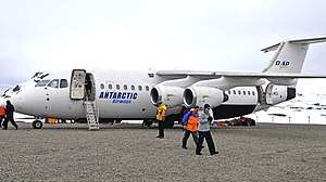 A DAP Airway's plane in the airport. | |||||||||||
| Summary | |||||||||||
| Airport type | Public | ||||||||||
| Operator | Aeropuertos Chile | ||||||||||
| Serves | Villa Las Estrellas and Base Presidente Eduardo Frei Montalva, Chile | ||||||||||
| Elevation AMSL | 147 ft / 45 m | ||||||||||
| Coordinates | 62°11′28″S 58°59′10″W / 62.19111°S 58.98611°WCoordinates: 62°11′28″S 58°59′10″W / 62.19111°S 58.98611°W | ||||||||||
| Map | |||||||||||
 TNM Location of airport in Antarctica | |||||||||||
| Runways | |||||||||||
| |||||||||||
The Teniente Rodolfo Marsh Martin Airport (IATA: TNM, ICAO: SCRM) is on King George Island, part of Chile's Antártica commune in Antarctica, and is the northernmost airport in the continent. The airport serves the nearby village of Villa Las Estrellas and the Base Presidente Eduardo Frei Montalva.
The airport has five small buildings (hangar, control tower) and a small apron area for parking aircraft.
The Isla Rey Jorge non-directional beacon (Ident: IRJ) is located 0.46 nautical miles (0.9 km) off the approach threshold of Runway 30. The Isla Rey Jorge VOR-DME (Ident: IRJ) is located on the field.[4][5]
The airport uses the GMT -4:00 timezone.
It is the only airport in Antarctica that has an IATA code. This is because it is served by various public flights, usually as part of a fly/cruise. There is no regular scheduled public service to the airport, although Aerovías DAP has some charter flights from Punta Arenas.
Accidents and incidents
- February 25, 1992 – Ejército de Chile (Chile) CASA 235M-100 with 11 on board crashed at the airport. No deaths or injuries were reported. The aircraft was written off.
See also
References
External links
- OpenStreetMap - Ten. Rodolfo Marsh Airport
- OurAirports - Ten. Rodolfo Marsh Martin Airport
- SkyVector - Ten. Rodolfo Marsh Airport
- Simtours - Anatarctica
- Accident history for Ten. Rodolfo Marsh Martin Airport at Aviation Safety Network
- Airport information for Ten. Rodolfo Marsh Martin Airport at World Aero Data. Data current as of October 2006.
- Current weather for Ten. Rodolfo Marsh Airport at NOAA/NWS
| General |
| .svg.png) |
|---|---|---|
| Geographic regions | ||
| Waterways | ||
| Famous explorers | ||