Prospect Point (Antarctica)
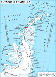
Prospect Point is a headland at the west extremity of Velingrad Peninsula on Graham Coast in Graham Land, nearly 2 nautical miles (3.7 km) south of Ferin Head and immediately east of the Fish Islands. Roughly charted by the British Graham Land Expedition (BGLE) under Rymill, 1934-37. Photographed by Hunting Aerosurveys Ltd. in 1956-57. The name was suggested in 1957 by E. P. Arrowsmith, Governor of the Falkland Islands.
Station J
Prospect Point was the location of the British research Station J. The hut, known as Penola, was occupied from February 2, 1957 to February 23 1959 and the researchers carried out searching in the survey and geology. The station was removed in April 2004.[1]
See also
References
![]()
External links
Coordinates: 66°1′S 65°21′W / 66.017°S 65.350°W
| General |
| .svg.png) |
|---|---|---|
| Geographic regions | ||
| Waterways | ||
| Famous explorers | ||