Pegasus Field
| Pegasus Field | |||||||||||||||
|---|---|---|---|---|---|---|---|---|---|---|---|---|---|---|---|
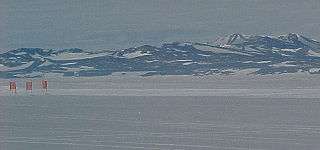 White ice runway at Pegasus Field | |||||||||||||||
| Summary | |||||||||||||||
| Location | McMurdo Station, Ross Island, Antarctica | ||||||||||||||
| Elevation AMSL | 18 ft / 5 m | ||||||||||||||
| Coordinates | 77°57′48″S 166°31′28″E / 77.96333°S 166.52444°ECoordinates: 77°57′48″S 166°31′28″E / 77.96333°S 166.52444°E | ||||||||||||||
| Map | |||||||||||||||
 NZPG Location of airfield in Antarctica | |||||||||||||||
| Runways | |||||||||||||||
| |||||||||||||||
Pegasus Field (ICAO: NZPG) was an airstrip in Antarctica, the southernmost of three airfields serving McMurdo Station. It closed due to excessive melting in the summer season caused by warmer temperatures combined with dust and dirt blown in from nearby Black Island. The last flight was on December 8, 2016[4] and it was replaced by Phoenix Airfield (ICAO: NZFX)[5][6][7] with flights expected to start in February 2017.[6]
Pegasus was originally conceived as a blue ice runway capable of handling wheeled aircraft year-round, but as it was developed, it was enhanced with a 4-inch layer of compacted snow on top—thus more properly characterizing it as a white ice runway. [8] Other local runways are the snow runways at Williams Field (ICAO: NZWD) that are limited to ski-equipped aircraft, and the Ice Runway (ICAO: NZIR) on the sea-ice available during the summer Antarctic field season.
The field is named after Pegasus, a C-121 Lockheed Constellation that made a forced landing on unprepared terrain in bad weather on October 8, 1970. No one on board was injured. The aircraft remains in-situ at the airfield to this day, and has remained well preserved due to the low temperatures of the surrounding area.
On September 11, 2008, a United States Air Force C-17 Globemaster III successfully completed the first landing in Antarctica using night-vision goggles at Pegasus Field.[9] Previously air transport in the permanent darkness of the winter was only used in emergencies, with burning barrels of fuel to outline the runway.
Gallery
 United States Air Force C-5 Galaxy being off-loaded at Pegasus Field.
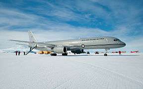 RNZAF Boeing 757 lands at Pegasus Airfield on the Ross Ice Shelf during its maiden flight to Antarctica.
See also
References
- ↑ Airport information for NZPG at World Aero Data. Data current as of October 2006.Source: DAFIF.
- ↑ Airport information for NZPG at Great Circle Mapper. Source: DAFIF (effective October 2006).
- ↑ USAP.gov US Antarctic Program Inter-agency Air Operations Manual
- ↑ NZDF Airlift Missions Renew Lifeline For Scientists In Antarctica Archived 2017-01-06 at the Wayback Machine.
- ↑ http://www.gcmap.com/airport/NZFX
- 1 2 US Antarctic Program Inter-agency Air Operations Manual – United States Antarctic Program
- ↑ "A New Runway for McMurdo Station is Named". National Science Foundation. 7 April 2016.
- ↑ Wallwork, Ellery D. (October 2006). "Operation Deep Freeze—50 Years of Air Force Airlift in Antarctica 1956–2006 (page 265)" (PDF). Archived from the original (PDF) on 2016-05-07.
- ↑ Rejcek, Peter (September 26, 2008). "Air Force successfully tests new capability to fly any time of year to McMurdo". Antarctic Sun.
External links
| Wikimedia Commons has media related to Pegasus Field. |
- Airfields on Antarctic Glacier Ice Malcolm Mellor and Charles Swithinbank, CRREL 1989.
- Lockheed Aircraft R7V-1 / R7V-1P / C-121J "Constellation" "Connie"
- Installation of runway-Pegasus
- Runway Project Clears the Way for Improved Antarctic Airlift National Science Foundation. February 20, 2002.
- Construction, Maintenance, and Operation of a Glacial Runway, McMurdo Station, Antarctica George L. Blaisdell et al., CRREL Monograph 98-1, March 1998.
- Current weather for NZPG at NOAA/NWS