Takoma station
Takoma | |||||||||||
|---|---|---|---|---|---|---|---|---|---|---|---|
|
| |||||||||||
 | |||||||||||
| Location |
327 Cedar Street, NW Washington, DC 20012 | ||||||||||
| Coordinates | 38°58′32″N 77°01′04″W / 38.975532°N 77.017834°WCoordinates: 38°58′32″N 77°01′04″W / 38.975532°N 77.017834°W | ||||||||||
| Owned by | WMATA | ||||||||||
| Line(s) |
| ||||||||||
| Platforms | 1 island platform | ||||||||||
| Tracks | 2 | ||||||||||
| Connections |
| ||||||||||
| Construction | |||||||||||
| Structure type | Surface | ||||||||||
| Parking | 146 spaces | ||||||||||
| Bicycle facilities | 38 racks, 60 lockers | ||||||||||
| Disabled access | Yes | ||||||||||
| Other information | |||||||||||
| Station code | B07 | ||||||||||
| History | |||||||||||
| Opened | February 6, 1978 | ||||||||||
| Traffic | |||||||||||
| Passengers (2017) |
5,108 daily [1] | ||||||||||
| Services | |||||||||||
| |||||||||||
Takoma is a Washington Metro station in Washington, D.C. on the Red Line, bordering Takoma Park, Maryland. The station is considered to be located in part of Takoma Park's Historic District. It is the last station in the District of Columbia on the eastern end of the Red Line heading to Maryland, although the station is located on the DC-Maryland state line (Eastern Avenue) and therefore Maryland is immediately across the street from the station.
Location
The station serves the city of Takoma Park, Maryland as well as the Takoma Park neighborhood of Washington, D.C. and is located at the corners of where Eastern Avenue (the MD/DC Line), Carroll Street NW, Piney Branch Road NW, and Blair Road NW intersect.
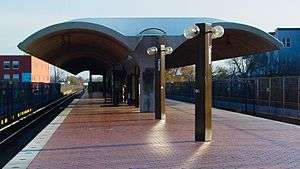
Station layout
| P Platform level |
Westbound | ← |
| Island platform, doors will open on the left | ||
| Eastbound | → | |
| M | Mezzanine | One-way faregates, ticket machines, station agent |
| G | Street Level | Exit/ Entrance |
The entrance to the station is at the street level, with escalators leading up to the platform. A separate accessible entrance consisting of a single elevator is located near the middle of the platform. The separate accessible and general entrances are a relative rarity in the Washington Metrorail System; only Rosslyn and Tenleytown-AU stations share this feature. Takoma, like Brookland-CUA, Fort Totten, and Silver Spring, is in the middle of a CSX rail line. There are two tracks to either side of the island platform, and Metrorail trains use the track on either side closest to the platform.
History
Prior to the opening of Metrorail, the Baltimore & Ohio Railroad (B&O) operated commuter trains that served intra-DC locations, including Takoma Park (this service continues as MARC's Brunswick Line, although the closest station serving the area is in Silver Spring Maryland). Commuter rail service ended before Metrorail service began, and the old shelter for the rail stop was demolished in order widen the right-of-way to accommodate Metrorail. Remnants of the Takoma Park B&O rail stop are visible to the west of the Metro station.[2] The original Takoma Park railroad station, located within DC, burned down in the 1950s. Construction of the Metrorail Station took place in the early 1970s, and the station shares architectural features with the other above-ground stations constructed across the system.
Service began on February 6, 1978. Takoma was among some of the first stations to open in the Metrorail System, less than one year after the system's inauguration on March 27, 1976.
2009 collision
On June 22, 2009, a southbound Metro train on the Red Line collided with another southbound train, which was stopped between the Takoma and Fort Totten stations, causing the deadliest accident in the system's history.[3]
References
- ↑ "Metrorail Average Weekday Passenger Boardings" (PDF). WMATA. Washington Metropolitan Area Transit Authority. Retrieved July 31, 2018.
- ↑ Bentley, Elizabeth. "Commerce in Takoma Park: A Century of Change" (PDF). Takoma Voice. Retrieved May 2, 2013.
- ↑ Lena H. Sun; Robert Thomson (June 22, 2009). "Red Line Collision Kills at Least 6". The Washington Post. Retrieved June 23, 2009.
External links
![]()
- WMATA: Takoma Station
- StationMasters Online: Takoma Station
- The Schumin Web Transit Center: Takoma Station