Strabane
| Strabane | |
|---|---|
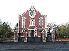
 Roman Catholic church, Barrack Street, Strabane | |
 Strabane Strabane shown within Northern Ireland | |
| Population | 17,670 |
| District | |
| County | |
| Country | Northern Ireland |
| Sovereign state | United Kingdom |
| Post town | STRABANE |
| Postcode district | BT82 |
| Dialling code | 028, +44 28 |
| Police | Northern Ireland |
| Fire | Northern Ireland |
| Ambulance | Northern Ireland |
| EU Parliament | Northern Ireland |
| UK Parliament | |
| NI Assembly | |
| Website | www.strabanedc.com |
Strabane (/strəˈbæn/ strə-BAN; from Irish: An Srath Bán, meaning "the white strath"),[2] historically spelt Straban, is a town in west Tyrone, Northern Ireland. It was the headquarters of the former Strabane District Council.
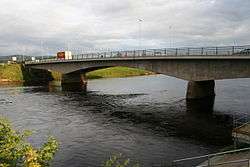
Strabane has a population of around 18,000. It is the second-largest town in Tyrone, after Omagh. It lies on the east bank of the River Foyle and is roughly equidistant from Omagh, Derry City and Letterkenny. The River Foyle marks the border between Northern Ireland and the Republic of Ireland. On the other side of the river (across Lifford Bridge) is the smaller town of Lifford, which is the county town of County Donegal. The Mourne flows through the centre of the town, and meets the Finn to form the Foyle River.
History
Early History
The locale was home to a group of northern Celts known as the Orighella as far back as the fourth century when the territories of Own [later Tyrone] and Connail [later Tirconnel, then Donegal] were established, and Orighella were assimilated into the Cineal Owen. With the arrival of St. Patrick, a mission established a church in the area near Castlefin, and having visited the Grianán Aileach for the conversion of Owen, returned along the Foyle river, establishing a further church at Leckpatrick [the name means 'the flagstone of St.Patrick']. A later church was established at Lifford/Clonleigh by a mission headed by St. Colmcille. In AD586 St. Colgan established a monestary at Camus [from whence the parish of Camus-Juxta-Mourne gets its name]. Other monasteries and religious sites were established at this time at Urney, Ballycolman, Donagheady, and Artigarvan[3].
The Middle Ages
Vikings arrived at Lifford in AD832 and maintained a pressence on the Foyle until AD863 when they were expelled by Aedh Finnliath. The regional seat of power was to be the Grianán Aileach until 1101, when it as destroyed by the O'Briens of Thomond, and was then move to Urney, three miles outside Strabane. In 1243, the seat of power for all Tyrone and the O'Neill dynasty was moved to Cookstown. It was during this epoch, in AD1231, that Franciscan friars established a religious foundation on what is now the old graveyard at St. Patrick's street, Strabane[4]..
Seventeenth century
The town was settled by Scottish families in the 1600s, an action that preceded the Plantation of Ulster. In 1608, during O'Doherty's Rebellion, most of the inhabitants fled to the safety of Lifford following Sir Cahir O'Doherty's Burning of Derry, as it was feared that Strabane would be his next target.
Recent history
In the late 20th century, during the height of The Troubles, Strabane garnered the dubious distinction of the highest unemployment rate in the industrial world. It is one of the most economically deprived towns in the United Kingdom. Huge economic damage occurred when much of the town centre flooded in 1987.[5]
In August 2005, a Channel 4 television programme presented by property experts Kirstie Allsopp and Phil Spencer named Strabane the eighth-worst place to live in the UK, largely owing to unemployment.[6] Strabane had been moved out of the top 20 in the 2007 edition.[7]
As a result, the Strabane Community Unemployed Group,[8] headquartered in 13a Newtown Street (BT82 8DN), was founded to find solutions to long-term unemployment and combat the causes for unemployment. Sister Mary Carmel Fanning, a retired Catholic girls school principal who had been awarded the MBE for her services to education in 1997,[9] became a director of the Group the following year.
The Troubles

Strabane suffered extensive damage during the Troubles, from the early 1970s and continuing throughout much of the 1990s, with bombings and shootings commonplace; Irish Republican paramilitary groups, mainly the Provisional Irish Republican Army, regularly attacked the town's British Army and Royal Ulster Constabulary (RUC) bases. Strabane was once the most bombed town in Europe in proportion to its size, and was the most bombed town in Northern Ireland.
Many civilians and members of the security forces were killed or injured in the area over the course of the Troubles. Many British Army regiments from England, Scotland and Wales served in Strabane at various times during the Troubles in the Barracks at the locally named "Camel's hump". As a result of the Good Friday Agreement, there is no longer any British Army presence in the town. Strabane became involved in the Ulster Project International, sending Catholic and Protestant teenagers to the United States for prejudice-reduction work.[10]
Transport
Railways
%2C_January_2010.JPG)
The Irish gauge 5 ft 3 in (1,600 mm) Londonderry and Enniskillen Railway (L&ER) reached Strabane in 1847,[11] Omagh in 1852[12] and Enniskillen in 1854.[12] The Great Northern Railway (Ireland) took over the L&ER in 1883.[13]
The Finn Valley Railway (FV) opened from Strabane to Stranorlar in 1863.[12][14] The FV was originally Irish gauge but in 1892 it merged with the 3 ft (914 mm) narrow gauge West Donegal Railway (WD) to form the Donegal Railway[15] and was reduced to the same narrow gauge for through running. The Donegal Railway opened its own line to Derry in 1900.[11] In 1906 the GNR and Northern Counties Committee jointly took over the Donegal Railway, making it the County Donegal Railways Joint Committee.[15] The 3 ft (914 mm) gauge Strabane and Letterkenny Railway opened in 1909[11] and was worked by the Joint Committee.[15] The narrow gauge lines made Strabane one of the most important railway connections for County Donegal.
The partition of Ireland in 1922 turned the boundary with County Donegal into an international frontier. This changed trade patterns to the railways' detriment and placed border posts on the Joint Committee's FV and S&L lines and on the GNR line to Derry.[11] Stops for customs inspections greatly delayed trains and disrupted timekeeping. Over the next few years customs agreements between the two states enabled GNR trains between Strabane and Derry to pass through the Free State without inspection unless they were scheduled to serve local stations on the west bank of the Foyle, and for goods on all railways to be carried between different parts of the Free State to pass through Northern Ireland under customs bond. The Joint Committee's Strabane-Derry line was closed in 1954, followed by the remainder of the narrow gauge system in 1960.[16] In 1958 the Ulster Transport Authority took over the remaining GNR lines on the Northern Ireland side of the border. In accordance with The Benson Report submitted to the Northern Ireland Government in 1963, the UTA closed the former GNR line through Strabane to Derry in 1965.[16][17]
Little trace remains of Strabane's railways except for one old railway building that survives in the town. The nearest railway is operated by Northern Ireland Railways and runs from Londonderry railway station via Coleraine to Belfast Central railway station and Belfast Great Victoria Street railway station. The strategically important Belfast-Derry railway line is to be upgraded to facilitate more frequent trains and improvements to the permanent way such as track and signalling to enable faster services.
Canal
In 1792, the 4 miles (6.4 km) Strabane Canal was built from the tidal waters of Lough Foyle at Leck, to Strabane. It fell into disuse in 1962. In June 2006 the Strabane Lifford Development Commission awarded a £1.3m cross-border waterways restoration contract. The project was launched by President of Ireland, Mary McAleese, in Lifford and involves the restoration of 1.5 miles (2.4 km) of canal and two locks to working order. Work was due to start on the Lough Foyle side of the canal in the summer of 2006. This work was begun but was done to a very poor standard to the extent that the water in the canal is now very dangerous. It was reported in the Strabane Weekly News that a dog went into the canal but fell ill and died as a consequence.
Demographics
Strabane is classified as a medium town (i.e. with population between 10,000 and 18,000 people) by the Northern Ireland Statistics and Research Agency (NISRA).[18]:11
2011 Census
On Census day (27 March 2011) there were 13,172 people living in Strabane (5,123 households), accounting for 0.73% of the NI total.[19] Of these:
- 23.00% were aged under 16 years and 13.19% were aged 65 and over;
- 52.32% of the usually resident population were female and 47.68% were male;
- 91.57% belong to or were brought up in the Catholic religion and 7.22% belong to or were brought up in a 'Protestant and Other Christian (including Christian related)' religion;
- 56.03% had an Irish national identity, 33.54% had a Northern Irish national identity and 12.03% indicated that they had a British national identity (respondents could indicate more than one national identity);
- 36 years was the average (median) age of the population;
- 17.43% had some knowledge of Irish (Gaelic) and 3.49% had some knowledge of Ulster-Scots.
2001 Census
On Census day, 29 April 2001, there were 13,456 people living in Strabane. Of these:
- 99.3% classed their ethnic group as white
- 93.3% were from a Catholic background and 6.1% were from a Protestant background
- 5.7% of people aged 16–74 were unemployed, of these 43.1% were long-term unemployed.
- 15.6% of people aged 16–59 were claiming incapacity benefit
- 27.6% were aged under 16 years and 13.7% were aged 60 and over
- 51.1% of the population were male and 48.9% were female.
Politics
As of 2015, Strabane and Derry councils joined together, and have a strong nationalist majority. At the local elections in May 2011, members of Strabane District Council were elected from the following political parties: 8 Sinn Féin, 4 Democratic Unionist Party (DUP), 1 Social Democratic and Labour Party (SDLP), 1 Ulster Unionist Party (UUP) and 2 Independent Nationalist. The council chairperson and vice-chairperson for 2013-14 are Ruairí McHugh and Michelle McMackin (both of Sinn Féin). The Strabane District Council area covers an area of 861.6 km² and according to the 2001 Census, the council area had a total population of 38,250.
Since 1997 Strabane has been part of the United Kingdom parliamentary constituency of West Tyrone, held since 2001 by Sinn Féin's Pat Doherty. From 1983 to 1997 it was part of the Foyle constituency, held during that time by the then-SDLP leader John Hume.
Culture
Sport
The local Gaelic football team, Strabane Sigersons, and the hurling team, Strabane Seamrogaí, are expanding. Owen Roe O'Neill's GAC, Leckpatrick, can also claim part of Strabane with the North part of the town following under their parish umbrella. The Sigerson Cup, the all-Ireland colleges cup for Gaelic football, is named after a native of the town, Dr George Sigerson. Strabane Cricket Club and Fox Lodge Cricket Club are members of the North West Senior League. Strabane also boasts several local football teams that play in various leagues. The most senior is Strabane Athletic F.C. of the Northern Ireland Intermediate League.
The town has three golf courses.[20] Strabane Golf Course[21] is an 18-hole parkland course set in the foothills of the Sperrin Mountains, 1 mile south of the town. Strabane also has a large number of road runners. The local 10k race which is run in July is well supported by local athletes as well as those from farther afield. Strabane also hosts the Tyrone Titans, a new franchise in the historic IAFL. The River Mourne, Burn Dennet River, Moore Lough and Lough Ash are all within easy access of the town therefore providing many opportunities for fishing.
Irish language
Strabane has an Irish-medium nursery, Naíscoil an tSratha Báin, which was founded in 1994,[22] and a Gaelscoil (primary school).[23] Other Irish language groups including the Craobh Mhic an Chrosáin branch of Conradh na Gaeilge and Gaelphobal, an umbrella group for Irish language organisations, are active in the Strabane District.
Music and arts
_-_geograph.org.uk_-_83262.jpg)
CRAIC (Cultural Revival Among Interested Communities) a cross-border, cross-community group provides music lessons to both adults and children on a voluntary basis in the local Irish language Gaelscoil. The Barret School of Irish Dancing has produced some of Ireland's best Irish dancers, and the local theatre group, The Puddle Alley Players, has won several awards over the years in amateur dramatic competitions.
In 2007, the Alley Arts and Conference Centre opened to the general public, offering a 270-seat theatre, art gallery, tourist information centre and cafe-bar. The Alley has won numerous awards since opening, including Northern Ireland Building of the Year 2008, Allianz Arts and Business Award 2009 and The Green Apple Award 2008. The venue has hosted the All Ireland Confined Drama Finals (2008) and is the current home of the North West Music Festival, The Stage Write Schools Drama Festival, Sounds Like Summer Music Festival, Strabane Drama Festival, and the Johnny Crampsie Music Festival.
Strabane plays host to a Saint Patrick's Day Parade each year. One of Strabane's most notable features are five 20 ft (6.1 m) steel structures on the banks of the river: two dancers and a fiddle player on the Lifford side, a flute player on the Strabane side and a drummer in the middle. Designed by Maurice Harron,[24] they were placed close the site of the former British Army base at the Tyrone-Donegal border. The sculptures were originally called "Let The Dance Begin" but have since become known affectionately as "The Tinneys".[25]
Education
%2C_January_2010.JPG)
Education in Strabane is provided by a mixture of infant, primary and secondary schools. The central location of the town allows parents the choice of schools in Derry, Omagh and Donegal. As of 2005, Strabane Grammar School had a 100% achievement rate of grades A-C at GCSE level and a 67% rate of three or more grades A-C at A level.[26] A state-of-the-art secondary school will be opening in 2009. The school will be joined by Strabane High School, to make a single larger second level school.
Holy Cross College is another one of Strabane's secondary schools. Holy Cross College was created in 2003 with the amalgamation of Strabane's three Catholic post-primary schools, the Convent Grammar School, St Colman's High School and Our Lady of Mercy High School. The College had been operating across the three sites until its 29m state-of-the-art new building opened in September 2009, catering for 1,400 pupils. Holy Cross is a co-ed bilateral college, which means it offers grammar status education within an all-ability school. It is regarded as a blueprint for the future of education in Northern Ireland because it caters for both academic and vocational paths.[27] Education over the age of sixteen is provided by The North West Institute of Further and Higher Education.[28] The Institute also offers a wide range of vocational and adult education courses.
Places of interest
The National Trust owns a Strabane shop in which John Dunlap learnt the printing trade. Dunlap went on to print the United States Declaration of Independence.
Dergalt, the ancestral home of Woodrow Wilson, 28th President of the United States, is near Strabane.[29] On 8 May 2008 it was severely damaged by a fire.[30]
In 2014, two Palestinian murals were painted in the town, one in the Ballycolman estate and one in the Head of the town. one mural in particular received international media attention, this was during the Israeli assault on Gaza. The murals were painted during a large pro-Palestinian campaign in which Strabane seen white line pickets, camps and protests.
Other
Strabane is twinned with Zeulenroda-Triebes in the state of Thuringia, Germany.
Strabane transmitting station is a broadcasting and telecommunications facility owned and operated by Arqiva.
It includes a 305.5 metre (1,002 ft) high guyed steel lattice mast, which is the tallest structure in Ireland. The transmission antennassurmounting the structure are contained within a fibreglass cylinder. Constructed in 1963, it came into service on 18 February of that year.
Notable people
- Paul Brady, singer songwriter
- Robert Welch, photographer and conchologist
- Ryan Dolan, singer for Ireland at the Eurovision Song Contest 2013
- Flann O'Brien, best known pseudonym of Brian O'Nolan, 20th century Irish satirist and humourist. He also wrote under the pseudonym Myles na gCopaleen
- William Burke, 19th century serial killer, from Urney, a Strabane townland[31]
- Sir Guy Carleton, Governor of the Province of Quebec & Governor General of British North America
- Declan Curry, BBC One correspondent
- Brian Dooher and Stephen O'Neill, members of the 2003, 2005 and 2008 All-Ireland winning Tyrone Gaelic football teams. Dooher captained the victorious team in 2005 and 2008. O'Neill was the top-scorer of the 2005 All-Ireland Senior Football Championship.
- Andrew Frederick Gault (1833–1903), merchant, industrialist, and philanthropist known as the Cotton King of Canada.
- Matthew Hamilton Gault, financier and politician at Montreal
- Pearse McAuley, IRA member jailed for the killing of Detective Garda Jerry McCabe[32]
- Hugo Duncan, popular entertainer
- John Dunlap, printer of the United States Declaration of Independence
- Annie Russell Maunder, astronomer
- Rory Patterson, Football striker currently playing for Derry City F.C in the Irish League of Ireland.
- Dr George Sigerson, Gaelic activist; namesake of the Sigerson Cup
- H.G. Simms, Chairman of the Shanghai Municipal Council (1922–23)
- The Freshmen, one of four Irish showbands featured on a special set of commemorative stamps issued in September
- Matthew Holmes, New Zealand runholder and politician
See also
| Wikimedia Commons has media related to Strabane. |
References
- ↑ "Snapshot: The magazine of Strabane District Council" (PDF). Retrieved 30 June 2015.
- ↑ Room, Adrian (2003), Placenames of the world, Jefferson, North Carolina: McFarland, p. 344, ISBN 0-7864-1814-1
- ↑ The Fair River Valley, Jim Bradley et al, 2000
- ↑ The Fair River Valley, Jim Bradley et al, 2000
- ↑ "Flood disaster recalled - 25 years on". Derry Journal. 16 October 2012. Retrieved 8 July 2017.
- ↑ "The Best and Worst Places to Live in Britain". Channel4.com. Retrieved 30 June 2015.
- ↑ "Town shrugs off dismal TV label". BBC News. Retrieved 24 May 2010.
- ↑ "Sister Carmel Fanning". Directorstats.co.uk. Retrieved 8 July 2017.
- ↑ "Listing". www.thegazette.co.uk. 13 June 1997.
- ↑ "Ulster Project International". Ulsterproject.org. Retrieved 30 June 2015.
- 1 2 3 4 Hajducki, S. Maxwell (1974). A Railway Atlas of Ireland. Newton Abbott: David & Charles. map 3. ISBN 0-7153-5167-2.
- 1 2 3 Hajducki, 1974, map 7
- ↑ Patterson, Edward M. (1962). The County Donegal Railways. Dawlish: David & Charles. pp. 10–11.
- ↑ Hajducki, 1974, map 6
- 1 2 3 Hajducki, 1974, page xi
- 1 2 Hajducki, 1974, map 39
- ↑ Baker, Michael H.C. (1972). Irish Railways since 1916. London, UK: Ian Allan. pp. 153, 207. ISBN 0-7110-0282-7.
- ↑ "Statistical Classification and Delineation of Settlements" (PDF). NI Statistics and Research Agency (NISRA). February 2005. Table 3 / Band C - Large Town. Retrieved 26 September 2018.
- ↑ "Census 2011 Population Statistics for Coleraine Settlement". Northern Ireland Statistics and Research Agency (NISRA). 2011. Retrieved 5 June 2018.
- ↑ "Strabane". www.discoveringireland.com. Retrieved 24 July 2018.
- ↑ Strabane Golf Course website, strabanegolfclub.co.uk; accessed 7 July 2015.
- ↑ "Naíscoil an tSratha Báin". Retrieved 30 June 2015.
- ↑ "History of Gaelscoil Uí Dhochartaigh". Archived from the original on 12 March 2012. Retrieved 30 June 2015.
- ↑ "Maurice Harron-Artist-sculptor". Mauriceharron.com. Retrieved 2 May 2012.
- ↑ "The Tinneys". Very Derry. Retrieved 2 May 2012.
- ↑ "Response to Location Location Location programme". 25 July 2005. Archived from the original on 16 July 2011. Retrieved 11 January 2010.
- ↑ "Holy Cross College hailed as a beacon". Retrieved 9 June 2018.
- ↑ "Department for Employment and Learning". Delni.gov.uk. Retrieved 30 June 2015.
- ↑ "World Travel Destinations, Culture and History Guide". Geographia. 3 October 2006. Retrieved 2 May 2012.
- ↑ "BBC News". BBC News. 8 May 2008. Retrieved 30 June 2015.
- ↑ "Famous People – Strabane History Society Website". strabanehistorysociety.org. Retrieved 24 July 2018.
- ↑ "Jail breaker on police killing charge". BBC News. Retrieved 30 June 2015.
External links
| Large |  | |
|---|---|---|
| Medium | ||
| Small | ||
Italics denote settlements that are classed as towns but also have city status | ||
| Authority control |
|---|