Ballynahinch, County Down
| Ballynahinch | |
|---|---|
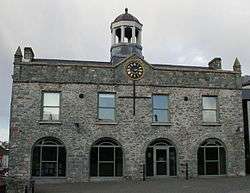
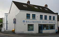
 The Market House (middle) and Credit Union (left) | |
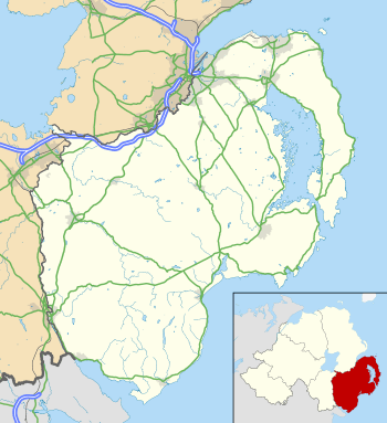 Ballynahinch shown within County Down | |
| Population | 5,364 (2001 Census) |
| District | |
| County | |
| Country | Northern Ireland |
| Sovereign state | United Kingdom |
| Post town | BALLYNAHINCH |
| Postcode district | BT24 |
| Dialling code | 028 |
| Police | Northern Ireland |
| Fire | Northern Ireland |
| Ambulance | Northern Ireland |
| EU Parliament | Northern Ireland |
| UK Parliament | |
| NI Assembly | |
Ballynahinch (from Irish: Baile na hInse, meaning "town of the island")[2] is a town in County Down, Northern Ireland. It had a population of 5,364 people in the 2001 Census.
Ballynahinch was traditionally a market town, although the market still takes place in the square every Thursday. The town lies on the main A24 Belfast to Newcastle road 15 miles (24 km) south of Belfast. Facilities in the town include a leisure centre. In recent years a regeneration committee has been formed for the development of the town and the surrounding Spa and Drumaness areas.
History
Until the 17th century, the area was controlled by the McCartan clan. Around the mid-1600s, Patrick McCartan sold lands around Ballynahinch to Sir George Rawdon, agent to Viscount Conway, and Sir William Petty, a surveyor from Hampshire. Before his death in 1687, Petty leased his interest in the land leaving Sir George in sole possession. He built two corn mills and founded the town with a market square. In 1683 Charles II of England granted the town a patent to hold a Thursday market and two fairs every 1 February and 29 June. Settlers from lowland Scotland increased the population and Ballynahinch grew as a market town with the sale of livestock, corn, potatoes and increasingly, flax was being cultivated. Sir John Rawdon, descendant of Sir George and now the Earl of Moira took up residence in Montalto house in Ballynahinch. He made significant improvements to the estate and to the town by promoting the linen market and causing the market house to be built. By the end of the eighteenth century sales in the market were grossing around £300 per week and the town was prospering.[3] Unfortunately it was about to suffer a setback.
The Society of United Irishmen launched a rebellion in 1798. It began in Leinster and quickly spread to Ulster. The United Irishmen had been founded in 1791 by liberal Protestants in Belfast. Its goal was to unite Catholics and Protestants and make Ireland an independent republic. Although its membership was mainly Catholic, many of its leaders and members in northeast Ulster were Protestant. The Battle of Ballynahinch began on 12 June 1798, when about 4000 United Irishmen camped at Ballynahinch were besieged by the British Army. The British bombarded the town with cannon for a full day until the United Irishmen retreated. Following this, the British burnt sixty-three houses in Ballynahinch and its hinterland. The commander of the United Irishmen, Henry Munro, was betrayed, captured and executed shortly after.
Montalto and Ballynahinch was sold in 1802 to David Ker Esq. who took advantage of the rising fashion for 'taking the waters' amongst tourists with money and developed the medicinal spa wells just over two miles outside the town. The village continued to expand thereafter.[3]
In mid-1920, the Royal Irish Constabulary (RIC) barracks at Ballynahinch was subject to a bomb attack by the Irish Republican Army (IRA).[4]
Then British Prime Minister John Major visited Ballynahinch in December 1996.
Ballynahinch is the site of Montalto Estate, Montalto House and The Carriage Rooms. The latter of which was the setting for Disney's The Lodge.
.JPG)
Demography
Ballynahinch is classified as a Small Town by the NI Statistics and Research Agency (NISRA) (i.e. with population between 4,500 and 10,000).
2011 Census
On Census day (27 March 2011) there were 5,703 people living in Ballynahinch (2,326 households), accounting for 0.31% of the NI total.[5] Of these:
- 21.01% were aged under 16 years and 16.48% were aged 65 and over;
- 52.27% of the usually resident population were female and 47.73% were male;
- 57.99% belong to or were brought up in a 'Protestant and Other Christian (including Christian related)' religion and 34.61% belong to or were brought up in the Catholic religion;
- 62.41% indicated that they had a British national identity, 30.46% had a Northern Irish national identity and 14.29% had an Irish national identity (respondents could indicate more than one national identity);
- 37 years was the average (median) age of the population;
- 6.95% had some knowledge of Ulster-Scots and 4.52% had some knowledge of Irish (Gaelic).
2001 Census
On Census day (29 April 2001) there were 5,364 people living in Ballynahinch. Of these:
- 22.4% were aged under 16 years and 17.0% were aged 60 and over,
- 48.3% of the population were male and 51.7% were female,
- 31.3% were from a Catholic background and 65.4% were from a Protestant background,
- 3.7% of people aged 16–74 were unemployed.
For more details see: NI Neighbourhood Information Service
Buildings of note
- The town's market house was built in 1795 and is currently used as a community centre
- An old flax mill and corn mill stand on the outskirts of the town. They are currently a proposed site for development.
Transport
Traffic congestion
The town is well known for its heavy congestion. A bypass is proposed for the town. Geological surveys were conducted over twenty years ago to determine the route of the bypass but money has never been allocated by the Department of the Environment. In the 1990s various traffic control measures were introduced including the present one way system, however all have failed to cope with the sheer volume of traffic which passes through the town daily, particularly evenings.
In January 2012 The Minister for Regional Development made the following announcement:
"Roads Service approved the stage 2 preferred options report for the scheme, including the recommendation for a preferred line for the A24 Ballynahinch bypass scheme around the eastern outskirts and adjacent to the development limit of the town. That line will run from the junction of the A24 Belfast Road and the A21 Saintfield Road, which is north of the town, to the junction of the A24 Drumaness Road and the B2 Downpatrick Road, which is south of the town, at a distance of approximately 3.1 km. The scheme will involve substantial earthworks to traverse the drumlin topography and ground conditions along the route, which includes the flood plain of the Ballynahinch River. Three substantial structures will be required where the route crosses Moss Road, Crossgar Road and the Ballynahinch river."
There will also be a junction with the B7 Crossgar Road.[6]
However this just shows the advanced nature of the planning rather than imminent construction; The official position is still that construction will take place between 2014 and 2019.[7]
Rail
- Ballynahinch railway station and Ballynahinch Junction railway station on the Belfast and County Down Railway, both opened on 10 September 1858, and both finally closed on 16 January 1950.[8]
Education
- The South Eastern Regional College has a main campus building in Ballynahinch.
- Assumption Grammar School
- The High School Ballynahinch
- St. Colman's High and Sixth Form College
- Drumlins Integrated Primary School
- Ballynahinch Primary School
- Saint Patrick's Primary School
Religion
- Edengrove Presbyterian Church, Dromore Road. Original church built in 1774, present church built in 1841.[9]
- St Patrick's Roman Catholic Church, 24 Church Street, Ballynahinch. Main church completed in 1812, tower and transepts added in the 1860s.[10]
Notable people
- Irish international cricketer, Joseph Coskery (1895–1965), was from Ballynahinch
- Hugh Gourley (1825–1906) emigrated from Ballynahinch aged 27 and was elected Mayor of Dunedin, New Zealand, on two occasions[11]
- David Howland, professional footballer, was born in Ballynahinch in 1986
- John McMullen (1832–1883), born in Ballynahinch, became a Roman Catholic Bishop in Iowa, USA
- Irish international footballer and manager, Frank Thompson (1885–1950), was born in Ballynahinch
Sport
- Ballynahinch Rugby Football Club founded 1954, home ground Ballymacarn Park, plays in AIB Division One
- Ballynahinch United F.C. play in the Northern Amateur Football League, and play at millbridge on the outskirts of the town.
- Ballynahinch Olympic FC founded in 1973 have a Senior side in Division 2A of the Northern Amateur Football League and a Senior side in Division 1 of the Newcastle League with Junior sides in DYFL. Ballynahinch Olympic Senior Side are Current Division 2A Champions, (Season 2011/2012). Both Senior Sides currently Play at Cedar Playing Fields, Crossgar.
- Temple Rangers Football Club have two teams playing in the northern amateur football league. They play their home games at the pitches in the Langley Road estate.
- Ballynahinch Rabbitohs rugby league football club are current Ulster Rugby league champions and have now won three consecutive titles from 2009–2011. They also field a second team in the Ulster second division.
- Ballynahinch Hockey club have 4 sides (2 men and women 1st, and 2 men's and women's 2nds) that compete in the ulster hockey leagues, the men's 1st's play in division 2 in the ONE1918 senior 2 league and the men's 2nds play in the corporate coaching men junior league 4, the women's 1sts play in the ONE1918 women's senior league 4, and the 2nds play in the corporate coaching junior league 9.
| Wikimedia Commons has media related to Ballynahinch, County Down. |
See also
References
- ↑ McDonald, Fiona. "Fae Cowie's Craig". Ulster-Scots Language Society. Retrieved 8 May 2017.
- ↑ Placenames NI Archived 31 March 2012 at the Wayback Machine.
- 1 2 Rose Jane Leslie, Gerard Sloan, (2012). Old Ballynahinch. Catrine, Ayrshire: Stenlake Publishing. p. 3. ISBN 9781840335811.
- ↑ Hezlet, Sir Arthur (1972). The 'B' Specials. London: Tom Stacey. p. 9. ISBN 0 85468 272 4.
- ↑ "Census 2011 Population Statistics for Coleraine Settlement". Northern Ireland Statistics and Research Agency (NISRA). 2011. Retrieved 5 June 2018.
- ↑ http://www.niassembly.gov.uk/Assembly-Business/Official-Report/Reports-11-12/24-January-2012/#a8
- ↑ http://www.wesleyjohnston.com/roads/A24ballynahinch.html
- ↑ "Ballynahinch and Ballynahinch Junction stations" (PDF). Railscot – Irish Railways. Archived (PDF) from the original on 26 September 2007. Retrieved 11 September 2007.
- ↑ "2nd and 3rd Presbyterian Church in Ballynahinch". Ros Davies' Co. Down. Retrieved 23 November 2010.
- ↑ "Parish of Magheradroll | Lisburn.com". lisburn.com. Retrieved 2015-10-07.
- ↑ Cyclopedia Company Limited (1905). "The Hon. Hugh Gourley". The Cyclopedia of New Zealand : Otago & Southland Provincial Districts. Christchurch: The Cyclopedia of New Zealand. Retrieved 18 February 2012.
External links

| Large |  | |
|---|---|---|
| Medium | ||
| Small | ||
Italics denote settlements that are classed as towns but also have city status | ||