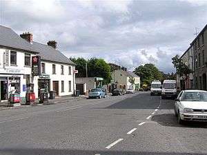
Donaghmore, County Tyrone
Donaghmore (pronounced /ˌdoʊnəˈmɔːr/ DOH-nə-MOR, Irish: Domhnach Mor (great church)[1]) is a village, townland and civil parish in County Tyrone, Northern Ireland, about five kilometres (3 mi) northwest of Dungannon. In the 2011 Census it had a population of 1,122 people. The village is beside the River Torrent, formerly known as the Torrent Flow.[2]
History
The Troubles
For more information see The Troubles in Donaghmore, which includes a list of incidents in Donaghmore during the Troubles resulting in two or more fatalities.
Demography
19th century population
The population of the village decreased during the 19th century:[3][4]
| Year | 1841 | 1851 | 1861 | 1871 | 1881 | 1891 |
|---|---|---|---|---|---|---|
| Population | 542 | 430 | 433 | 351 | 299 | 234 |
| Houses | 109 | 104 | 108 | 79 | 87 | 80 |
21st century population
Donaghmore is classified as a Small Village by the NI Statistics and Research Agency (NISRA) (i.e. with population between 500 and 1,000 people). On Census day (29 April 2001) there were 947 people living in Donaghmore. Of these:
- 26.0% were aged under 16 years and 14.3% were aged 60 and over
- 46.6% of the population were male and 53.4% were female
- 89.2% were from a Catholic background and 10.4% were from a Protestant background
For more details see: NI Neighbourhood Information Service
Places of interest
- Donaghmore Heritage Centre is a converted National School (1885) which preserves photographs, old school roll books, land registration ledgers, documents and artefacts of local interest.
- The Brewer's House is a gastropub that opened in September 2011 serving excellent food and a wide array of ales and wines.
- The village also features a High Cross which is six metres tall and is one of Ulster's finest Early Christian monuments. Donaghmore High Cross probably dates from the 10th century and is said to have been thrown down in the 17th century and re-erected in the 18th century.
- A stone pillar stands in the old churchyard to the memory of Hugh O'Neill, 3rd Earl of Tyrone, erected by one of his descendants.
- The Bardic Theatre was formed in 1982 and after a number of years on the drama festival circuit, the group now stages classic plays, major musicals, comedies, experimental work and new writing at its own theatre on the edge of the village. Other unofficial performances are held routinely in Kieran McCauslands low public bar. The Bardic has recently done performances of High School Musical, Buddy Holly, Jesus Christ Superstar, Blood Brothers and Joseph and the Technicolor Dream coat.
- The Rotharlann is unused currently, but it was busy in its heyday in the mid-1980s. Used mainly by the local cyclists, it also hosted discos that attracted youngsters from all over the country and was a local hot spot for "other" activities. A small campaign is gathering momentum to get the hall restored to its former glories.
Famous locals
- Malachi Cush, singer
- Niall McGinn, winger for Aberdeen and Northern Ireland
- James Dilworth, farmer, investor, speculator and philanthropist
Sport
- Donaghmore St. Patrick's is the local Gaelic Athletic Association club.
- St Joseph's Grammar School have won 2 Nolan Cup and 1 Mallon Cup in Ulster College GAA. They won their first Ulster title (Nolan Cup) in the 2010 and their second in 2013 and in the same year won the Mallon Cup In u14's
- Donaghmore F.C. is the local football club and play in the Mid-Ulster Division 1
Donaghmore Townland
The townland is situated in the historic barony of Dungannon Middle and the civil parish of Donaghmore and covers an area of 91 acres.[5]
The population of the townland increased slightly during the 19th century:[3][6]
| Year | 1841 | 1851 | 1861 | 1871 | 1812 | 1891 |
|---|---|---|---|---|---|---|
| Population | 12 | - | - | 11 | 10 | 13 |
| Houses | 3 | - | - | 3 | 3 | 2 |
In 1891, the village of Donaghmore, which stands in the townland of the same name, had an estimated area of 13 acres.[7]
See also
References
- ↑ "Donaghmore". Place Names NI. Retrieved 19 March 2013.
- ↑ "Donaghmore Area Profile". Donaghmore Living History. Retrieved 1 March 2009.
- 1 2 "Census of Ireland 1851". Enhanced Parliamentary Papers on Ireland. Retrieved 21 March 2013.
- ↑ "Census of Ireland 1891". Enhanced Parliamentary Papers on Ireland. Retrieved 21 March 2013.
- ↑ "Townlands of County Tyrone". IreAtlas Townland Database. Retrieved 19 March 2013.
- ↑ "Census of Ireland 1891". Enhanced Parliamentary Papers on Ireland. Retrieved 19 March 2013.
- ↑ "Census of Ireland 1891". Enhanced Parliamentary Papers on Ireland. Retrieved 19 March 2013.
External links
| Wikimedia Commons has media related to Donaghmore, County Tyrone. |