Tamnamore
Tamnamore
| |
|---|---|
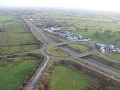 Tamnamore roundabout | |
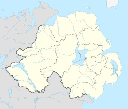 Tamnamore Tamnamore shown within Northern Ireland | |
| County | |
| Country | Northern Ireland |
| Sovereign state | United Kingdom |
| Postcode district | BT71 |
| Dialling code | 028 |
| EU Parliament | Northern Ireland |
Tamnamore (from Irish: An Tamhnach Mhór, meaning "the large field") is a small village in County Tyrone, Northern Ireland, beside the M1 motorway, 7 km east of Dungannon. It lies within the townland of Tamlaghtmore in the civil parish of Killyman, the historic barony of Dungannon Middle,[1] and is situated in Dungannon and South Tyrone Borough Council.
Tamnamore Roundabout connects the M1 with the roads to Coalisland, Derrylaughan, Maghery and The Moy.[2]
References
- ↑ "Tamnamore". Place Names NI. Retrieved 12 May 2015.
- ↑ "Google Maps".
| Wikimedia Commons has media related to Tamnamore. |
This article is issued from
Wikipedia.
The text is licensed under Creative Commons - Attribution - Sharealike.
Additional terms may apply for the media files.