Nigtevecht
| Nigtevecht | ||
|---|---|---|
| Town | ||
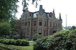 The gardens of Zwaanwijck in Nigtevecht were disigned by landscape architect Mien Ruys. | ||
| ||
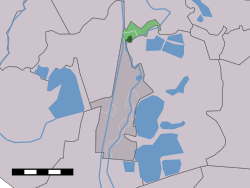 The town centre (dark green) and the statistical district (light green) of Nigtevecht in the former municipality of Loenen | ||
| Coordinates: 52°16′27″N 5°1′40″E / 52.27417°N 5.02778°ECoordinates: 52°16′27″N 5°1′40″E / 52.27417°N 5.02778°E | ||
| Country | Netherlands | |
| Province |
| |
| Municipality | Stichtse Vecht | |
| Population (2014) | 1,395 | |
| Postcode | 1393 | |
| Area code | 0294 | |

Nigtevecht (Dutch pronunciation: [ˈnɪxtəˌvɛxt]) is a town in the province of Utrecht, Netherlands with a population of 1,395. Formerly part of the municipality of Loenen; it has been part of the newly-formed municipality of Stichtse Vecht since 2011. It is situated about 9 km (5.6 mi) west of Bussum along the Vecht River in the Vechtstreek.
In 2001 the village of Nigtevecht had 1,284 inhabitants; in 2004 it had a population of 1,450. The built-up area of the town was 0.21 km² (0.081 sq mi) and contained 506 residences.[1] Between 1818 and 1989 Nigtevecht was a separate municipality, also comprising the neighbouring village of Hinderdam.[2]
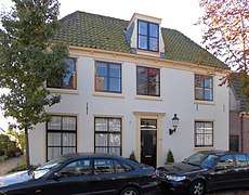 Dorpstraat 112
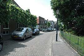 Town centre
 Breevecht
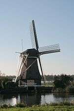 Garsten Windmill
References
- ↑ Statistics Netherlands (CBS), Bevolkingskernen in Nederland 2001 "Archived copy". Archived from the original on March 19, 2006. Retrieved January 24, 2007. . Statistics are for the continuous built-up area.
- ↑ Ad van der Meer and Onno Boonstra, "Repertorium van Nederlandse gemeenten", KNAW, 2006. "Archived copy". Archived from the original on February 20, 2007. Retrieved December 3, 2009.
This article is issued from
Wikipedia.
The text is licensed under Creative Commons - Attribution - Sharealike.
Additional terms may apply for the media files.