Setubinha
| Setubinha | |||
|---|---|---|---|
| |||
 Location in Minas Gerais | |||
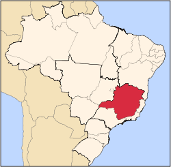
 Setubinha Location in Brazil | |||
| Coordinates: 17°36′00″S 42°09′32″W / 17.60000°S 42.15889°WCoordinates: 17°36′00″S 42°09′32″W / 17.60000°S 42.15889°W | |||
| Country |
| ||
| Region | Southeast | ||
| State |
| ||
| Mesoregion | Mucuri Valley | ||
| Microregion | Teófilo Otoni | ||
| Incorporated (municipality) | December 22, 1995 | ||
| Government | |||
| • Mayor | Warlem Antônio José Barbosa | ||
| Area | |||
| • Total | 534.655 km2 (206.431 sq mi) | ||
| Elevation | 750 m (2,460 ft) | ||
| Population (2006) | |||
| • Total | 11,952 | ||
| [1] | |||
| Time zone | UTC-3 (BRT) | ||
| • Summer (DST) | UTC-2 (BRST) | ||
| HDI (2010) | 0.542 | ||
| Website | setubinha.mg.gov.br | ||


Setubinha is a municipality in the northeast of the Brazilian state of Minas Gerais. As of 2007 the population was 10,834 in a total area of 536 km². The elevation is 729 metres. It is part of the IBGE statistical microregion of Teófilo Otoni
The economy is based on cattle raising and agriculture, with the main crops being coffee, bananas, sugarcane, and corn. As of 2005 there were no hospitals and 3 public health clinics. In 2006 there were 14 primary schools and 2 middle schools.
References
- ↑ "Setubinha". Instituto Brasileiro de Geografia e Estatística. Retrieved 2017-01-19.
External links
Capital: Belo Horizonte | |||||||||||||||||||||||||
|  | ||||||||||||||||||||||||
|
| |||||||||||||||||||||||||
| |||||||||||||||||||||||||
| |||||||||||||||||||||||||
| |||||||||||||||||||||||||
| |||||||||||||||||||||||||
| |||||||||||||||||||||||||
| |||||||||||||||||||||||||
| |||||||||||||||||||||||||
| |||||||||||||||||||||||||
| |||||||||||||||||||||||||
This article is issued from
Wikipedia.
The text is licensed under Creative Commons - Attribution - Sharealike.
Additional terms may apply for the media files.