Belo Vale
| Belo Vale | ||
|---|---|---|
| Municipality | ||
| The Municipality of Belo Vale' | ||
| ||
 | ||
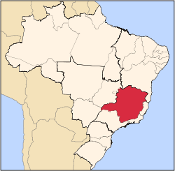
 Belo Vale Location in Brazil | ||
| Coordinates: 20°24′28″S 44°01′26″W / 20.40778°S 44.02389°WCoordinates: 20°24′28″S 44°01′26″W / 20.40778°S 44.02389°W | ||
| Country |
| |
| Region | Southeast | |
| State |
| |
| Founded | 1938 | |
| Incorporated (as city) | December 17, 1938 | |
| Government | ||
| • Mayor | José Lapa dos Santos (PMDB) | |
| Area | ||
| • Municipality | 365 km2 (127.7 sq mi) | |
| • Urban | 5 km2 (2 sq mi) | |
| Elevation | 797 m (2,615 ft) | |
| Time zone | UTC-3 (BST) | |
| Postal Code | 35473-000 | |
| HDI (2000) | 0.733 – high | |
| Website | Belo Vale, Minas Gerais | |
Belo Vale is a municipality in the state of Minas Gerais, Brazil. It is located 82 km south from Belo Horizonte, the state capital. The population was 7,470 inhabitants in 2009.
In 2014, a story about the village of Noiva do Cordeiro, situated within Belo Vale, was published by tabloids around the world. Among other things, these reports said that the population of Noiva do Cordeiro was entirely made up of single women,[1] but this has been dismissed as a hoax by BBC Brazil.[2]
References
- ↑ "Town in Brazil made up entirely of women has made an appeal for bachelors (but only those willing to live by female rules!)". Retrieved 5 February 2015.
- ↑ "'Cidade de beldades' desmente boato internacional de 'campanha por homens'" (in Portuguese). Retrieved 5 February 2015.
Capital: Belo Horizonte | |||||||||||||||||||||||||
|  | ||||||||||||||||||||||||
|
| |||||||||||||||||||||||||
| |||||||||||||||||||||||||
| |||||||||||||||||||||||||
| |||||||||||||||||||||||||
| |||||||||||||||||||||||||
| |||||||||||||||||||||||||
| |||||||||||||||||||||||||
| |||||||||||||||||||||||||
| |||||||||||||||||||||||||
| |||||||||||||||||||||||||
This article is issued from
Wikipedia.
The text is licensed under Creative Commons - Attribution - Sharealike.
Additional terms may apply for the media files.