Sabará
| Sabará | ||
|---|---|---|
| ||
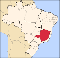
 Location in Brazil | ||
| Coordinates: 19°53′09″S 43°48′25″W / 19.88583°S 43.80694°W | ||
| Country | Brazil | |
| Region | Southeast | |
| State | Minas Gerais | |
| Founded | 1675 | |
| Government | ||
| • Mayor | Diógenes Fantini | |
| Elevation | 705 m (2,313 ft) | |
| Population (2006)[1] | ||
| • Total | 134,282 | |
| • Density | 442/km2 (1,140/sq mi) | |
| Time zone | UTC-3 (UTC-3) | |
| • Summer (DST) | UTC-2 (UTC-2) | |

Sabará is a Brazilian municipality located in the state of Minas Gerais. The city belongs to the mesoregion Metropolitana de Belo Horizonte and to the microregion of Belo Horizonte.
See also

Historical buildings from the colonial period in Sabará.
References
- ↑ "Estimativas das Populações Residentes, em 01.07.2006, Segundo os Municípios" (PDF) (in Portuguese). IBGE. Retrieved 2006-09-01.
Capital: Belo Horizonte | |||||||||||||||||||||||||
|  | ||||||||||||||||||||||||
|
| |||||||||||||||||||||||||
| |||||||||||||||||||||||||
| |||||||||||||||||||||||||
| |||||||||||||||||||||||||
| |||||||||||||||||||||||||
| |||||||||||||||||||||||||
| |||||||||||||||||||||||||
| |||||||||||||||||||||||||
| |||||||||||||||||||||||||
| |||||||||||||||||||||||||
Coordinates: 19°53′9″S 43°48′25″W / 19.88583°S 43.80694°W
This article is issued from
Wikipedia.
The text is licensed under Creative Commons - Attribution - Sharealike.
Additional terms may apply for the media files.