Presidente Bernardes, Minas Gerais
| Presidente Bernardes | |
|---|---|
| Municipality | |
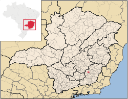 Location in Minas Gerais state | |
 Presidente Bernardes Location in Brazil | |
| Coordinates: 20°46′8″S 43°11′16″W / 20.76889°S 43.18778°WCoordinates: 20°46′8″S 43°11′16″W / 20.76889°S 43.18778°W | |
| Country |
|
| Region | Southeast Region |
| State | Minas Gerais |
| Area | |
| • Total | 237 km2 (92 sq mi) |
| Population (2015) | |
| • Total | 5,594 |
| • Density | 24/km2 (61/sq mi) |
| Time zone | BRT/BRST (UTC-3/-2) |
Presidente Bernardes is a municipality in the state of Minas Gerais in Brazil. The population is 5,594 (2015 est.) in an area of 237 km².[1] The elevation is 591 m. Presidente Bernardes is named after President Artur da Silva Bernardes.
See also
References
This article is issued from
Wikipedia.
The text is licensed under Creative Commons - Attribution - Sharealike.
Additional terms may apply for the media files.