Santa Luzia, Minas Gerais
| Santa Luzia | |||
|---|---|---|---|
| Municipality | |||
|
Município de Santa Luzia Municipality of Santa Luzia | |||
 Top:Santa Luzia Administrative Office, Middle left:A monument of 1842 Liberal Revolution, Middle upper right:Floriano Peixoto Street, Middle lower right:Brasilia Avenue, shopping area, Bottom:Direita Street and Santa Luzia Cathedral | |||
| |||
| Motto(s): Hodie et Semper Nihil Déficit | |||
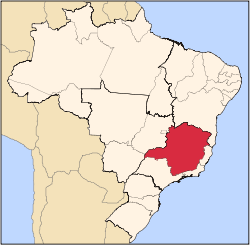
 Santa Luzia Localization of Santa Luzia in Brazil | |||
| Coordinates: 19°46′12″S 43°51′2″W / 19.77000°S 43.85056°WCoordinates: 19°46′12″S 43°51′2″W / 19.77000°S 43.85056°W | |||
| Country | Brazil | ||
| Region | Southeast | ||
| State | Minas Gerais | ||
| Founded | 1692 | ||
| Incorporated (as city) | March 18, 1847 | ||
| Government | |||
| • Mayor | Carlos Calixto | ||
| Area | |||
| • Municipality | 233.7 km2 (90.2 sq mi) | ||
| • Urban | 35 km2 (14 sq mi) | ||
| Elevation | 751 m (2,464 ft) | ||
| Population (2012)[1] | |||
| • Municipality | 205,666 | ||
| • Density | 880/km2 (2,300/sq mi) | ||
| Demonym(s) | luziense | ||
| Time zone | UTC-3 (UTC-3) | ||
| • Summer (DST) | UTC-2 (UTC-2) | ||


Santa Luzia is a Brazilian municipality located in the state of Minas Gerais. The city belongs to the mesoregion Metropolitana de Belo Horizonte and to the microregion of Belo Horizonte. Its population in 2012 was 205,666.
See also
References
- ↑ "Estimativas das Populações Residentes, em 1º de julho de 2012, Segundo os Municípios" (PDF) (in Portuguese). IBGE. Retrieved 2012-08-31.
Capital: Belo Horizonte | |||||||||||||||||||||||||
|  | ||||||||||||||||||||||||
|
| |||||||||||||||||||||||||
| |||||||||||||||||||||||||
| |||||||||||||||||||||||||
| |||||||||||||||||||||||||
| |||||||||||||||||||||||||
| |||||||||||||||||||||||||
| |||||||||||||||||||||||||
| |||||||||||||||||||||||||
| |||||||||||||||||||||||||
| |||||||||||||||||||||||||
This article is issued from
Wikipedia.
The text is licensed under Creative Commons - Attribution - Sharealike.
Additional terms may apply for the media files.