Saint-Corneille
| Saint-Corneille | ||
|---|---|---|
| Commune | ||
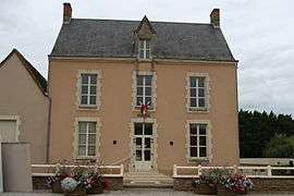 The town hall of Saint-Corneille | ||
| ||
 Saint-Corneille Location within Pays de la Loire region  Saint-Corneille | ||
| Coordinates: 48°04′02″N 0°20′34″E / 48.0672°N 0.3429°ECoordinates: 48°04′02″N 0°20′34″E / 48.0672°N 0.3429°E | ||
| Country | France | |
| Region | Pays de la Loire | |
| Department | Sarthe | |
| Arrondissement | Mamers | |
| Canton | Savigné-l'Évêque | |
| Intercommunality | Communauté de communes du Pays des Brières et du Gesnois | |
| Government | ||
| • Mayor (2008–2014) | Patrick Gaudré | |
| Area1 | 10.88 km2 (4.20 sq mi) | |
| Population (2006[1])2 | 1,012 | |
| • Density | 93/km2 (240/sq mi) | |
| Demonym(s) | Cornélien, Cornélienne | |
| Time zone | UTC+1 (CET) | |
| • Summer (DST) | UTC+2 (CEST) | |
| INSEE/Postal code | 72275 /72460 | |
| Elevation | 52–75 m (171–246 ft) | |
|
1 French Land Register data, which excludes lakes, ponds, glaciers > 1 km2 (0.386 sq mi or 247 acres) and river estuaries. 2 Population without double counting: residents of multiple communes (e.g., students and military personnel) only counted once. | ||

Saint-Corneille is a commune in the Sarthe department in the region of Pays-de-la-Loire in north-western France, famous for its chicken breeding facilities.
See also
References
| Wikimedia Commons has media related to Saint-Corneille. |
This article is issued from
Wikipedia.
The text is licensed under Creative Commons - Attribution - Sharealike.
Additional terms may apply for the media files.