Courgenard
| Courgenard | |
|---|---|
| Commune | |
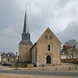 The church of Saint Martin | |
 Courgenard Location within Pays de la Loire region  Courgenard | |
| Coordinates: 48°09′08″N 0°44′11″E / 48.1521°N 0.7365°ECoordinates: 48°09′08″N 0°44′11″E / 48.1521°N 0.7365°E | |
| Country | France |
| Region | Pays de la Loire |
| Department | Sarthe |
| Arrondissement | Mamers |
| Canton | Saint-Calais |
| Intercommunality | Communauté de communes du Val de Braye |
| Government | |
| • Mayor (2008–2014) | Thierry Renvoisé |
| Area1 | 11.32 km2 (4.37 sq mi) |
| Population (2006[1])2 | 460 |
| • Density | 41/km2 (110/sq mi) |
| Demonym(s) | Cosnellien, Cosnellienne |
| Time zone | UTC+1 (CET) |
| • Summer (DST) | UTC+2 (CEST) |
| INSEE/Postal code | 72105 /72320 |
|
1 French Land Register data, which excludes lakes, ponds, glaciers > 1 km2 (0.386 sq mi or 247 acres) and river estuaries. 2 Population without double counting: residents of multiple communes (e.g., students and military personnel) only counted once. | |
Courgenard is a commune in the Sarthe department in the Pays de la Loire region in north-western France.
See also
References
| Wikimedia Commons has media related to Courgenard. |
This article is issued from
Wikipedia.
The text is licensed under Creative Commons - Attribution - Sharealike.
Additional terms may apply for the media files.