Poillé-sur-Vègre
| Poillé-sur-Vègre | |
|---|---|
| Commune | |
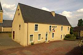 The town hall of Poillé-sur-Vègre | |
 Poillé-sur-Vègre Location within Pays de la Loire region  Poillé-sur-Vègre | |
| Coordinates: 47°55′15″N 0°15′46″W / 47.9208°N 0.2628°WCoordinates: 47°55′15″N 0°15′46″W / 47.9208°N 0.2628°W | |
| Country | France |
| Region | Pays de la Loire |
| Department | Sarthe |
| Arrondissement | La Flèche |
| Canton | Loué |
| Intercommunality | Communauté de communes de Vègre et Champagne |
| Government | |
| • Mayor (2008–2014) | Danièle Ploncard |
| Area1 | 17.57 km2 (6.78 sq mi) |
| Population (2006 [1])2 | 658 |
| • Density | 37/km2 (97/sq mi) |
| Demonym(s) | Poilléen, Poilléenne |
| Time zone | UTC+1 (CET) |
| • Summer (DST) | UTC+2 (CEST) |
| INSEE/Postal code | 72239 /72350 |
| Elevation | 38–96 m (125–315 ft) |
|
1 French Land Register data, which excludes lakes, ponds, glaciers > 1 km2 (0.386 sq mi or 247 acres) and river estuaries. 2 Population without double counting: residents of multiple communes (e.g., students and military personnel) only counted once. | |
Poillé-sur-Vègre is a commune in the Sarthe department in the region of Pays-de-la-Loire in north-western France.
Geography
The village lies in the middle of the commune, on the right bank of the Vègre, which forms part of the commune's north-eastern and south-eastern borders.
See also
References
- ↑ http://www.insee.fr/fr/ppp/bases-de-donnees/recensement/populations-legales/departement.asp?dep=72#dep_B Populations légales 2006 publiées par l’INSEE le 1er janvier 2009
External links
| Wikimedia Commons has media related to Poillé-sur-Vègre. |
- Town council website (in French)
This article is issued from
Wikipedia.
The text is licensed under Creative Commons - Attribution - Sharealike.
Additional terms may apply for the media files.