Le Lude
| Le Lude | ||
|---|---|---|
| Commune | ||
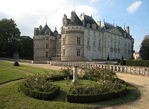 The Château du Lude | ||
| ||
 Le Lude Location within Pays de la Loire region  Le Lude | ||
| Coordinates: 47°38′45″N 0°09′14″E / 47.6458°N 0.1539°ECoordinates: 47°38′45″N 0°09′14″E / 47.6458°N 0.1539°E | ||
| Country | France | |
| Region | Pays de la Loire | |
| Department | Sarthe | |
| Arrondissement | La Flèche | |
| Canton | Le Lude | |
| Intercommunality | Sud Sarthe | |
| Government | ||
| • Mayor (2014–2019) | Louis Jean de Nicolaÿ (Senateur-Maire) | |
| Area1 | 68.36 km2 (26.39 sq mi) | |
| Population (2015)2 | 4,428 | |
| • Density | 65/km2 (170/sq mi) | |
| Demonym(s) | Ludois, Ludoise | |
| Time zone | UTC+1 (CET) | |
| • Summer (DST) | UTC+2 (CEST) | |
| INSEE/Postal code | 72176 /72800 | |
| Elevation | 30–93 m (98–305 ft) | |
|
1 French Land Register data, which excludes lakes, ponds, glaciers > 1 km2 (0.386 sq mi or 247 acres) and river estuaries. 2 Population without double counting: residents of multiple communes (e.g., students and military personnel) only counted once. | ||
.svg.png)
Le Lude castle
Le Lude is a commune in the Sarthe department in the region of Pays-de-la-Loire in northwestern France. On 1 January 2018, the former commune of Dissé-sous-le-Lude was merged into Le Lude.[1]
See also
References
- ↑ Arrêté préfectoral 15 November 2017 (in French)
External links
| Wikimedia Commons has media related to Le Lude. |
| Authority control |
|---|
This article is issued from
Wikipedia.
The text is licensed under Creative Commons - Attribution - Sharealike.
Additional terms may apply for the media files.