Saint-Christophe, Charente
| Saint-Christophe | |
|---|---|
| Commune | |
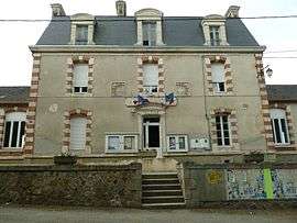 Town hall | |
 Saint-Christophe Location within Nouvelle-Aquitaine region  Saint-Christophe | |
| Coordinates: 46°00′13″N 0°51′03″E / 46.0036°N 0.8508°ECoordinates: 46°00′13″N 0°51′03″E / 46.0036°N 0.8508°E | |
| Country | France |
| Region | Nouvelle-Aquitaine |
| Department | Charente |
| Arrondissement | Confolens |
| Canton | Charente-Vienne |
| Intercommunality | Confolentais |
| Government | |
| • Mayor (2008–2014) | Gilles Sénégas |
| Area1 | 23.65 km2 (9.13 sq mi) |
| Population (2008)2 | 320 |
| • Density | 14/km2 (35/sq mi) |
| Time zone | UTC+1 (CET) |
| • Summer (DST) | UTC+2 (CEST) |
| INSEE/Postal code | 16306 /16420 |
| Elevation |
199–340 m (653–1,115 ft) (avg. 279 m or 915 ft) |
|
1 French Land Register data, which excludes lakes, ponds, glaciers > 1 km2 (0.386 sq mi or 247 acres) and river estuaries. 2 Population without double counting: residents of multiple communes (e.g., students and military personnel) only counted once. | |
Saint-Christophe is a commune in the Charente department in southwestern France.
Population
| Historical population | ||
|---|---|---|
| Year | Pop. | ±% |
| 1793 | 1,264 | — |
| 1800 | 923 | −27.0% |
| 1806 | 1,117 | +21.0% |
| 1821 | 1,222 | +9.4% |
| 1831 | 1,212 | −0.8% |
| 1841 | 1,205 | −0.6% |
| 1846 | 1,250 | +3.7% |
| 1851 | 1,235 | −1.2% |
| 1856 | 1,150 | −6.9% |
| 1861 | 1,102 | −4.2% |
| 1866 | 1,106 | +0.4% |
| 1872 | 1,042 | −5.8% |
| 1876 | 1,081 | +3.7% |
| 1881 | 1,095 | +1.3% |
| 1886 | 1,102 | +0.6% |
| 1891 | 1,072 | −2.7% |
| 1896 | 1,075 | +0.3% |
| 1901 | 1,088 | +1.2% |
| 1906 | 1,047 | −3.8% |
| 1911 | 1,017 | −2.9% |
| 1921 | 907 | −10.8% |
| 1926 | 833 | −8.2% |
| 1931 | 785 | −5.8% |
| 1936 | 775 | −1.3% |
| 1946 | 733 | −5.4% |
| 1954 | 671 | −8.5% |
| 1962 | 628 | −6.4% |
| 1968 | 480 | −23.6% |
| 1975 | 414 | −13.7% |
| 1982 | 381 | −8.0% |
| 1990 | 339 | −11.0% |
| 1999 | 315 | −7.1% |
| 2008 | 320 | +1.6% |
See also
References
| Wikimedia Commons has media related to Saint-Christophe (Charente). |
This article is issued from
Wikipedia.
The text is licensed under Creative Commons - Attribution - Sharealike.
Additional terms may apply for the media files.